Subject: Western United States
Period: 1849 (published)
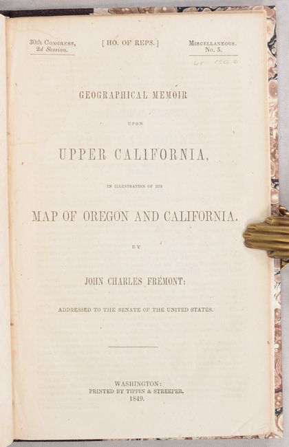
Publication: Misc. Doc. 5, 30th Congress, 2nd Session
Color: Hand Color
Size:
26.7 x 33.3 inches
67.8 x 84.6 cm
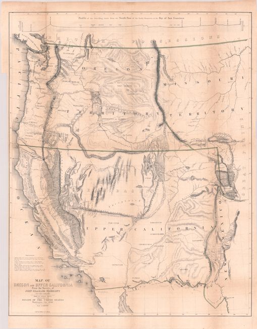
This map has been accorded twofold importance in the development of the westward expansion: first, as a major contribution to geographical and cartographic knowledge, and secondly, as historic documentation of Fremont's third expedition. The map is a remarkable graphic depiction of this expedition and is considered one of the most important 19th century American maps. It covers all of the western territories from the 105th Meridian. Among the most interesting features are the appearance of the term Golden Gate at the entrance to the Bay of San Francisco, the markings of the El Dorado or Gold Region in the California Gold Fields, a hypothetical east-west mountain range near the 42nd parallel, and a notation identifying the location of Mormon settlements for the first time. Wheat illustrates the map and devotes eight pages to its description.
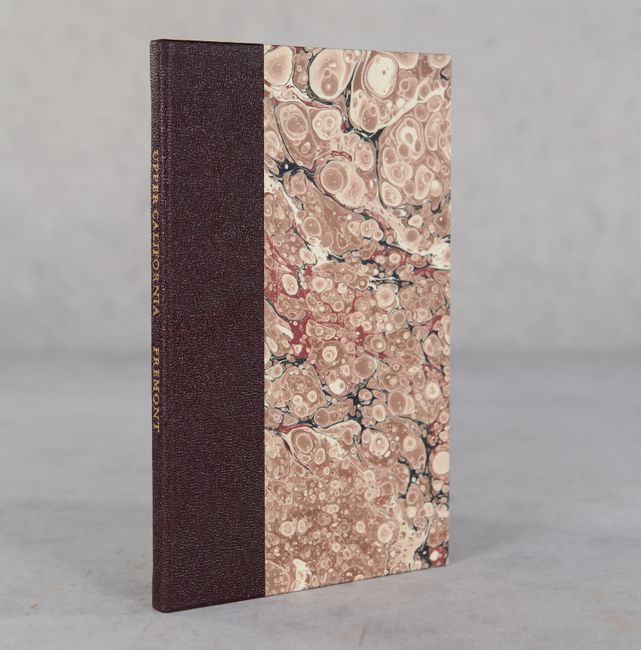
Having been court-marshaled and dismissed from the Army in 1847, Fremont was not asked to publish the details of this last expedition by the Corps of Topographical Engineers as would normally be required. Instead, the Geographical Memoir comprised his report. It was published nonetheless by Congress at the behest of the powerful Senator Thomas Hart Benton, Fremont's father-in-law. The memoir here was published as Misc. Doc. 5, 30th Congress, 2nd Session. This is the large, and increasingly rare, map that is accompanied by the 40-page report. Octavo, rebound in faux leather over marbled boards with gilt title on the spine.
References: Wheat (TMW) #559; Wheat (Gold) #40; Wagner-Camp #150:2; Goss (NA) #77; Schwartz & Ehrenberg plt. 171.
Condition: B+
Issued folding with light toning along the fold lines and scattered foxing. There is a binder's trim at left. Report text is mostly clean and bright and modern binding is pristine.