Showing No Reserve Lots(remove filter)
Showing results for:Auction 167
Catalog Archive
15 lots

Auction 167, Lot 55
Subject: North America
Virtue, George
North America, 1850
Size: 9.8 x 12.4 inches (24.9 x 31.5 cm)
Estimate: $90 - $110
NO RESERVE
Sold for: $70
Closed on 3/28/2018
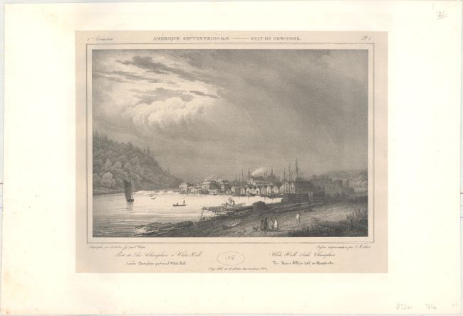
Auction 167, Lot 176
Subject: White Hall, New York
Milbert, J.
Port du Lac Champlain a White Hall / White Hall, Lake Champlain / Lacus Champlain Portus ad White Hall / Der Haven White-Hall ain Champlain-See, 1828
Size: 11.7 x 8.2 inches (29.7 x 20.8 cm)
Estimate: $100 - $130
NO RESERVE
Sold for: $26
Closed on 3/28/2018
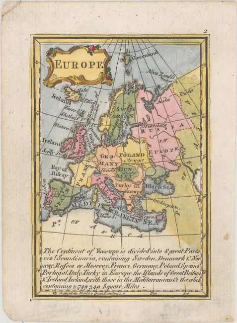
Auction 167, Lot 257
Subject: Europe
Gibson, John
Europe, 1758
Size: 2.5 x 3.7 inches (6.4 x 9.4 cm)
Estimate: $50 - $75
NO RESERVE
Sold for: $55
Closed on 3/28/2018
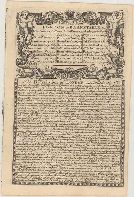
Auction 167, Lot 262
Subject: England
Owen & Bowen
[Lot of 4 - Road Maps], 1720
Size: 4.5 x 7.1 inches (11.4 x 18 cm)
Estimate: $55 - $75
NO RESERVE
Sold for: $50
Closed on 3/28/2018
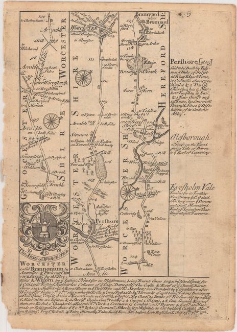
Auction 167, Lot 274
Subject: England & Wales
Owen & Bowen
[Lot of 4 - Road Maps], 1720
Size: 4.9 x 7.3 inches (12.4 x 18.5 cm)
Estimate: $55 - $75
NO RESERVE
Sold for: $26
Closed on 3/28/2018
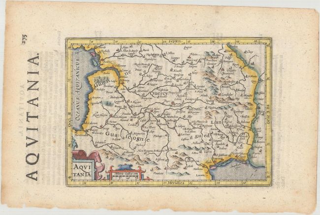
Auction 167, Lot 288
Subject: Southwestern France
Mercator/Hondius
[Lot of 6] Aquitania [and] Provincia [and] Bourdelois Pais de Medoc et la Prevoste de Born [and] Xaintonge [and] Cadurcium [and] La Partie Septentrionale du Languedoc, 1635
Size: See Description
Estimate: $140 - $180
NO RESERVE
Sold for: $140
Closed on 3/28/2018
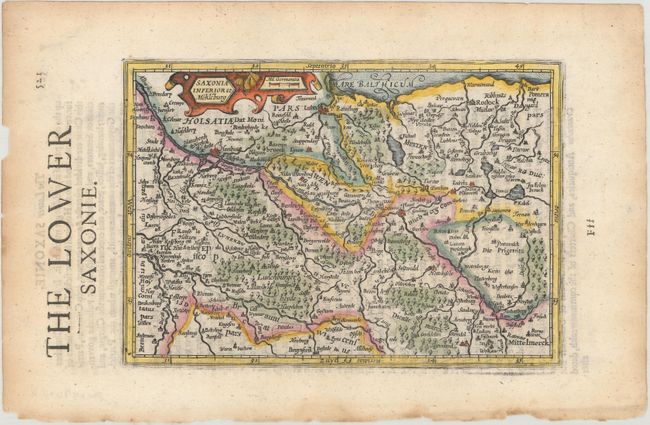
Auction 167, Lot 299
Subject: Northern Germany
Mercator/Hondius
[Lot of 2] Saxonia Inferior et Mekleburg [and] Monasteriensis Episcopatus, 1635
Size: 7.6 x 5.4 inches (19.3 x 13.7 cm)
Estimate: $120 - $150
NO RESERVE
Sold for: $38
Closed on 3/28/2018
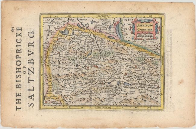
Auction 167, Lot 310
Subject: Austria
Mercator/Hondius
[Lot of 2] Saltzburg Carinthia [and] Stiria, 1635
Size: 7.2 x 5.6 inches (18.3 x 14.2 cm)
Estimate: $120 - $150
NO RESERVE
Sold for: $14
Closed on 3/28/2018
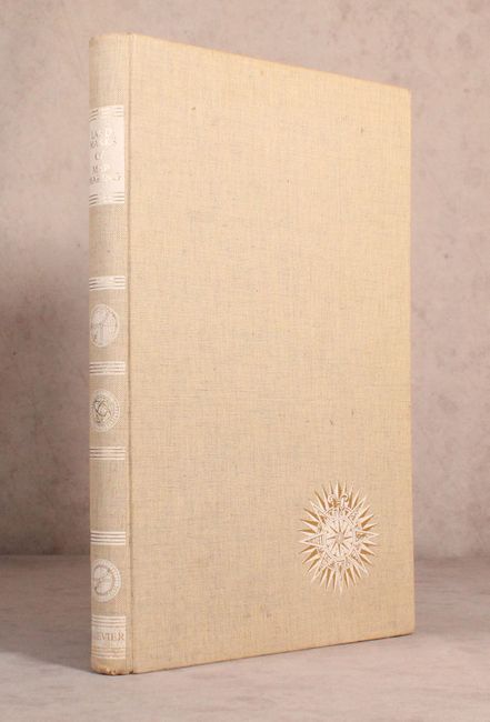
Auction 167, Lot 453
Subject: References
Tooley & Bricker
Landmarks of Mapmaking - An Illustrated Survey of Maps and Mapmakers, 1968
Size: 10.9 x 16.3 inches (27.7 x 41.4 cm)
Estimate: $60 - $80
NO RESERVE
Sold for: $65
Closed on 3/28/2018
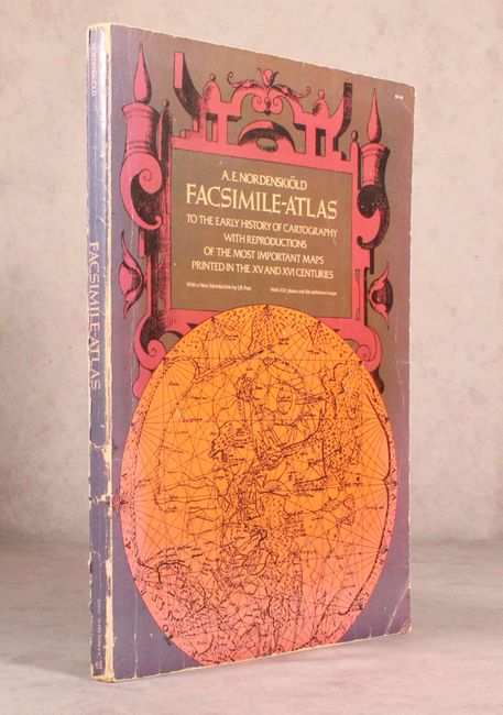
Auction 167, Lot 455
Subject: References
Nordenskiold, Nils Adolf E.
Facsimile-Atlas to the Early History of Cartography with Reproductions of the Most Important Maps Printed in the XV and XVI Centuries, 1973
Size: 11 x 15.9 inches (27.9 x 40.4 cm)
Estimate: $70 - $90
NO RESERVE
Sold for: $55
Closed on 3/28/2018

Auction 167, Lot 456
Subject: References
Shirley, Rodney W.
Printed Maps of the British Isles 1650-1750, 1988
Size: 8.9 x 11.1 inches (22.6 x 28.2 cm)
Estimate: $100 - $130
NO RESERVE
Sold for: $65
Closed on 3/28/2018
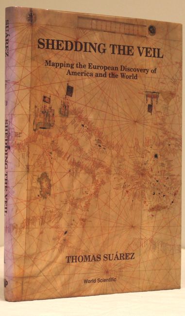
Auction 167, Lot 458
Subject: References
Suarez, Thomas
Shedding the Veil - Mapping the European Discovery of America and the World, 1992
Size: 8.8 x 11.8 inches (22.4 x 30 cm)
Estimate: $90 - $120
NO RESERVE
Sold for: $60
Closed on 3/28/2018
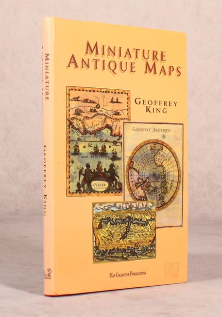
Auction 167, Lot 459
Subject: References
King, Geoffrey L.
Miniature Antique Maps, 1996
Size: 7.2 x 11 inches (18.3 x 27.9 cm)
Estimate: $80 - $100
NO RESERVE
Sold for: $130
Closed on 3/28/2018
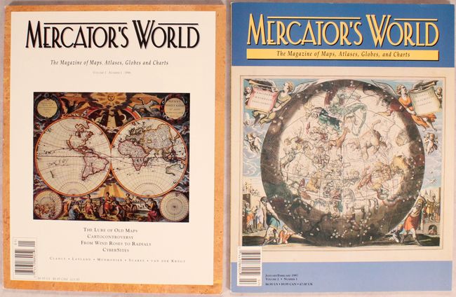
Auction 167, Lot 461
Subject: References
[Lot of 2] Mercator's World The Magazine of Maps, Atlases, Globes and Charts, 1996-97
Size: 8.4 x 10.9 inches (21.3 x 27.7 cm)
Estimate: $15 - $30
NO RESERVE
Sold for: $32
Closed on 3/28/2018
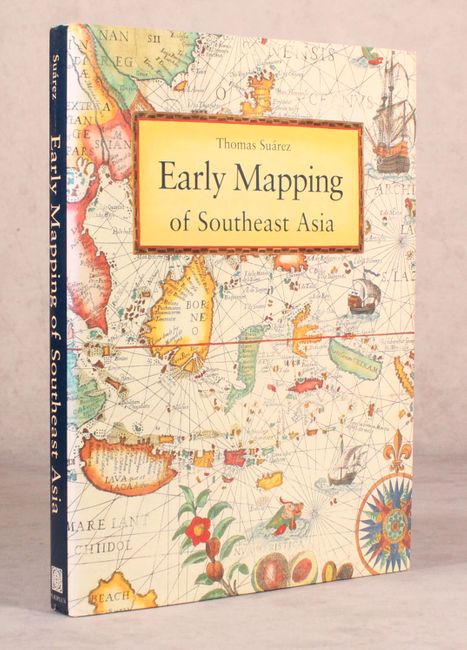
Auction 167, Lot 462
Subject: References
Suarez, Thomas
Early Mapping of Southeast Asia, 1999
Size: 9.4 x 12.3 inches (23.9 x 31.2 cm)
Estimate: $80 - $100
NO RESERVE
Sold for: $100
Closed on 3/28/2018
15 lots