Showing Featured Lots(remove filter)
Filtered by Category:United States(Show All Categories)
Showing results for:Auction 180
Catalog Archive
16 lots
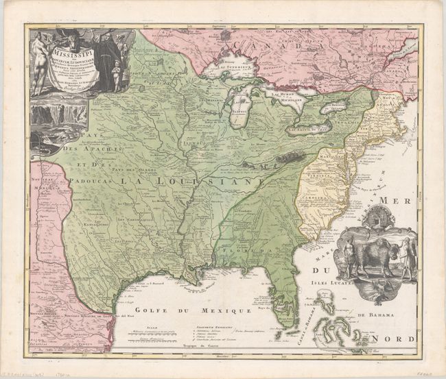
Auction 180, Lot 106
Subject: Colonial Eastern United States & Canada
Homann, Johann Baptist
Amplissimae Regionis Mississipi seu Provinciae Ludovicianae a R.P. Ludovico Hennepin Francisc Miss in America Septentrionali Anno 1687..., 1720
Size: 22.6 x 19.1 inches (57.4 x 48.5 cm)
Estimate: $2,200 - $2,500
Striking Map of Colonial America with Buffalo Vignette
Sold for: $2,750
Closed on 11/18/2020
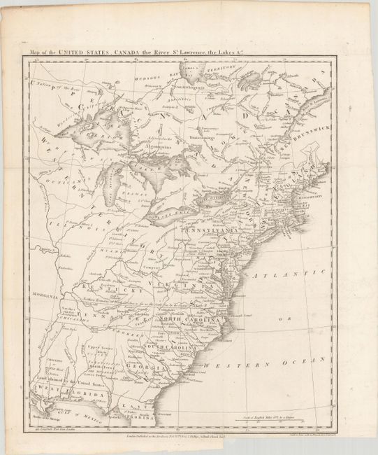
Auction 180, Lot 109
Subject: Eastern United States & Canada, Franklin
Phillips, Richard (Sir)
Map of the United States, Canada the River St. Lawrence, the Lakes &c., 1801
Size: 13.4 x 16 inches (34 x 40.6 cm)
Estimate: $1,400 - $1,700
Features the Short-Lived Franklinia and Morgania
Sold for: $1,000
Closed on 11/18/2020
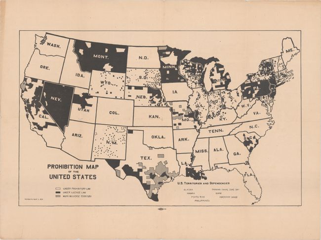
Auction 180, Lot 130
Subject: United States
Prohibition Map of the United States, 1915
Size: 21.3 x 13.2 inches (54.1 x 33.5 cm)
Estimate: $300 - $400
Rare Map Issued 5 Years Before the Prohibition Amendment Passed
Sold for: $325
Closed on 11/18/2020
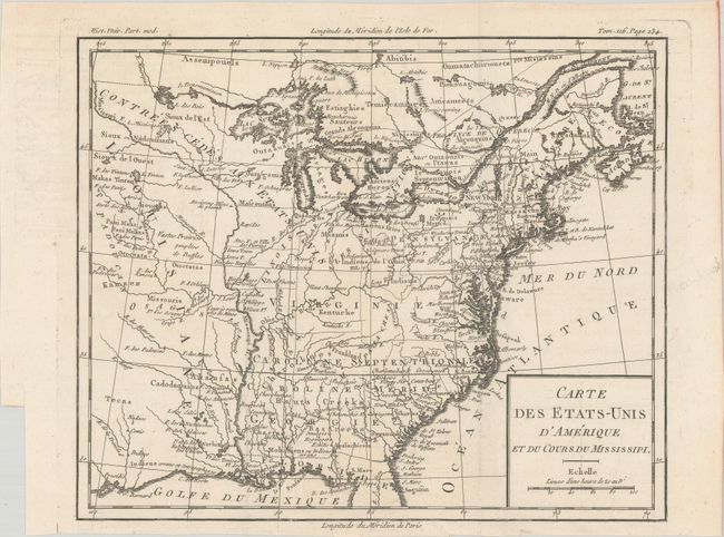
Auction 180, Lot 144
Subject: Eastern United States, Franklin
Brion de la Tour, Louis
Carte des Etats-Unis d'Amerique et du Cours du Mississipi, 1788
Size: 10.6 x 8.7 inches (26.9 x 22.1 cm)
Estimate: $900 - $1,100
One of the Earliest Maps to Feature the State of Franklin
Sold for: $650
Closed on 11/18/2020
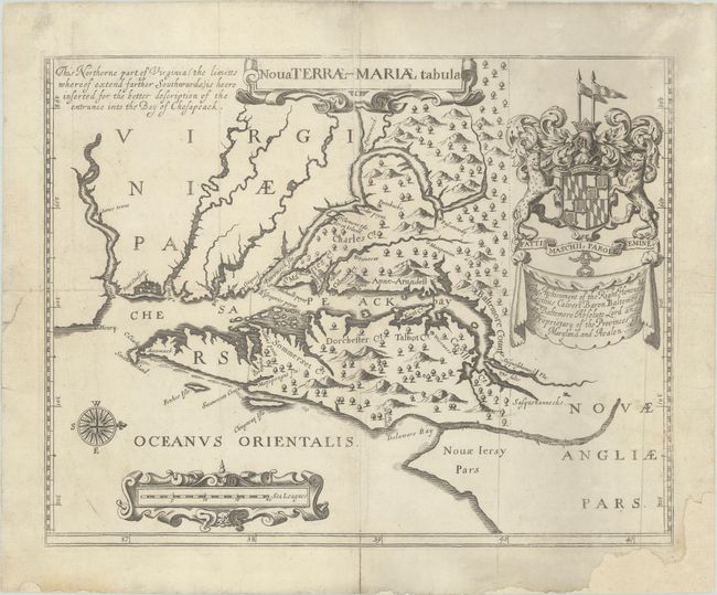
Auction 180, Lot 158
Subject: Colonial Mid-Atlantic United States, Maryland
Ogilby, John
Nova Terrae-Mariae Tabula, 1671
Size: 14.8 x 11.6 inches (37.6 x 29.5 cm)
Estimate: $4,750 - $6,000
Ogilby's Copy of the Extremely Rare "Lord Baltimore's Map," the Earliest Obtainable Printed Map of Maryland
Sold for: $3,500
Closed on 11/18/2020
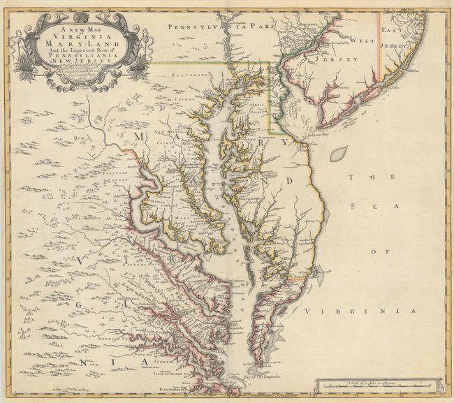
Auction 180, Lot 162
Subject: Colonial Mid-Atlantic United States
Browne/Senex
A New Map of Virginia Mary-land and the Improved Parts of Pennsylvania & New Jersey..., 1719
Size: 21.8 x 19.1 inches (55.4 x 48.5 cm)
Estimate: $4,000 - $5,000
Map of Chesapeake Bay Based on Landmark Herrman Map
Unsold
Closed on 11/18/2020
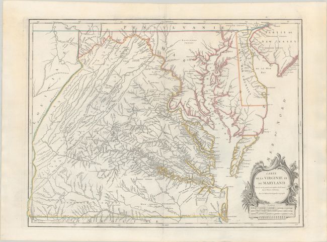
Auction 180, Lot 164
Subject: Mid-Atlantic United States
Robert de Vaugondy, Didier
Carte de la Virginie et du Maryland Dressee sur la Grande Carte Angloise de Mrs. Josue Fry et Pierre Jefferson, 1793
Size: 25.2 x 19 inches (64 x 48.3 cm)
Estimate: $1,600 - $1,900
An Essential Map of Virginia and Maryland
Unsold
Closed on 11/18/2020
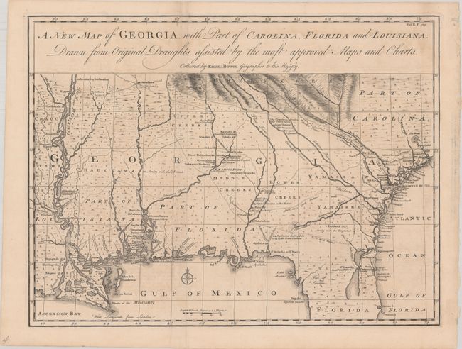
Auction 180, Lot 171
Subject: Colonial Southeastern United States
Bowen, Emanuel
A New Map of Georgia, with Part of Carolina, Florida and Louisiana. Drawn from Original Draughts, Assisted by the Most Approved Maps and Charts, 1748
Size: 18.9 x 14.3 inches (48 x 36.3 cm)
Estimate: $2,200 - $2,500
Important Map of the Georgia Colony
Sold for: $2,100
Closed on 11/18/2020
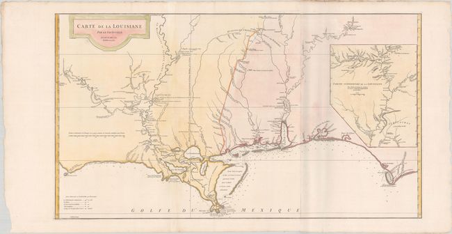
Auction 180, Lot 176
Subject: Colonial Southern United States
Anville, Jean Baptiste Bourguignon d'
Carte de la Louisiane par Le Sr. D'Anville Dressee en Mai 1732. Publiee en 1752., 1752
Size: 36.4 x 20.4 inches (92.5 x 51.8 cm)
Estimate: $1,600 - $1,900
An Early, Detailed Depiction of the Gulf Coast
Sold for: $1,200
Closed on 11/18/2020
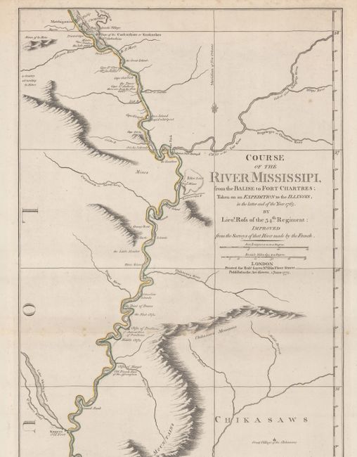
Auction 180, Lot 183
Subject: Colonial Central United States, Mississippi River
Ross, John (Lt.)
Course of the River Mississipi, from the Balise to Fort Chartres; Taken on an Expedition to the Illinois, in the Latter End of the Year 1765, 1775
Size: 13.8 x 44.4 inches (35.1 x 112.8 cm)
Estimate: $3,250 - $4,000
First English Map of the Lower Mississippi River
Unsold
Closed on 11/18/2020
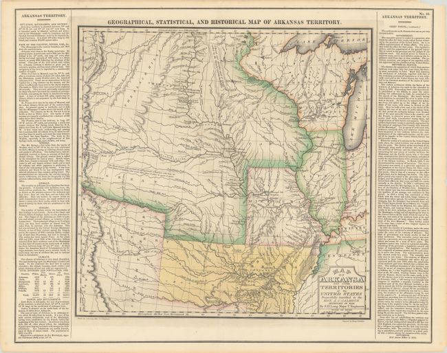
Auction 180, Lot 184
Subject: Central United States, Arkansas
Carey & Lea
Geographical, Historical, and Statistical Map of Arkansas Territory, 1822
Size: 14.6 x 14.4 inches (37.1 x 36.6 cm)
Estimate: $1,400 - $1,700
A Foundation Map in the Cartography of the Louisiana Purchase
Sold for: $1,000
Closed on 11/18/2020
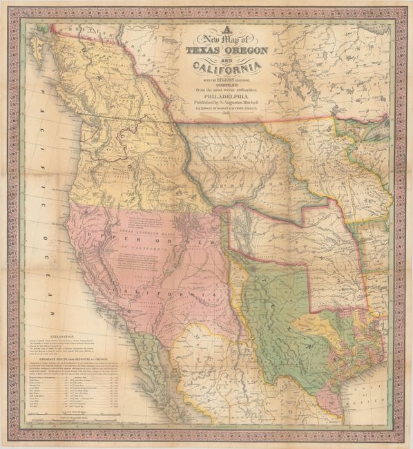
Auction 180, Lot 189
Subject: Western United States, Texas
Mitchell, Samuel Augustus
A New Map of Texas Oregon and California with the Regions Adjoining. Compiled from the Most Recent Authorities, 1846
Size: 20.5 x 22.4 inches (52.1 x 56.9 cm)
Estimate: $11,000 - $14,000
One of the Most Influential Maps of Westward Expansion
Sold for: $8,000
Closed on 11/18/2020
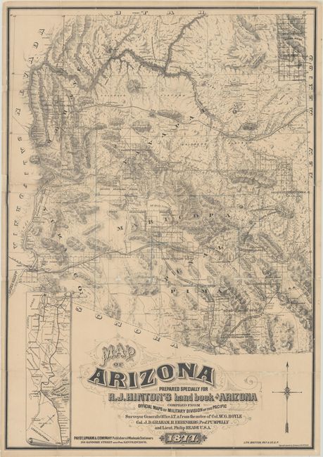
Auction 180, Lot 215
Subject: Arizona
Hinton, Richard J.
Map of Arizona Prepared Specially for R.J. Hinton's Hand Book of Arizona Compiled from Official Maps of Military Division of the Pacific… [with] The Hand-book to Arizona: Its Resources, History, Towns, Mines, Ruins and Scenery..., 1877
Size: 24.1 x 34.6 inches (61.2 x 87.9 cm)
Estimate: $6,000 - $8,000
One of the Earliest Large-Scale Maps of Arizona Territory
Unsold
Closed on 11/18/2020
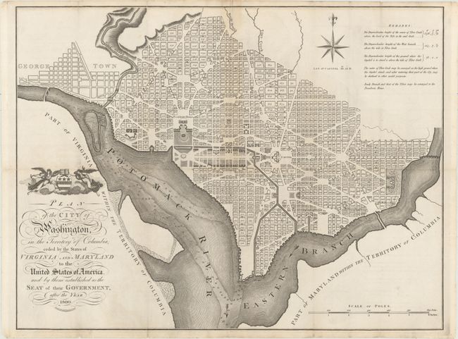
Auction 180, Lot 242
Subject: Washington, D.C.
Russell, John C.
Plan of the City of Washington, in the Territory of Columbia, Ceded by the States of Virginia and Maryland to the United States of America, and by Them Established as the Seat of Their Government, After the Year 1800, 1795
Size: 20.9 x 15.9 inches (53.1 x 40.4 cm)
Estimate: $2,200 - $2,500
Rare, Early, Large-Format Map of Washington D.C.
Sold for: $1,900
Closed on 11/18/2020
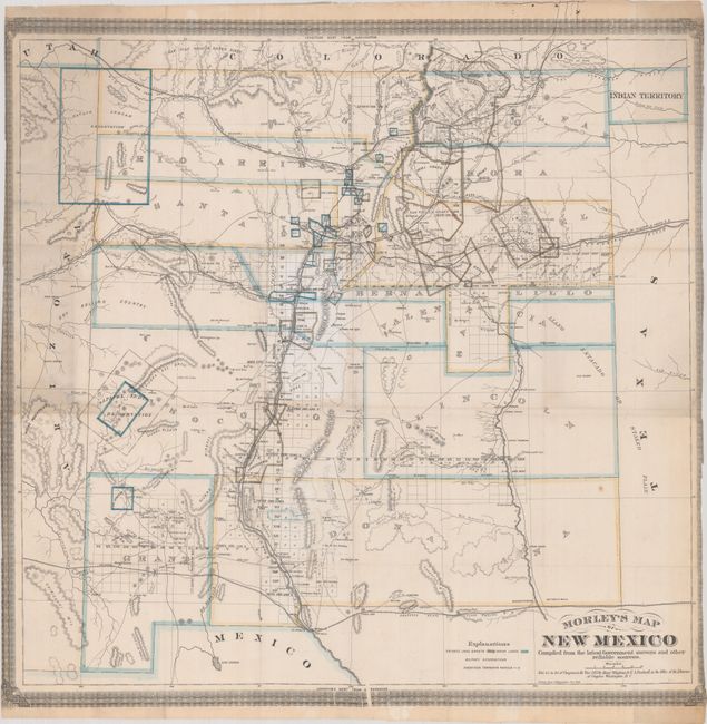
Auction 180, Lot 269
Subject: New Mexico
Morley's Map of New Mexico Compiled from the Latest Government Surveys and Other Reliable Sources, 1873
Size: 24.8 x 24.2 inches (63 x 61.5 cm)
Estimate: $12,000 - $15,000
One of the Earliest Maps Dedicated to New Mexico Territory
Unsold
Closed on 11/18/2020
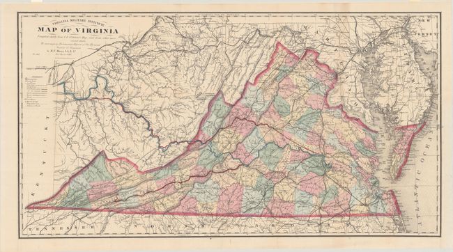
Auction 180, Lot 303
Subject: Virginia, Civil War Reconstruction
Maury, M. F.
Virginia Military Institute Map of Virginia [with] Physical Survey of Virginia. Geographical Position of Its Commercial Advantages, and National Importance. (Preliminary Report), 1868
Size: 34.9 x 18.6 inches (88.6 x 47.2 cm)
Estimate: $1,400 - $1,700
Includes the Third Edition of the Bucholtz-Ludwig Map of 1858 in Fine Condition
Sold for: $1,000
Closed on 11/18/2020
16 lots