Filtered by Category:United States(Show All Categories)
Showing results for:Auction 159
Catalog Archive
198 lots
Page 1 of 4
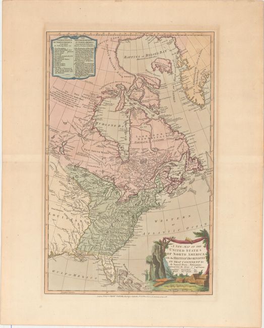
Auction 159, Lot 120
Subject: United States & Canada
Dunn, Samuel
A New Map of the United States of North America with the British Dominions on that Continent &c., 1786
Size: 12 x 18.5 inches (30.5 x 47 cm)
Estimate: $750 - $900
Sold for: $700
Closed on 9/14/2016
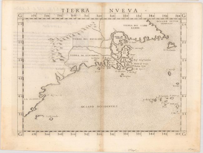
Auction 159, Lot 121
Subject: Eastern United States & Canada
Ruscelli, Girolamo
Tierra Nueva, 1562
Size: 9.6 x 7.1 inches (24.4 x 18 cm)
Estimate: $1,200 - $1,500
First State of Ruscelli's Map of the East Coast
Sold for: $900
Closed on 9/14/2016
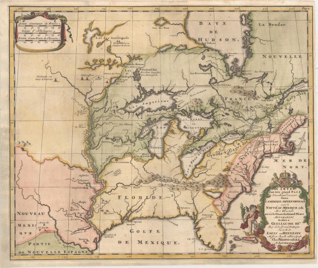
Auction 159, Lot 122
Subject: Colonial Eastern United States & Canada
Hennepin, Louis de (Fr.)
Carte d'un Tres Grand Pais Nouvellement d'Ecouvert dans l'Amerique Septentrionale entre le Nouveau Mexique et las Mer Glaciale avec le Cours de Grand Fleuve Meschasipi..., 1704
Size: 17.6 x 14.7 inches (44.7 x 37.3 cm)
Estimate: $2,400 - $3,000
Sold for: $1,800
Closed on 9/14/2016
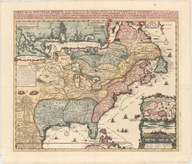
Auction 159, Lot 123
Subject: Colonial Eastern United States & Canada
Chatelain, Henry Abraham
Carte de la Nouvelle France, ou se voit le Cours des Grandes Rivieres de S. Laurens & de Mississipi Aujour d'hui S. Louis, aux Environs des-quelles se Trouvent les Etats, Pais, Nations, Peuples &c..., 1719
Size: 19.4 x 16.7 inches (49.3 x 42.4 cm)
Estimate: $2,500 - $3,000
One of the Most Informative 18th Century Maps of the French Possessions in North America
Sold for: $1,900
Closed on 9/14/2016
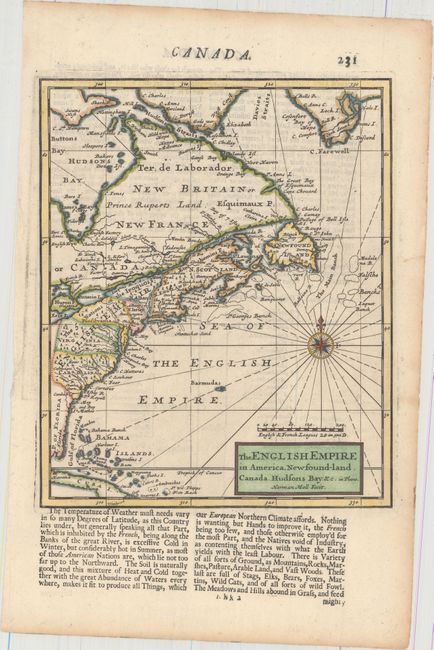
Auction 159, Lot 124
Subject: Colonial Eastern United States & Canada
Moll, Herman
The English Empire in America, Newfound-land. Canada. Hudsons Bay. &c in Plano, 1723
Size: 7 x 8.5 inches (17.8 x 21.6 cm)
Estimate: $275 - $350
Sold for: $200
Closed on 9/14/2016
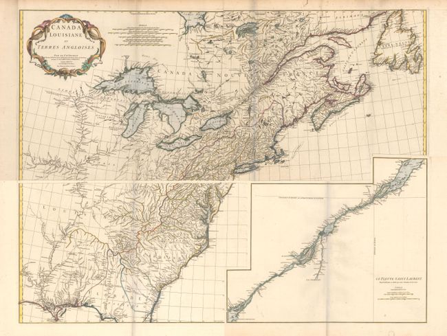
Auction 159, Lot 125
Subject: Colonial Eastern United States & Canada
Anville, Jean Baptiste Bourguignon d'
[On 4 Sheets] Canada Louisiane et Terres Angloises, 1755
Size: 44.5 x 18.8 inches (113 x 47.8 cm)
Estimate: $2,000 - $2,300
D'Anville's Spectacular Map of Eastern Seaboard
Unsold
Closed on 9/14/2016
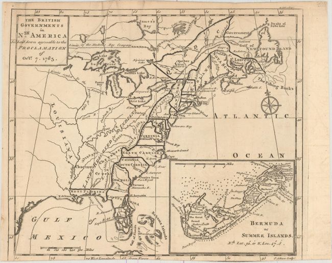
Auction 159, Lot 126
Subject: Colonial Eastern United States & Canada
Gibson, John
The British Governments in Nth. America Laid Down Agreeable to the Proclamation of Octr. 7. 1763, 1763
Size: 9.2 x 8 inches (23.4 x 20.3 cm)
Estimate: $325 - $400
Sold for: $425
Closed on 9/14/2016
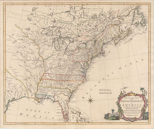
Auction 159, Lot 127
Subject: Colonial Eastern United States & Canada
Kitchin, Thomas
A New and Accurate Map of the British Dominions in America, According to the Treaty of 1763; Divided into the Several Provinces and Jurisdictions..., 1766
Size: 24.8 x 20.8 inches (63 x 52.8 cm)
Estimate: $2,200 - $2,500
Rare Map of the British Colonies Just After the French & Indian War
Sold for: $1,600
Closed on 9/14/2016
Auction 159, Lot 128
Subject: Colonial Eastern United States & Canada
Lotter, Mathias Albrecht
Carte Nouvelle de l'Amerique Angloise Contenant tout ce que les nglois Possedent sur le Continent de l'Amerique Septentrionale Savoir le Canada..., 1776
Size: 19.4 x 23.7 inches (49.3 x 60.2 cm)
Estimate: $1,000 - $1,300
Sold for: $750
Closed on 9/14/2016
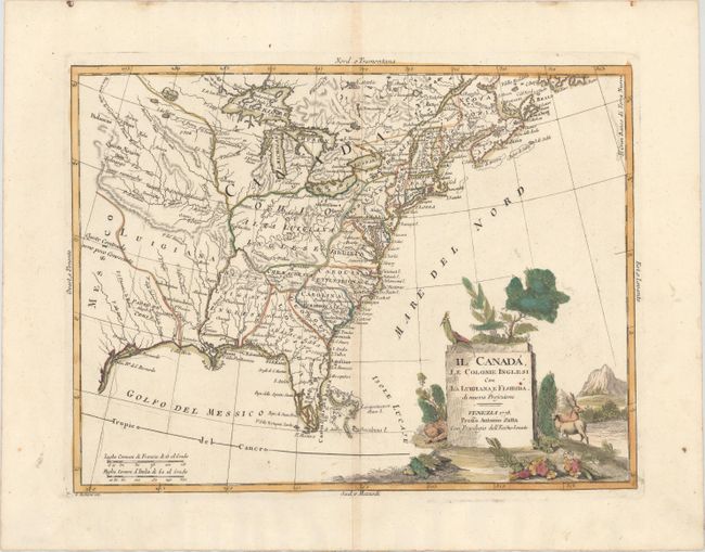
Auction 159, Lot 129
Subject: Colonial Eastern United States & Canada
Zatta, Antonio
Il Canada, le Colonie Inglesi con la Luigiana, e Florida di Nuova Projezione, 1778
Size: 15.9 x 11.9 inches (40.4 x 30.2 cm)
Estimate: $300 - $375
Sold for: $375
Closed on 9/14/2016
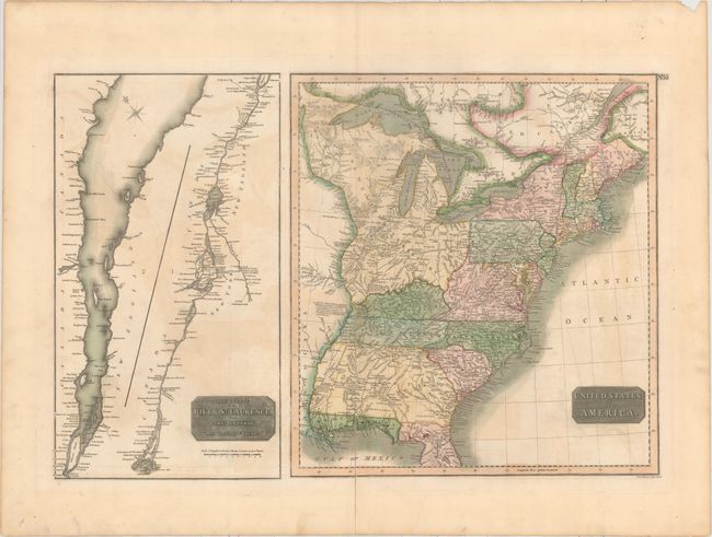
Auction 159, Lot 130
Subject: Eastern United States & Canada
Thomson, John
United States of America [on sheet with] The Course of the River St. Laurence, from Lake Ontario, to Manicouagan Point, 1817
Size: 24.2 x 16.1 inches (61.5 x 40.9 cm)
Estimate: $200 - $250
Sold for: $120
Closed on 9/14/2016
Auction 159, Lot 131
Subject: Eastern United States & Canada
SDUK Society for the Diffusion of Useful Knowledge
[Lot of 15 - United States & Canada], 1832-34
Size: See Description
Estimate: $1,000 - $1,300
Matching Set of SDUK Maps
Sold for: $700
Closed on 9/14/2016
Auction 159, Lot 132
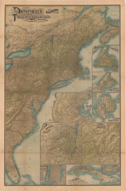
Subject: Eastern United States & Canada
Railroad Companies, (Various)
ABC The Pathfinder Railway Guide Map. Eastern Section, 1901
Size: 27.9 x 42.9 inches (70.9 x 109 cm)
Estimate: $150 - $180
Sold for: $220
Closed on 9/14/2016
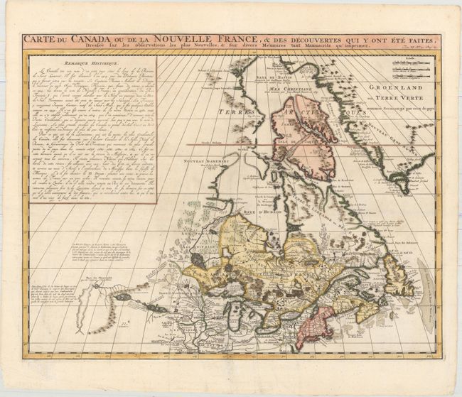
Auction 159, Lot 133
Subject: Colonial Northeastern United States & Canada
Chatelain, Henry Abraham
Carte du Canada ou de la Nouvelle France, & des Decouvertes qui y ont ete Faites, Dressee sur les Observations les Plus Nouvelles, & sur Divers Memoires tant Manuscrits qu' Imprimez, 1719
Size: 20.7 x 16.1 inches (52.6 x 40.9 cm)
Estimate: $600 - $750
Sold for: $425
Closed on 9/14/2016
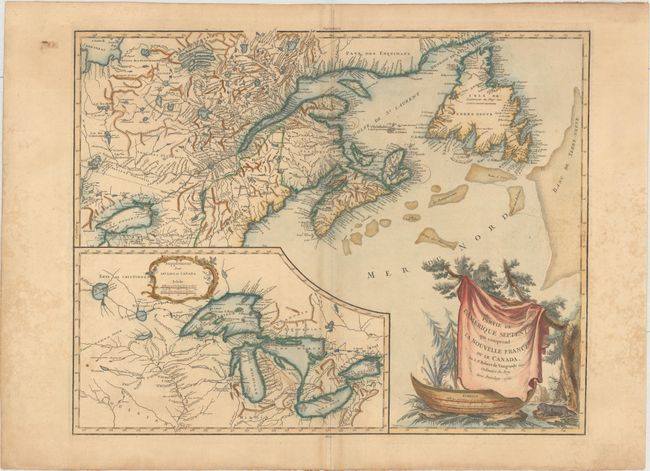
Auction 159, Lot 134
Subject: Colonial Northeastern United States & Canada, Great Lakes
Robert de Vaugondy, Didier
Partie de l'Amerique Septent? qui Comprend la Nouvelle France ou le Canada, 1755
Size: 23.9 x 18.8 inches (60.7 x 47.8 cm)
Estimate: $600 - $750
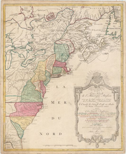
Sold for: $400
Closed on 9/14/2016
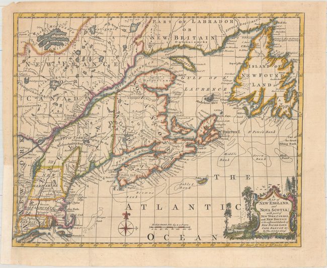
Auction 159, Lot 135
Subject: Colonial Northeastern United States & Canada
Kitchin, Thomas
A Map of New England, and Nova Scotia; with Part of New York, Canada, and New Britain & the Adjacent Islands of New Found Land Cape Breton &c., 1758
Size: 13 x 10.6 inches (33 x 26.9 cm)
Estimate: $240 - $300
Sold for: $180
Closed on 9/14/2016
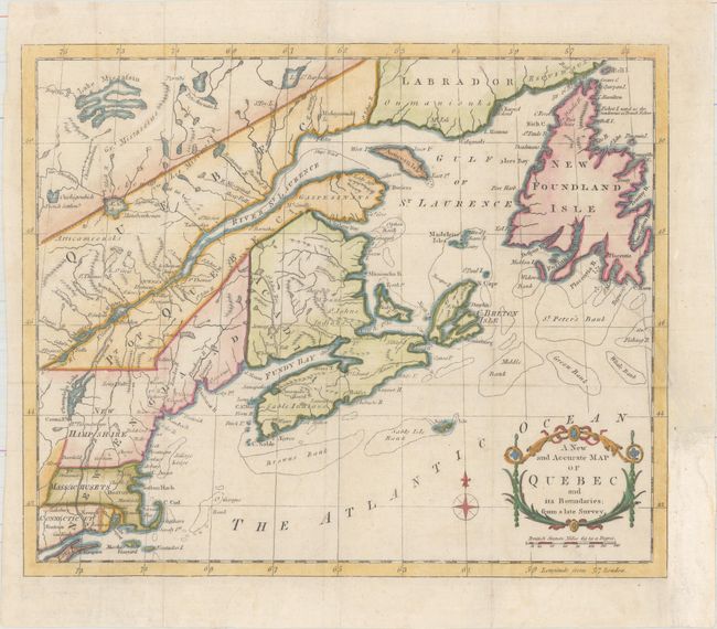
Auction 159, Lot 136
Subject: Colonial Northeastern United States & Canada
Anon.
A New and Accurate Map of Quebec and Its Boundaries; from a Late Survey, 1781
Size: 12.7 x 10.6 inches (32.3 x 26.9 cm)
Estimate: $200 - $230
Sold for: $150
Closed on 9/14/2016
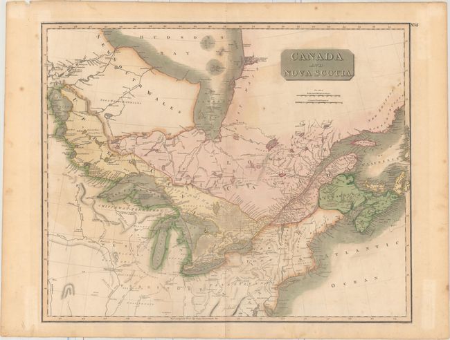
Auction 159, Lot 137
Subject: Northeastern United States & Canada
Thomson, John
Canada and Nova Scotia, 1817
Size: 23.5 x 19.1 inches (59.7 x 48.5 cm)
Estimate: $150 - $180
Unsold
Closed on 9/14/2016
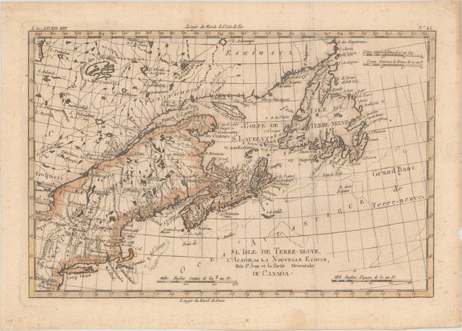
Auction 159, Lot 138
Subject: Northeastern United States & Canada
Bonne, Rigobert
L'Isle de Terre-Neuve, l'Acadie, ou la Nouvelle Ecosse, l'Isle St. Jean et la Partie Orientale du Canada, 1820
Size: 12.5 x 8.3 inches (31.8 x 21.1 cm)
Estimate: $160 - $200
Sold for: $65
Closed on 9/14/2016
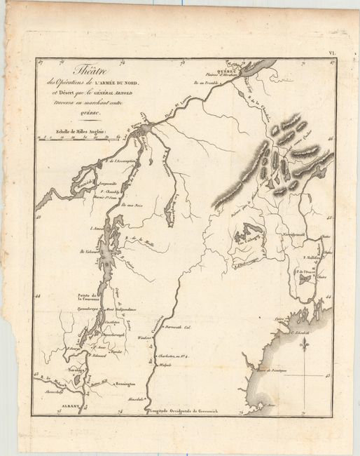
Auction 159, Lot 139
Subject: New England & Eastern Canada
Marshall, John
Theatre des Operations de l'Armee du Nord, et Desert que le General Arnold Traversa en Marchant Contre Quebec, 1807
Size: 8.4 x 10 inches (21.3 x 25.4 cm)
Estimate: $150 - $180
NO RESERVE
Sold for: $95
Closed on 9/14/2016
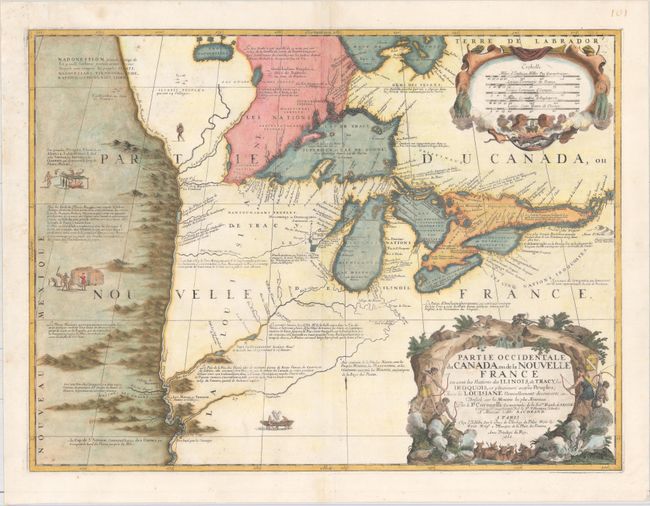
Auction 159, Lot 140
Subject: Colonial Great Lakes
Coronelli/Nolin
Partie Occidentale du Canada ou de la Nouvelle France ou Sont les Nations des Ilinois, de Tracy, les Iroquois, et Plusieurs Autres Peuples; avec la Louisiane Nouvellement Decouverte etc., 1688
Size: 23.3 x 17.4 inches (59.2 x 44.2 cm)
Estimate: $12,000 - $15,000
Third State of Coronelli's Important Map of the Great Lakes
Sold for: $11,500
Closed on 9/14/2016
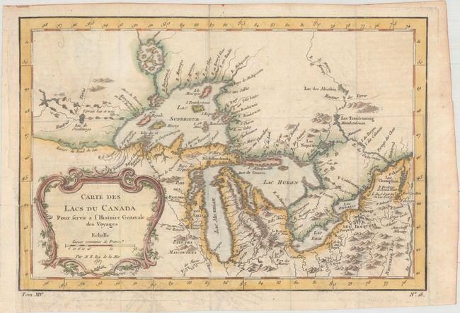
Auction 159, Lot 141
Subject: Colonial Great Lakes
Bellin, Jacques Nicolas
Carte des Lacs du Canada pour Servir a l'Histoire Generale des Voyages, 1757
Size: 11.5 x 7.8 inches (29.2 x 19.8 cm)
Estimate: $400 - $475
Sold for: $375
Closed on 9/14/2016
Auction 159, Lot 142
Subject: United States
Brue, Adrien Hubert
Carte Generale des Etats-Unis de l'Amerique Septentrionale, 1820
Size: 19.8 x 14.3 inches (50.3 x 36.3 cm)
Estimate: $300 - $400
Sold for: $400
Closed on 9/14/2016
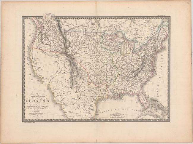
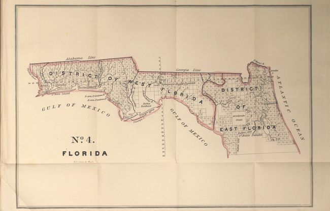
Auction 159, Lot 143
Subject: United States
Huntington, F. J.
United States, 1830
Size: 16 x 10.1 inches (40.6 x 25.7 cm)
Estimate: $150 - $180
Sold for: $275
Closed on 9/14/2016
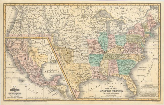
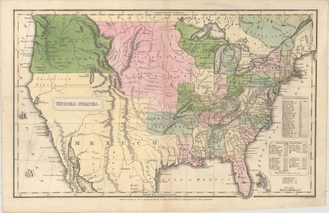
Auction 159, Lot 144
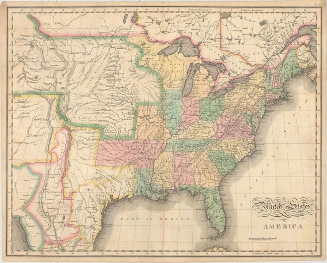
Subject: United States, Texas, Mexico
Mitchell, Samuel Augustus
No. 5 Map of the United States Engraved to Illustrate Mitchell's School and Family Geography, 1839
Size: 16.6 x 10.4 inches (42.2 x 26.4 cm)
Estimate: $350 - $425
Sold for: $250
Closed on 9/14/2016
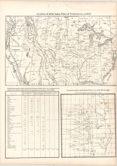
Auction 159, Lot 145
Subject: United States
Bowen & Co., John T.
Localities of All the Indian Tribes of North America in 1833 [on sheet with] Statement Showing the Number of Each Tribe of Indians... [and] Present Localities of the Indian Tribes West of the Mississippi..., 1844
Size: 13.3 x 16.8 inches (33.8 x 42.7 cm)
Estimate: $600 - $750
Sold for: $450
Closed on 9/14/2016
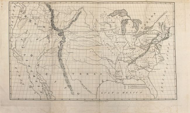
Auction 159, Lot 146
Subject: United States, Railroads
Throop, O. H.
[Untitled - Map of Proposed Routes of Western Railroads] [with report], 1846
Size: 15.9 x 9.4 inches (40.4 x 23.9 cm)
Estimate: $240 - $300
First Edition Issued with Original Report
Sold for: $220
Closed on 9/14/2016
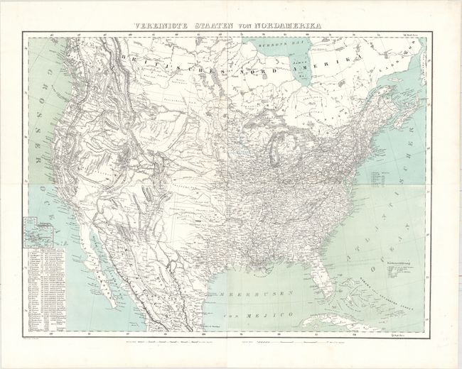
Auction 159, Lot 147
Subject: United States
Flemming, Carl
Vereinigte Staaten von Nordamerika, 1857
Size: 27.2 x 20.5 inches (69.1 x 52.1 cm)
Estimate: $200 - $240
Unsold
Closed on 9/14/2016
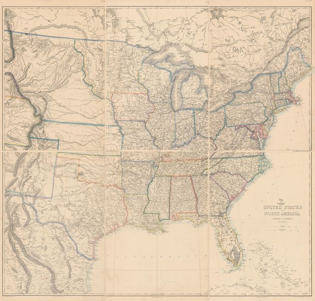
Auction 159, Lot 148
Subject: United States
Ettling, Theodor
[On 6 Sheets] United States of North America (Eastern & Central), 1860
Size: 12 x 16.9 inches (30.5 x 42.9 cm)
Estimate: $200 - $240
Sold for: $240
Closed on 9/14/2016
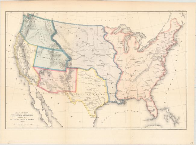
Auction 159, Lot 149
Subject: United States
U.S. Government
Map of the United States Exhibiting the Military Depts. & Posts, 1860
Size: 19.7 x 13 inches (50 x 33 cm)
Estimate: $200 - $250
Sold for: $350
Closed on 9/14/2016
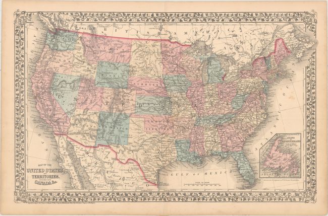
Auction 159, Lot 150
Subject: United States
Mitchell, Samuel Augustus
Map of the United States, and Territories. Together with Canada &c., 1876
Size: 21.5 x 13.7 inches (54.6 x 34.8 cm)
Estimate: $80 - $100
NO RESERVE
Sold for: $80
Closed on 9/14/2016
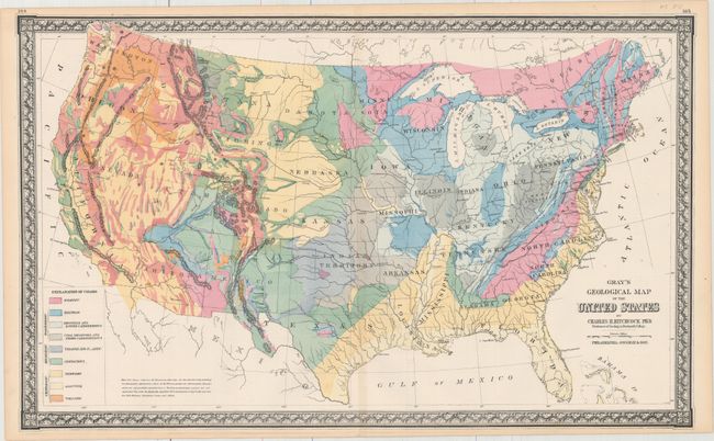
Auction 159, Lot 151
Subject: United States
Gray, Ormando Willis & Son
Gray's Geological Map of the United States, 1876
Size: 26.9 x 16.4 inches (68.3 x 41.7 cm)
Estimate: $120 - $150
Sold for: $275
Closed on 9/14/2016
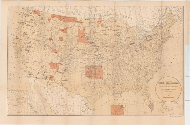
Auction 159, Lot 152
Subject: United States
U.S. Bureau of Indian Affairs
Map Showing the Location of the Indian Reservations Within the Limits of the United States and Territories..., 1884
Size: 33.5 x 21 inches (85.1 x 53.3 cm)
Estimate: $100 - $130
Sold for: $75
Closed on 9/14/2016
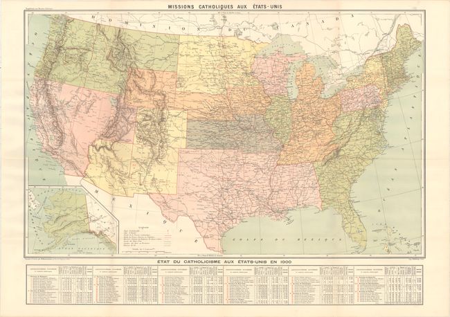
Auction 159, Lot 153
Subject: United States
Hausermann, R.
Missions Catholiques aux Etats-Unis, 1900
Size: 37.4 x 23.3 inches (95 x 59.2 cm)
Estimate: $350 - $425
Sold for: $250
Closed on 9/14/2016
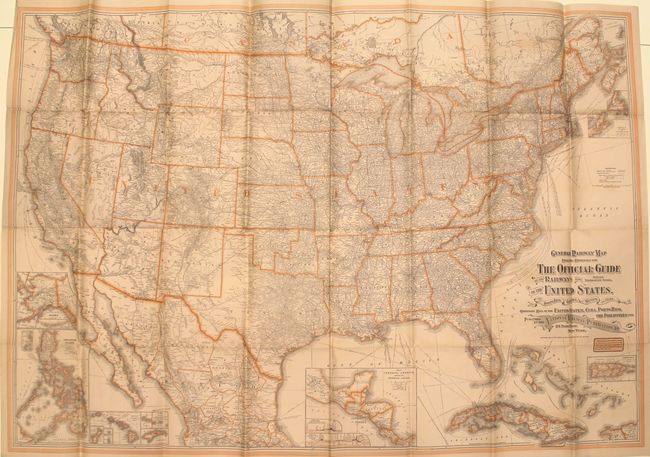
Auction 159, Lot 154
Subject: United States
Matthews-Northrup Co
General Railway Map Engraved Expressly for the Official Guide of the Railways and Steam Navigation Lines, of the United States, Porto Rico, Canada, Mexico, and Cuba..., 1903
Size: 52.6 x 36.2 inches (133.6 x 91.9 cm)
Estimate: $140 - $170
Sold for: $100
Closed on 9/14/2016
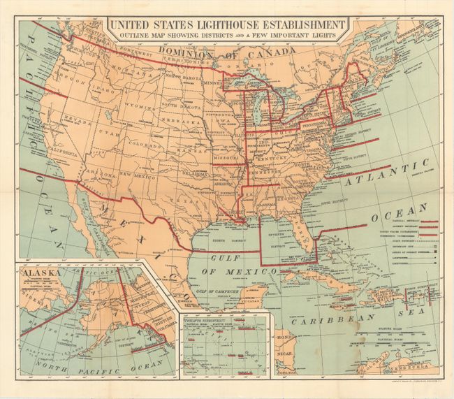
Auction 159, Lot 155
Subject: United States
U.S. Government
[Lot of 21 - Maps of Lighthouse Districts in the United States], 1906
Size: See Description
Estimate: $350 - $450
Sold for: $550
Closed on 9/14/2016
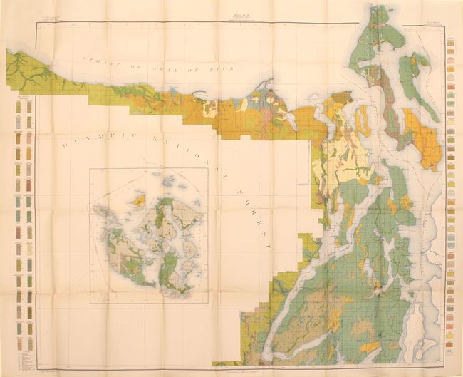
Auction 159, Lot 156
Subject: United States
U.S.D.A.
[Lot of 43 - U.S.D.A. Soil Maps], 1910
Size: 6.1 x 9.6 inches (15.5 x 24.4 cm)
Estimate: $300 - $375
Sold for: $275
Closed on 9/14/2016
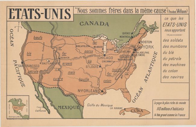
Auction 159, Lot 157
Subject: United States
Etats-Unis, 1917
Size: 36.8 x 22.8 inches (93.5 x 57.9 cm)
Estimate: $220 - $250
Fascinating WWI Map of the United States
Sold for: $475
Closed on 9/14/2016
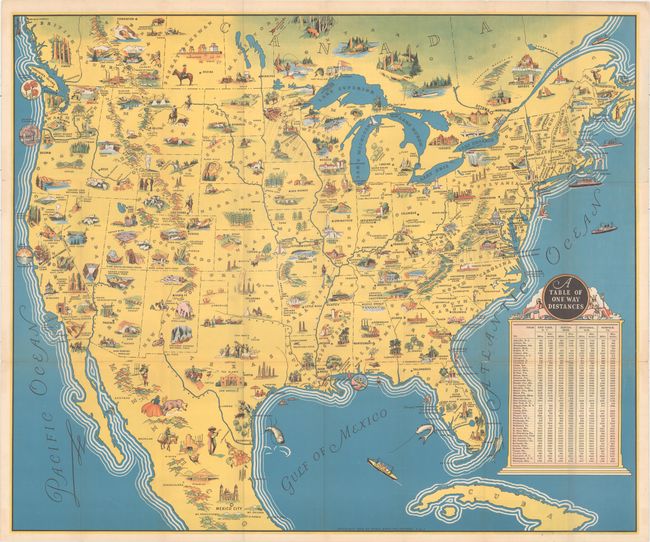
Auction 159, Lot 158
Subject: United States
Poole Bros.
[Title on Cover] America , 1936
Size: 30.8 x 25.7 inches (78.2 x 65.3 cm)
Estimate: $250 - $325
Pictorial Map with German Text on Verso
Sold for: $250
Closed on 9/14/2016
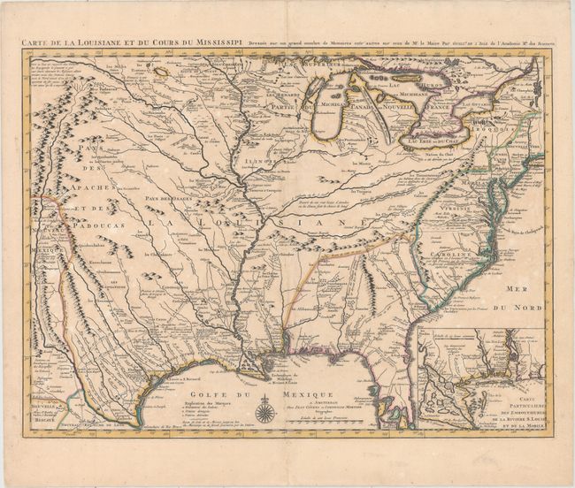
Auction 159, Lot 159
Subject: Colonial Eastern United States, Louisiana Territory
Delisle/Covens & Mortier
Carte de la Louisiane et du Cours du Mississipi Dressee sur un Grand Nombre de Memoires Entr' Autres sur ceux de Mr. le Maire, 1730
Size: 23.6 x 17.3 inches (59.9 x 43.9 cm)
Estimate: $2,750 - $3,500
Delisle's Influential Map of the Louisiana Territory
Sold for: $1,400
Closed on 9/14/2016
Auction 159, Lot 160
Subject: Colonial Eastern United States
Gibson, John
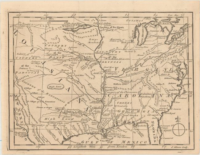
[Untitled - North America, Louisiana, Virginia & Carolina], 1763
Size: 9.5 x 7.1 inches (24.1 x 18 cm)
Estimate: $220 - $250
Sold for: $100
Closed on 9/14/2016
Auction 159, Lot 161
Subject: Eastern United States
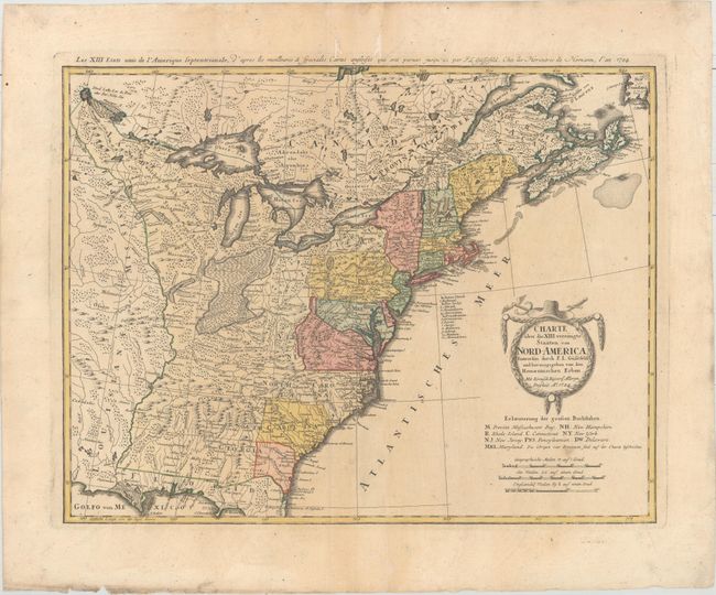
Gussefeld/Homann Heirs
Charte uber die XIII Vereinigte Staaten von Nord-America..., 1784
Size: 22.9 x 17.8 inches (58.2 x 45.2 cm)
Estimate: $600 - $750
Sold for: $425
Closed on 9/14/2016
Auction 159, Lot 162
Subject: Eastern United States
Melish, John
United States of America, 1822
Size: 21.5 x 16.9 inches (54.6 x 42.9 cm)
Estimate: $600 - $750
Sold for: $400
Closed on 9/14/2016
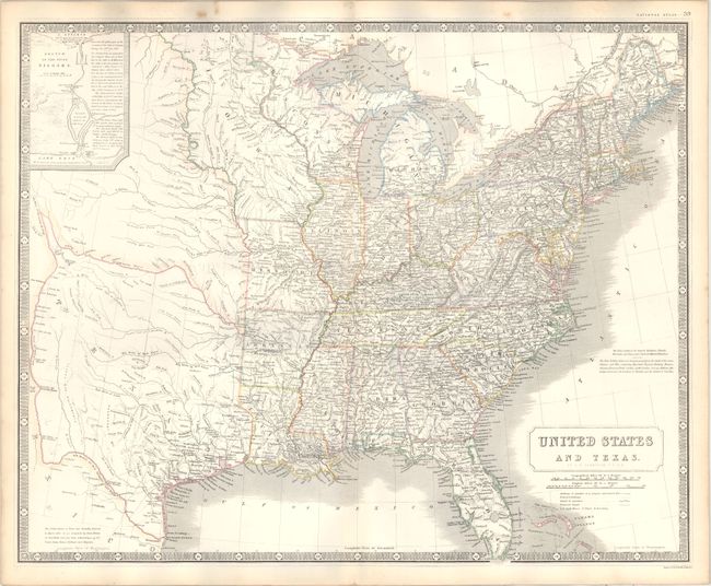
Auction 159, Lot 163
Subject: Eastern United States
Cobbett, William
United States, 1822
Size: 16.4 x 12.6 inches (41.7 x 32 cm)
Estimate: $275 - $350
Sold for: $140
Closed on 9/14/2016
Auction 159, Lot 164
Subject: Eastern United States
General Land Office
[9 Maps in Report - Public Surveys], 1841
Size: See Description
Estimate: $140 - $170
Sold for: $100
Closed on 9/14/2016
Auction 159, Lot 165
Subject: Eastern United States, Texas
Johnston, Alexander K.
United States and Texas, 1842
Size: 24 x 19.6 inches (61 x 49.8 cm)
Estimate: $1,200 - $1,400
Sold for: $600
Closed on 9/14/2016
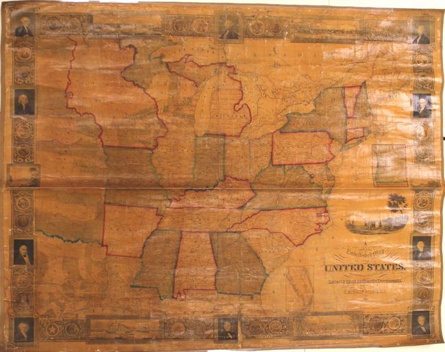
Auction 159, Lot 166
Subject: Eastern United States
A New and Embellished Map of the United States. Compiled from the Latest & Most Authentic Documents, 1846
Size: 47 x 36.6 inches (119.4 x 93 cm)
Estimate: $1,400 - $1,700
Sold for: $2,400
Closed on 9/14/2016
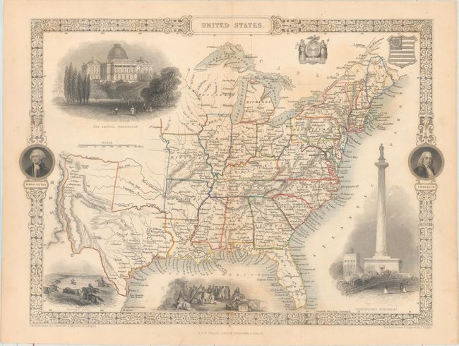
Auction 159, Lot 167
Subject: Eastern United States, Texas
Tallis, John
United States, 1851
Size: 13.5 x 9.7 inches (34.3 x 24.6 cm)
Estimate: $300 - $375
Sold for: $200
Closed on 9/14/2016
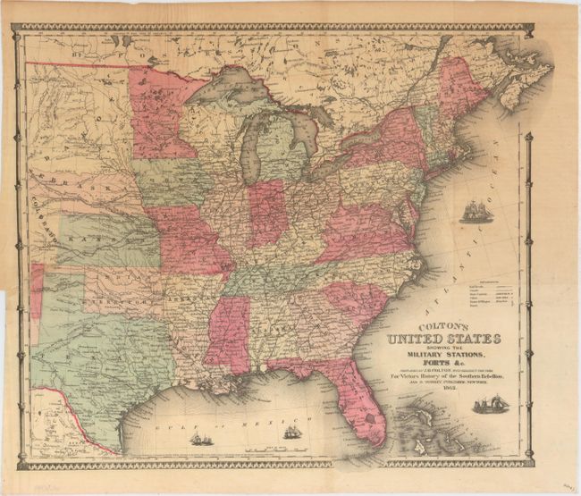
Auction 159, Lot 168
Subject: Eastern United States, Civil War
Colton, Joseph Hutchins
Colton's United States Shewing the Military Stations Forts &c., 1862
Size: 16.3 x 14.5 inches (41.4 x 36.8 cm)
Estimate: $200 - $250
Unsold
Closed on 9/14/2016
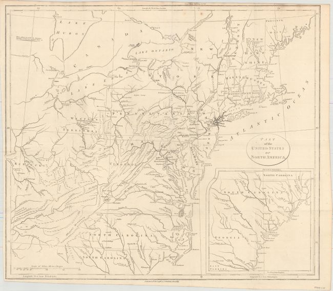
Auction 159, Lot 169
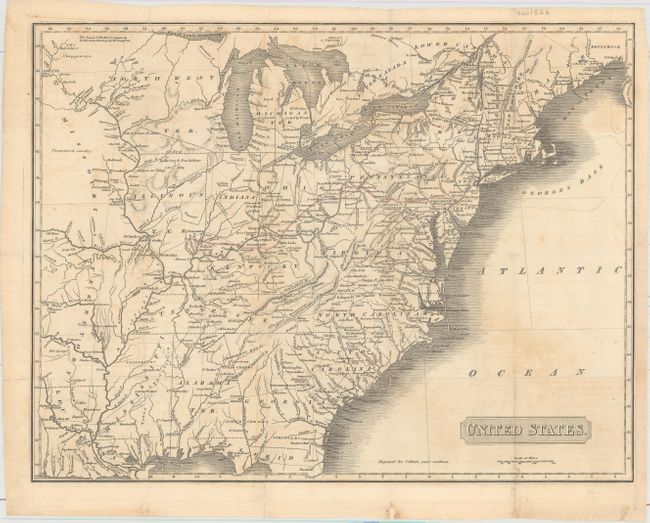
Subject: Northeastern United States
Stockdale, John
Part of the United States of North America, 1798
Size: 18.4 x 16.2 inches (46.7 x 41.1 cm)
Estimate: $300 - $375
Sold for: $200
Closed on 9/14/2016
198 lots
Page 1 of 4