Showing Featured Lots(remove filter)
Filtered by Category:United States(Show All Categories)
Showing results for:Auction 133
Catalog Archive
14 lots
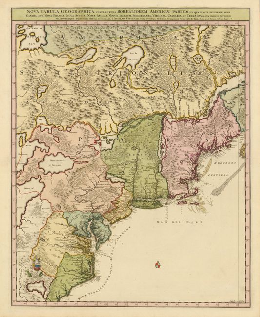
Auction 133, Lot 105
Subject: Colonial United States and Canada
Visscher/Schenk
[Lot of 2] Nova Tabula Geographica Complectens Borealiorem Americae Partem… [and] Carte Nouvelle contenant la Partie d'Amerique la Plus Septentrionale…, 1718
Size: 18.5 x 23 inches (47 x 58.4 cm)
Estimate: $3,000 - $4,000
Sold for: $2,200
Closed on 9/1/2010
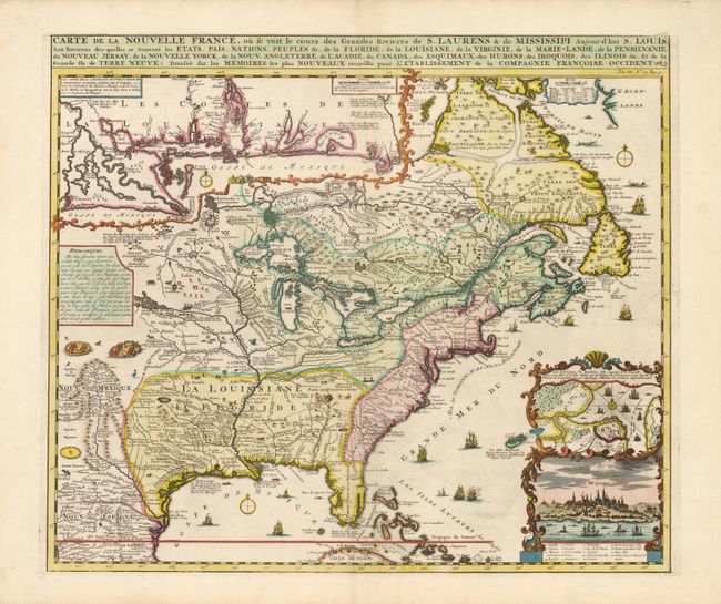
Auction 133, Lot 106
Subject: Colonial United States and Canada
Chatelain, Henry Abraham
Carte de la Nouvelle France, ou se voit le cours des Grandes Rivieres de S. Laurens & de Mississipi Aujour d'hui S. Louis, Aux Environs des-quelles se trouvent les Etats, Pais, Nations, Peuples &c., 1719
Size: 19.2 x 16.5 inches (48.8 x 41.9 cm)
Estimate: $2,500 - $3,000
Sold for: $3,250
Closed on 9/1/2010
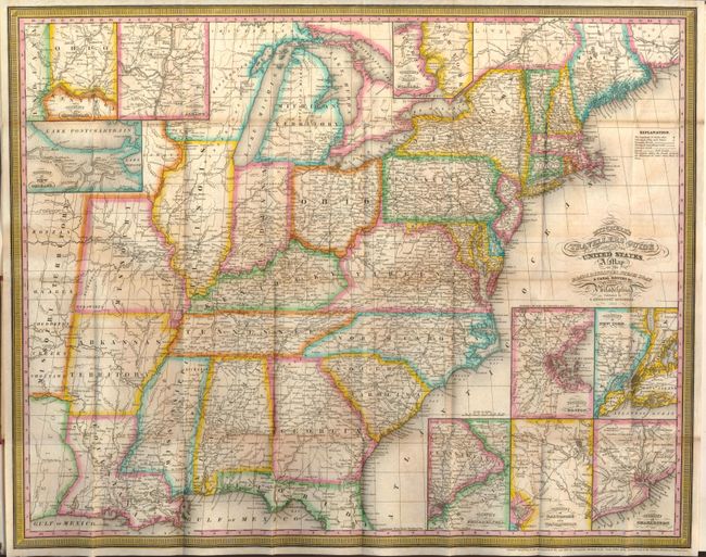
Auction 133, Lot 144
Subject: Eastern United States
Mitchell, Samuel Augustus
Mitchell's Travellers Guide Through the United States. A Map of the Roads, Distances, Steam Boat & Canal Routes & c. by J.H. Young, 1833
Size: 21.7 x 17.3 inches (55.1 x 43.9 cm)
Estimate: $750 - $850
Sold for: $850
Closed on 9/1/2010
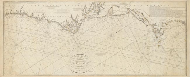
Auction 133, Lot 147
Subject: Eastern United States
Norie, John William
To the Independent Mariners of America, This Chart of their Coast from Savannah to Boston Is most Respectfully Dedicated…, 1852
Size: 61.3 x 25.3 inches (155.7 x 64.3 cm)
Estimate: $3,250 - $3,750
Unsold
Closed on 9/1/2010
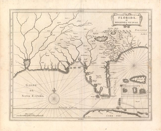
Auction 133, Lot 167
Subject: Colonial South
Gerritsz/De Laet
Florida, et Regiones Vicinae, 1630
Size: 13.8 x 10.8 inches (35.1 x 27.4 cm)
Estimate: $3,000 - $3,750
Sold for: $3,500
Closed on 9/1/2010
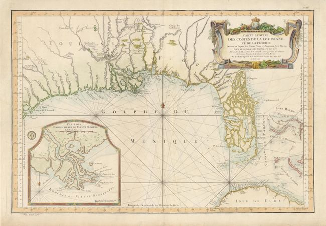
Auction 133, Lot 169
Subject: Colonial South - Florida & Bahamas
Bellin, Jacques Nicolas
Carte Reduite des Costes de la Louisiane et de la Floride…, 1764
Size: 33.2 x 22.2 inches (84.3 x 56.4 cm)
Estimate: $3,000 - $3,750
Sold for: $2,750
Closed on 9/1/2010
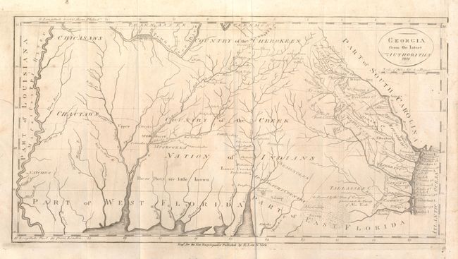
Auction 133, Lot 170
Subject: Southern United States - Georgia
Low, E.
Georgia from the latest Authorities, 1810
Size: 15 x 7.8 inches (38.1 x 19.8 cm)
Estimate: $500 - $700
Sold for: $700
Closed on 9/1/2010
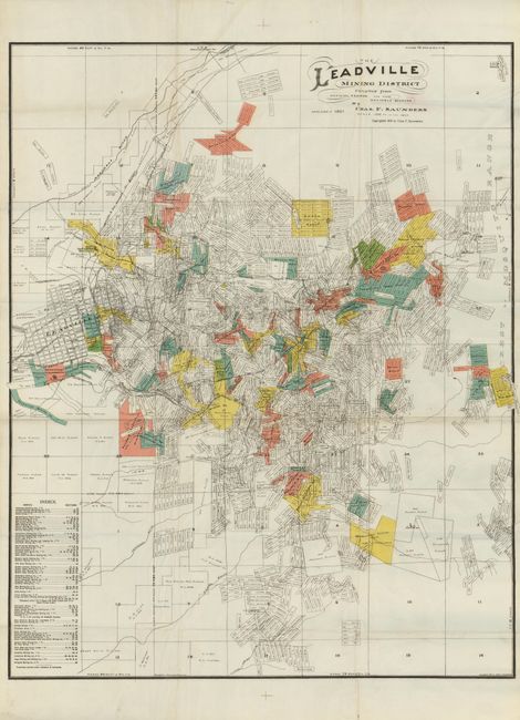
Auction 133, Lot 221
Subject: Colorado
The Leadville Mining District, 1901
Size: 30.5 x 38 inches (77.5 x 96.5 cm)
Estimate: $200 - $300
Sold for: $170
Closed on 9/1/2010
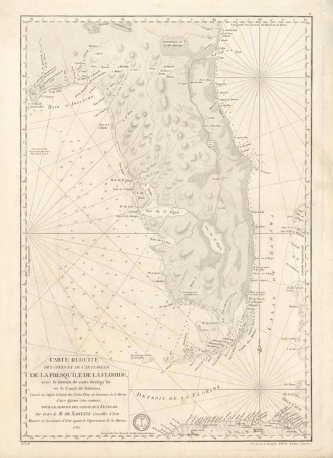
Auction 133, Lot 229
Subject: Colonial Florida, Bahamas
Sartine
Carte Reduite des Cotes et de l'Interieur de la Presqu'ile de la Floride, avec le Detroit de Cette Presqu'ile et le Canal de Bahama, 1780
Size: 15.6 x 22.8 inches (39.6 x 57.9 cm)
Estimate: $2,500 - $3,000
Sold for: $2,200
Closed on 9/1/2010
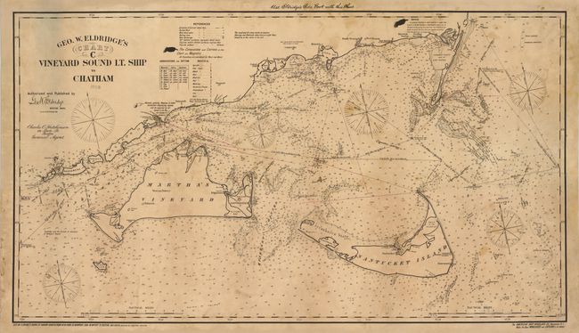
Auction 133, Lot 253
Subject: Massachusetts
Eldridge, George
Geo. W. Eldridge's Chart C Vineyard Sound Lt. Ship to Chatham, 1908
Size: 46.8 x 26.5 inches (118.9 x 67.3 cm)
Estimate: $2,400 - $3,000
Unsold
Closed on 9/1/2010
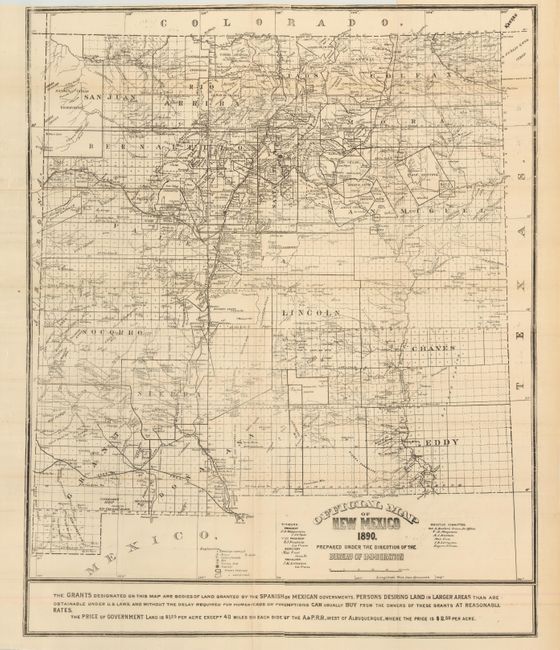
Auction 133, Lot 258
Subject: New Mexico
Official Map of New Mexico. 1890. Prepared Under the Direction of the Bureau of Immigration, 1890
Size: 25.5 x 31.5 inches (64.8 x 80 cm)
Estimate: $300 - $500
Sold for: $150
Closed on 9/1/2010
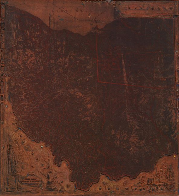
Auction 133, Lot 266
Subject: Ohio
U.S. Geographical Survey
[Copper Printing Plate] Ohio. United States Department of the Interior. Geological Survey., 1890-1920
Size: 8 x 8.5 inches (20.3 x 21.6 cm)
Estimate: $250 - $300
Sold for: $160
Closed on 9/1/2010
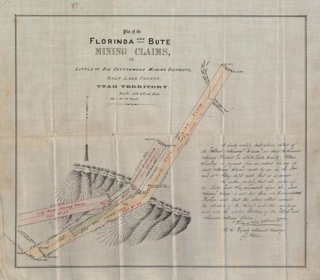
Auction 133, Lot 284
Subject: Utah
[Manuscript Mining Claim] Plat of the Florinda and Bute Mining Claims, in Little and Big Cottonwood Mining Districts, Salt Lake County, Utah Territory, 1874
Size: 16.5 x 14.3 inches (41.9 x 36.3 cm)
Estimate: $180 - $250
Sold for: $350
Closed on 9/1/2010
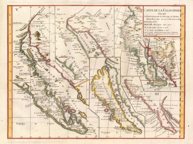
Auction 133, Lot 293
Subject: California and Baja Mexico
Robert de Vaugondy, Didier
Carte de la Californie Suivant I. La Carte Manuscrite de l'Amerique de Mathieu Neron Pecci Olen Dresse a Florence en 1604, II. Sanson 1656, III. De L'Isle Amerique Sept. 1700, IV. Le Pere Kino Jesuite en 1705, V. La Societe des Jesuites en 1767, 1777
Size: 15.2 x 11.4 inches (38.6 x 29 cm)
Estimate: $600 - $700
Sold for: $750
Closed on 9/1/2010
14 lots