Showing Featured Lots(remove filter)
Filtered by Category:United States(Show All Categories)
Showing results for:Auction 127
Catalog Archive
22 lots
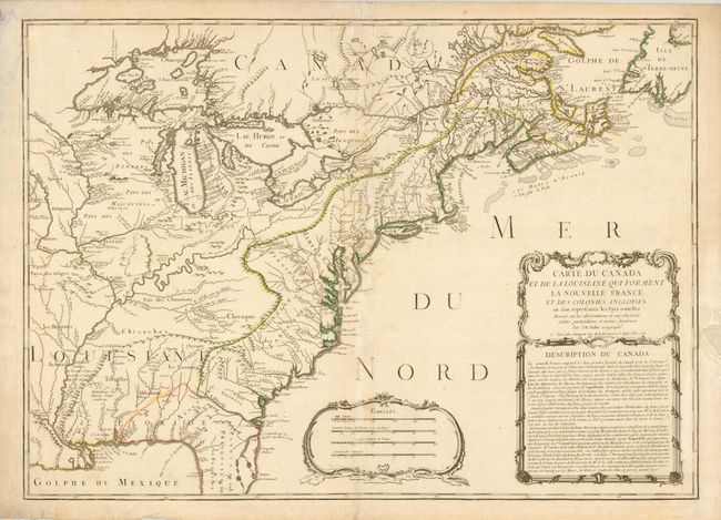
Auction 127, Lot 129
Subject: Colonial United States and Canada
Nolin, Jean Batiste
Carte du Canada et de la Louisiane qui Forment la Nouvelle France et des Colonies Angloises…, 1756
Size: 28 x 19.8 inches (71.1 x 50.3 cm)
Estimate: $2,400 - $3,000
Unsold
Closed on 2/25/2009
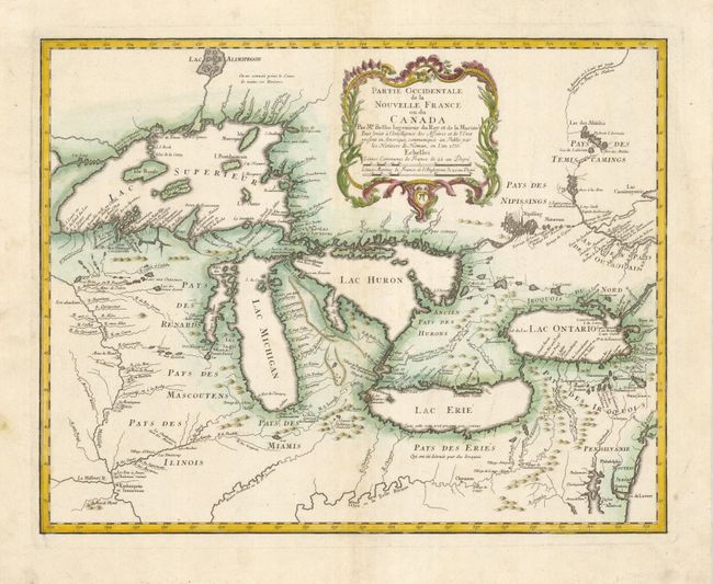
Auction 127, Lot 130
Subject: Great Lakes
Bellin/Homann Heirs
Partie Occidentale de la Nouvelle France ou du Canada, 1755
Size: 21.3 x 16.9 inches (54.1 x 42.9 cm)
Estimate: $2,100 - $2,400
Unsold
Closed on 2/25/2009
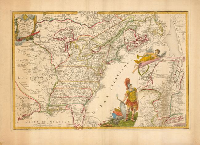
Auction 127, Lot 134
Subject: Colonial United States and Canada
Beaurain, Jean Chev. De
Carte de l'Amerique Septle. Pour servir a l'Intelligence de la Guerre entre les Anglois et les Insurgents, 1777
Size: 24.3 x 16.3 inches (61.7 x 41.4 cm)
Estimate: $7,000 - $10,000
Sold for: $5,000
Closed on 2/25/2009
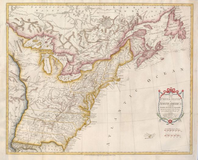
Auction 127, Lot 137
Subject: Eastern United States and Canada
Kitchin, Thomas
Map of the United States in North America: with the British, French and Spanish Dominions adjoining, according to the Treaty of 1783, 1783
Size: 20 x 16 inches (50.8 x 40.6 cm)
Estimate: $1,100 - $1,500
Sold for: $800
Closed on 2/25/2009

Auction 127, Lot 158
Subject: United States
Johnson & Browning
Colton's United States of America, 1859
Size: 26.5 x 15.5 inches (67.3 x 39.4 cm)
Estimate: $750 - $900
Sold for: $550
Closed on 2/25/2009
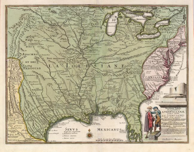
Auction 127, Lot 170
Subject: Colonial United States
Weigel, Christopher
Novissima Tabula Regionis Ludovicianae Gallice dicta la Louisiane…, 1734
Size: 16.3 x 12.5 inches (41.4 x 31.8 cm)
Estimate: $1,500 - $1,800
Sold for: $950
Closed on 2/25/2009
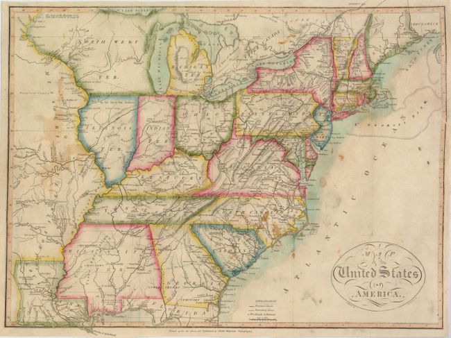
Auction 127, Lot 177
Subject: Eastern United States
Melish, John
Map of the United States of America, 1816
Size: 17.8 x 13.5 inches (45.2 x 34.3 cm)
Estimate: $800 - $1,200
Sold for: $550
Closed on 2/25/2009
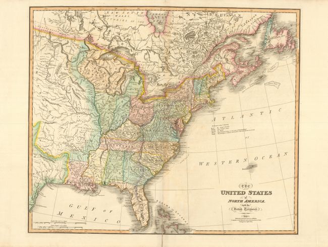
Auction 127, Lot 179
Subject: Eastern United States
Wyld, James
The United States of North America, with the British Territories, 1824
Size: 25 x 21 inches (63.5 x 53.3 cm)
Estimate: $700 - $800
Sold for: $300
Closed on 2/25/2009
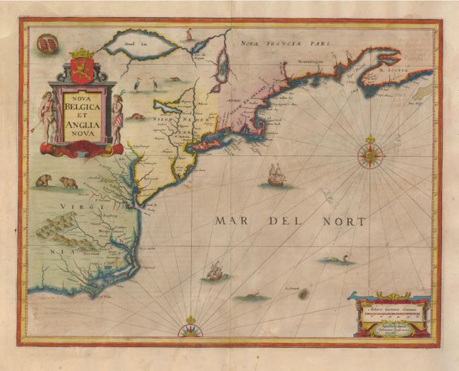
Auction 127, Lot 185
Subject: Colonial New England and Mid-Atlantic
Jansson, Jan
Nova Belgica et Anglia Nova, 1647
Size: 19.7 x 15.2 inches (50 x 38.6 cm)
Estimate: $2,000 - $2,400
Sold for: $1,500
Closed on 2/25/2009
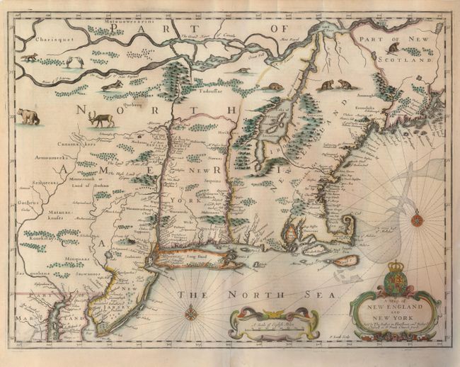
Auction 127, Lot 186
Subject: Colonial New England and New York
Speed/Lamb
A Map of New England and New York, 1676
Size: 19.7 x 15 inches (50 x 38.1 cm)
Estimate: $5,500 - $6,500
Unsold
Closed on 2/25/2009
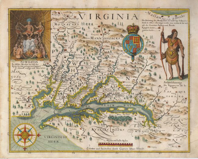
Auction 127, Lot 193
Subject: Colonial Mid-Atlantic
Merian, Matthaus
Virginia - Erforshet und Beschriben durch Capitain Iohan Schmidt, 1627
Size: 14 x 11.3 inches (35.6 x 28.7 cm)
Estimate: $5,500 - $6,500
Sold for: $5,500
Closed on 2/25/2009
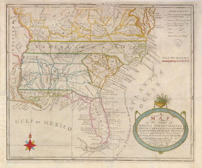
Auction 127, Lot 202
Subject: Southeast United States
Purcell, Joseph
A Map of the States of Virginia, North Carolina, South Carolina and Georgia Comprehending the Spanish Provinces of East and West Florida Exhibiting the Boundaries between the Unites States and Spanish Dominions as Fixed by the Treaty of Peace in 1783, 1793
Size: 14.8 x 12.5 inches (37.6 x 31.8 cm)
Estimate: $1,100 - $1,300
Sold for: $800
Closed on 2/25/2009
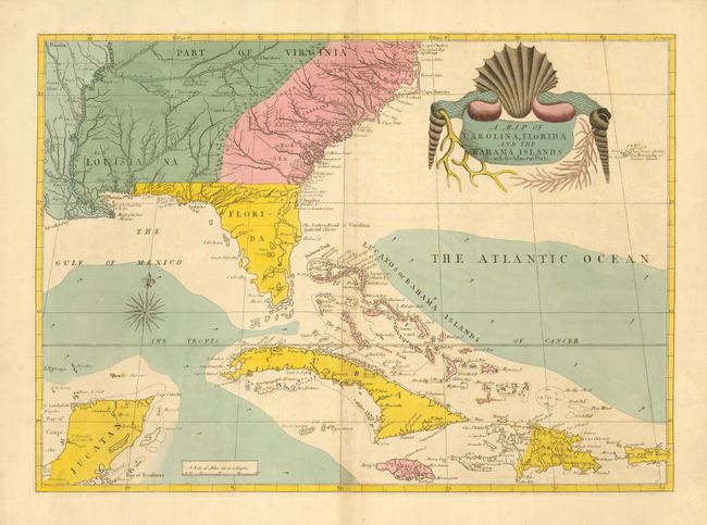
Auction 127, Lot 216
Subject: Colonial Southeast and Bahamas
Catesby, Mark
A Map of Carolina, Florida and the Bahama Islands with the Adjacent Parts, 1815
Size: 24 x 17 inches (61 x 43.2 cm)
Estimate: $6,500 - $8,000
Sold for: $4,750
Closed on 2/25/2009
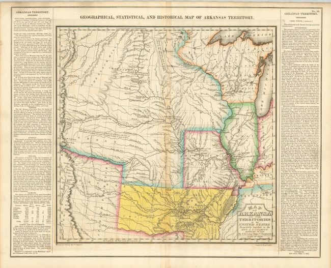
Auction 127, Lot 220
Subject: Central United States, Arkansas
Carey & Lea
Map of Arkansa and other Territories of the United States, 1823
Size: 14.5 x 14.5 inches (36.8 x 36.8 cm)
Estimate: $800 - $1,000
Sold for: $650
Closed on 2/25/2009
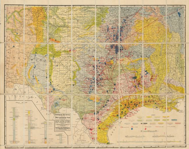
Auction 127, Lot 226
Subject: Central United States and Texas, Oil Fields
Geographical Publishing Co.
Geological Oil Survey Map of the Mid-Continental Field Embracing the States of Arkansas, Colorado, Illinois, Kansas, Louisiana, Mississippi, Missouri, New Mexico, Oklahoma, Tennessee and Texas, 1920
Size: 28 x 22 inches (71.1 x 55.9 cm)
Estimate: $350 - $425
Sold for: $550
Closed on 2/25/2009
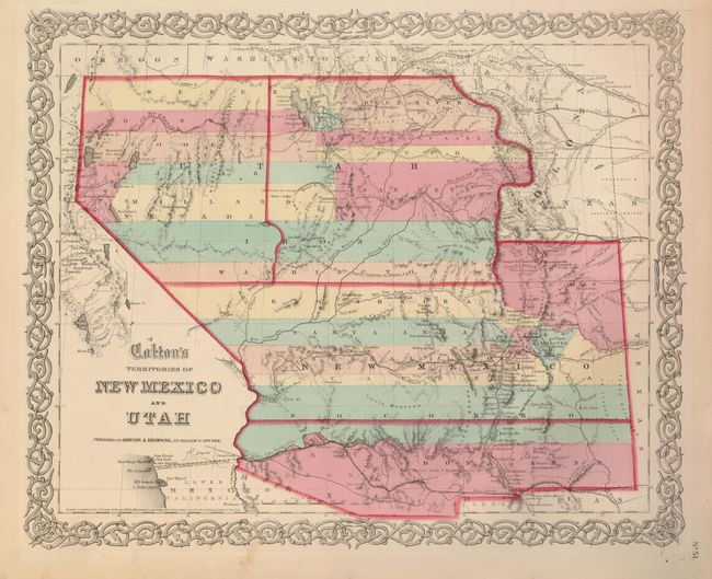
Auction 127, Lot 247
Subject: Southwestern United States
Johnson & Browning
Colton's Territories of New Mexico and Utah, 1859-60
Size: 15.6 x 12.8 inches (39.6 x 32.5 cm)
Estimate: $425 - $550
Sold for: $800
Closed on 2/25/2009
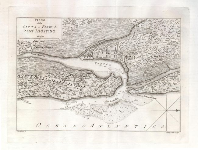
Auction 127, Lot 271
Subject: St. Augustine, Colonial Florida
Masi, Gio. Tommaso
Piano della Citta, e Porto di Sant. Agostino, 1763
Size: 11.3 x 8 inches (28.7 x 20.3 cm)
Estimate: $400 - $500
Sold for: $300
Closed on 2/25/2009
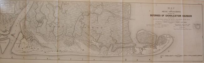
Auction 127, Lot 331
Subject: South Carolina
Gillmore, Q.A., Major-General
Engineer and Artillery Operations against the Defences of Charleston Harbor in 1863; Comprising the Descent Upon Morris Island, the Demolition of Fort Sumter, the Reduction of Forts Wagner and Gregg, 1865
Size: 6.5 x 9.5 inches (16.5 x 24.1 cm)
Estimate: $800 - $1,200
Sold for: $750
Closed on 2/25/2009
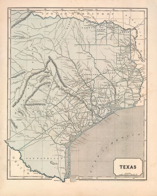
Auction 127, Lot 332
Subject: Texas
Morse & Breese
Texas, 1844
Size: 12 x 15 inches (30.5 x 38.1 cm)
Estimate: $750 - $900
Sold for: $700
Closed on 2/25/2009
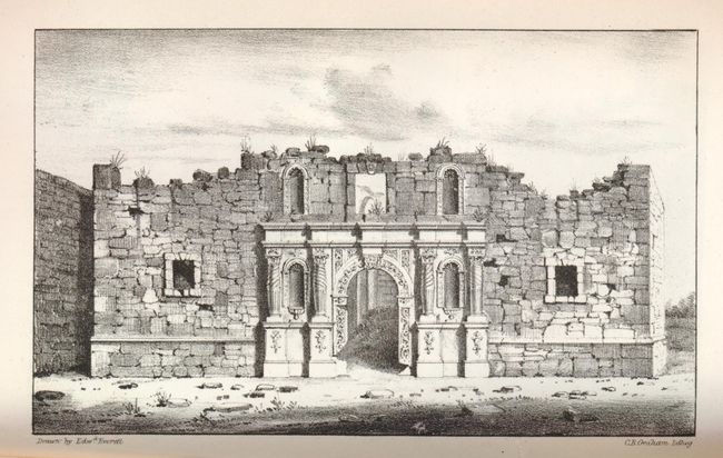
Auction 127, Lot 334
Subject: Texas and Alamo
U.S. War Department
Report of the Secretary of War, Communicating...Operations of the Army of the United States in Texas and the Adjacent Mexican States on the Rio Grande…, 1850
Size: 6 x 9.3 inches (15.2 x 23.6 cm)
Estimate: $800 - $1,200
Sold for: $1,100
Closed on 2/25/2009
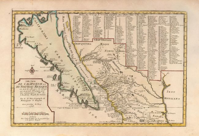
Auction 127, Lot 351
Subject: California, Southwest U.S., Mexico
Fer, Nicolas de
Cette Carte de Californie et du Nouveau Mexique…, 1705
Size: 13.4 x 8.7 inches (34 x 22.1 cm)
Estimate: $1,500 - $2,000
Sold for: $1,600
Closed on 2/25/2009
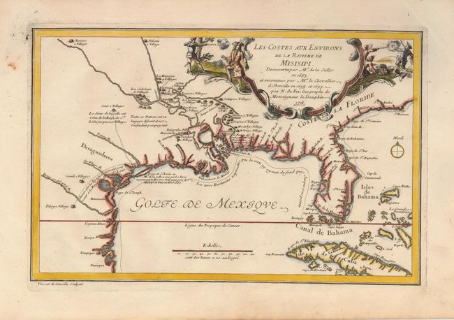
Auction 127, Lot 375
Subject: Colonial South
Fer, Nicolas de
Les Costes aux Environs de la Riviere de Misisipi. Decouvertes par Mr. de la Salle en 1683…, 1705
Size: 13 x 8.5 inches (33 x 21.6 cm)
Estimate: $950 - $1,200
Sold for: $850
Closed on 2/25/2009
22 lots