Showing Featured Lots(remove filter)
Filtered by Category:Latin America, Caribbean(Show All Categories)
Showing results for:Auction 154
Catalog Archive
6 lots
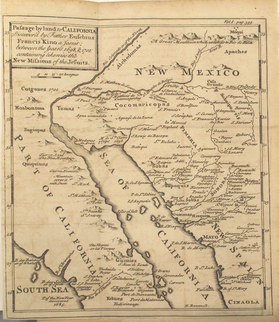
Auction 154, Lot 294
Subject: Southwestern United States & Mexico
Kino, Eusebio Francisco, SJ
Passage by Land to California Discovered by Father Eusebius Francis Kino a Jesuit; Between the Years 1698, & 1701: Containing Likewise the New Missions of the Jesuits [Bound in] Travels of the Jesuits, 1743
Size: 8 x 9.2 inches (20.3 x 23.4 cm)
Estimate: $1,000 - $1,300
Father Kino's Important Map of California
Sold for: $850
Closed on 9/16/2015
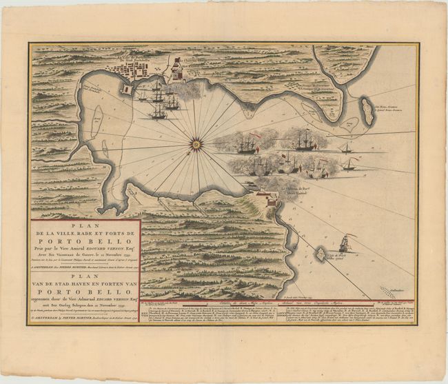
Auction 154, Lot 315
Subject: Portobelo, Panama
Mortier, Pierre
Plan de la Ville Rade et Forts de Porto Bello... / Plan van de Stad Haven en Forten van Porto Bello..., 1740
Size: 22.4 x 16.3 inches (56.9 x 41.4 cm)
Estimate: $2,000 - $2,300
Rare Chart of the Battle of Portobello
Sold for: $1,400
Closed on 9/16/2015
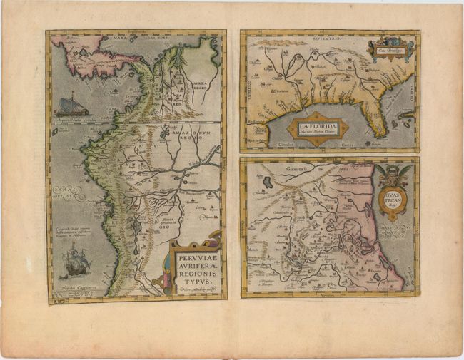
Auction 154, Lot 318
Subject: Gulf of Mexico, Florida & Peru
Ortelius, Abraham
Peruviae Auriferae Regionis Typus [on sheet with] La Florida [and] Guastecan, 1598
Size: 18.1 x 13.1 inches (46 x 33.3 cm)
Estimate: $1,600 - $1,900
The First Printed Map of the Southern United States
Sold for: $950
Closed on 9/16/2015
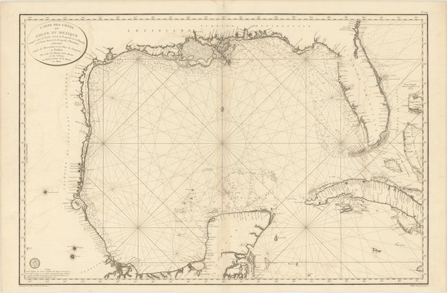
Auction 154, Lot 319
Subject: Gulf of Mexico and Cuba
Depot de la Marine
Carte des Cotes du Golfe du Mexique Compris Entre la Pointe Sud de la Presqu'Ile de la Floride et la Pointe Nord de la Presqu' Ile d'Yucatan..., 1800
Size: 35.6 x 23.6 inches (90.4 x 59.9 cm)
Estimate: $800 - $1,000
Important Map for the Texas Collector
Sold for: $600
Closed on 9/16/2015
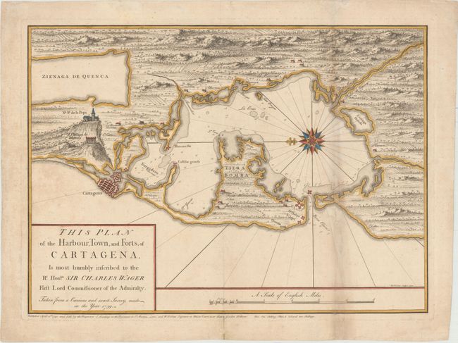
Auction 154, Lot 356
Subject: Cartagena, Colombia
Toms, William Henry
This Plan of the Harbour, Town, and Forts, of Cartagena, Is Most Humbly Inscribed to the Rt. Honble. Sir Charles Wager First Lord Commissioner of the Admiralty..., 1740
Size: 22.8 x 16.6 inches (57.9 x 42.2 cm)
Estimate: $600 - $750
Rare Chart Issued Prior to the Battle of Cartagena
Sold for: $950
Closed on 9/16/2015
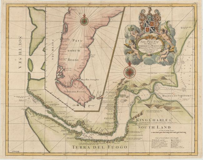
Auction 154, Lot 382
Subject: Strait of Magellan
Narbrough, John
To the Honble. Sam: Pepys Esqr. This Mapp of the Streights of Magellan Drawn by Sr Ion. Narbrough..., 1694
Size: 20.6 x 16.4 inches (52.3 x 41.7 cm)
Estimate: $1,800 - $2,200
First Edition of Narborough's Scarce Map of the Strait of Magellan
Sold for: $1,200
Closed on 9/16/2015
6 lots