Showing Featured Lots(remove filter)
Filtered by Category:Europe & Mediterranean(Show All Categories)
Showing results for:Auction 180
Catalog Archive
5 lots
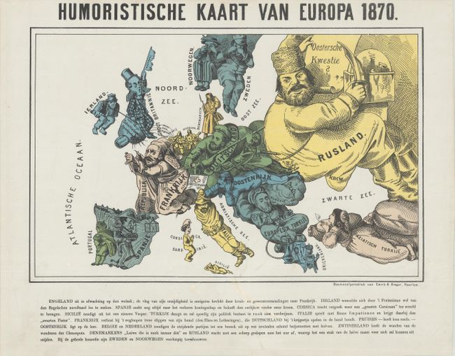
Auction 180, Lot 395
Subject: Europe, War
Emrik & Binger
[Lot of 2] Humoristische Kaart van Europa 1870 [and] Nieuwe Kaart van Europa 1870, 1870
Size: See Description
Estimate: $1,500 - $1,800
Pair of Satirical Dutch Maps Showing Contrasting Views at the Outset of the Franco-Prussian War
Sold for: $850
Closed on 11/18/2020
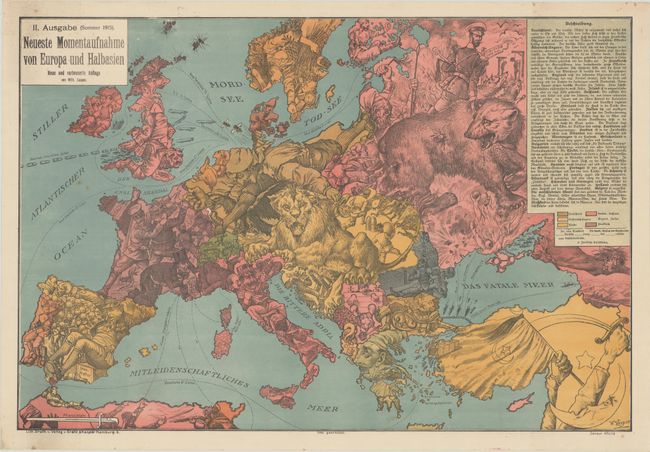
Auction 180, Lot 396
Subject: Europe, World War I
II. Ausgabe (Sommer 1915). Neueste Momentaufnahme von Europa und Halbasien, 1915
Size: 26.6 x 17.9 inches (67.6 x 45.5 cm)
Estimate: $1,200 - $1,500
Rare Updated Propaganda Map from WWI in Support of Central Powers
Sold for: $950
Closed on 11/18/2020
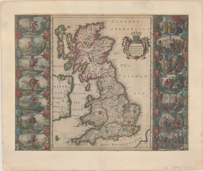
Auction 180, Lot 401
Subject: Britain
Blaeu, Johannes
Britannia Prout Divisa suit Temporibus Anglo-Saxonum, Praesertim Durante Illorum Heptarchia, 1658
Size: 20.8 x 16.3 inches (52.8 x 41.4 cm)
Estimate: $2,000 - $2,300
Decorative Map of Britain with Vignettes of Saxon History - Spanish Edition
Sold for: $1,200
Closed on 11/18/2020
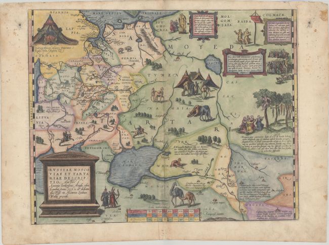
Auction 180, Lot 540
Subject: Russia, Eastern Europe & Central Asia
Ortelius, Abraham
Russiae, Moscoviae et Tartariae Descriptio. Auctore Antonio Ienkensono Anglo..., 1572
Size: 17.3 x 13.6 inches (43.9 x 34.5 cm)
Estimate: $1,600 - $1,900
Ortelius' Map of Russia with a Vignette of Ivan the Terrible
Sold for: $1,500
Closed on 11/18/2020
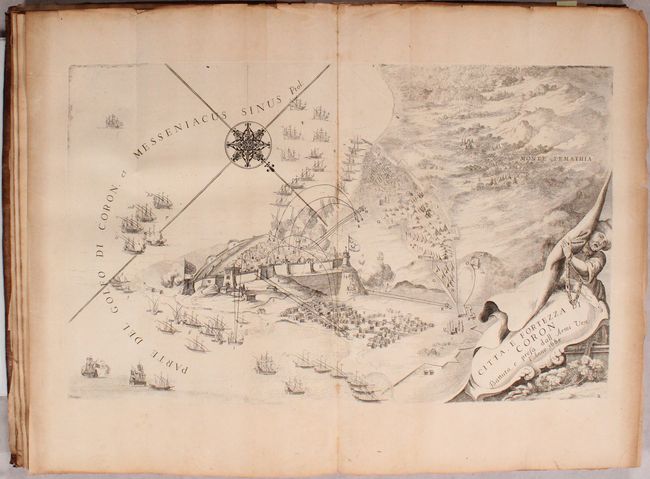
Auction 180, Lot 567
Subject: Southern Greece
Coronelli, Vincenzo Maria
Description Geographique, et Historique de la Moree, Reconquise par les Venitiens. du Royaume de Negrepont..., 1687
Size: 9.9 x 14.9 inches (25.1 x 37.8 cm)
Estimate: $2,300 - $2,750
Attractive Plates of Southern Greece
Sold for: $1,600
Closed on 11/18/2020
5 lots