Showing Featured Lots(remove filter)
Filtered by Category:Canada(Show All Categories)
Showing results for:Auction 186
Catalog Archive
4 lots
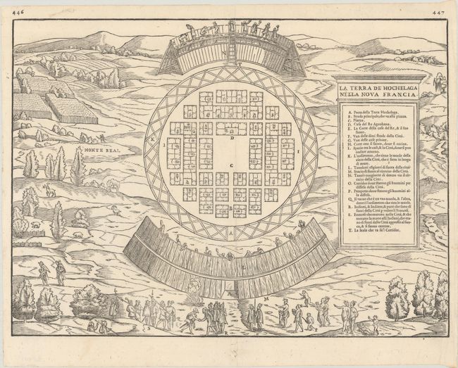
Auction 186, Lot 126
Subject: Montreal, Canada
Gastaldi/Ramusio
La Terra de Hochelaga Nella Nova Francia, 1556
Size: 14.5 x 10.6 inches (36.8 x 26.9 cm)
Estimate: $2,400 - $3,000
The First Published Plan of a Settlement in North America
Sold for: $3,000
Closed on 2/9/2022
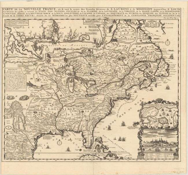
Auction 186, Lot 131
Subject: Colonial Eastern United States & Canada
Chatelain, Henry Abraham
Carte de la Nouvelle France, ou se voit le Cours des Grandes Rivieres de S. Laurens & de Mississipi Aujour d'hui S. Louis, aux Environs des-quelles se Trouvent les Etats, Pais, Nations, Peuples &c..., 1720
Size: 19.3 x 16.6 inches (49 x 42.2 cm)
Estimate: $2,400 - $3,000
One of the Most Informative 18th Century Maps of the French Possessions in North America
Sold for: $2,100
Closed on 2/9/2022
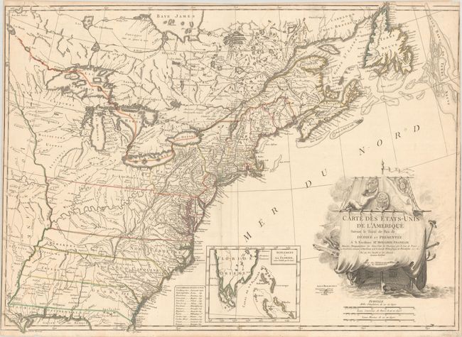
Auction 186, Lot 137
Subject: Eastern United States & Canada
Lattre, Jean
Carte des Etats-Unis de l'Amerique Suivant le Traite de Paix de ... Dediee et Presentee a S. Excellence Mr. Benjamin Franklin..., 1791
Size: 30 x 21.9 inches (76.2 x 55.6 cm)
Estimate: $5,500 - $7,000
First French Map of the New United States
Sold for: $7,000
Closed on 2/9/2022
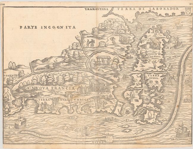
Auction 186, Lot 143
Subject: Colonial Northeastern United States & Canada
Gastaldi/Ramusio
La Nuova Francia, 1556
Size: 14.8 x 10.8 inches (37.6 x 27.4 cm)
Estimate: $5,000 - $6,500
Rare First State of the First Printed Map to Focus on New England and New France
Sold for: $3,500
Closed on 2/9/2022
4 lots