Showing Featured Lots(remove filter)
Filtered by Category:Canada(Show All Categories)
Showing results for:Auction 159
Catalog Archive
4 lots
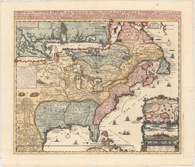
Auction 159, Lot 123
Subject: Colonial Eastern United States & Canada
Chatelain, Henry Abraham
Carte de la Nouvelle France, ou se voit le Cours des Grandes Rivieres de S. Laurens & de Mississipi Aujour d'hui S. Louis, aux Environs des-quelles se Trouvent les Etats, Pais, Nations, Peuples &c..., 1719
Size: 19.4 x 16.7 inches (49.3 x 42.4 cm)
Estimate: $2,500 - $3,000
One of the Most Informative 18th Century Maps of the French Possessions in North America
Sold for: $1,900
Closed on 9/14/2016
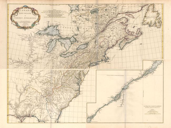
Auction 159, Lot 125
Subject: Colonial Eastern United States & Canada
Anville, Jean Baptiste Bourguignon d'
[On 4 Sheets] Canada Louisiane et Terres Angloises, 1755
Size: 44.5 x 18.8 inches (113 x 47.8 cm)
Estimate: $2,000 - $2,300
D'Anville's Spectacular Map of Eastern Seaboard
Unsold
Closed on 9/14/2016
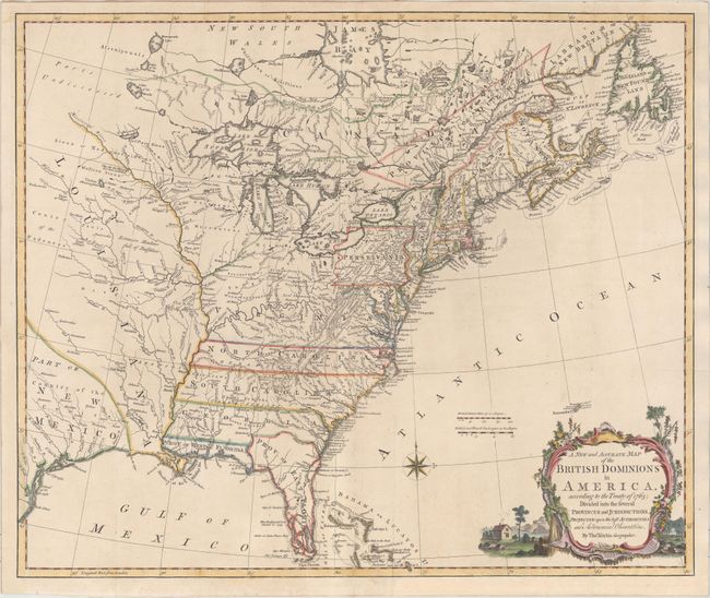
Auction 159, Lot 127
Subject: Colonial Eastern United States & Canada
Kitchin, Thomas
A New and Accurate Map of the British Dominions in America, According to the Treaty of 1763; Divided into the Several Provinces and Jurisdictions..., 1766
Size: 24.8 x 20.8 inches (63 x 52.8 cm)
Estimate: $2,200 - $2,500
Rare Map of the British Colonies Just After the French & Indian War
Sold for: $1,600
Closed on 9/14/2016
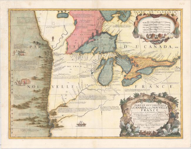
Auction 159, Lot 140
Subject: Colonial Great Lakes
Coronelli/Nolin
Partie Occidentale du Canada ou de la Nouvelle France ou Sont les Nations des Ilinois, de Tracy, les Iroquois, et Plusieurs Autres Peuples; avec la Louisiane Nouvellement Decouverte etc., 1688
Size: 23.3 x 17.4 inches (59.2 x 44.2 cm)
Estimate: $12,000 - $15,000
Third State of Coronelli's Important Map of the Great Lakes
Sold for: $11,500
Closed on 9/14/2016
4 lots