Showing Featured Lots(remove filter)
Filtered by Category:Canada(Show All Categories)
Showing results for:Auction 157
Catalog Archive
7 lots
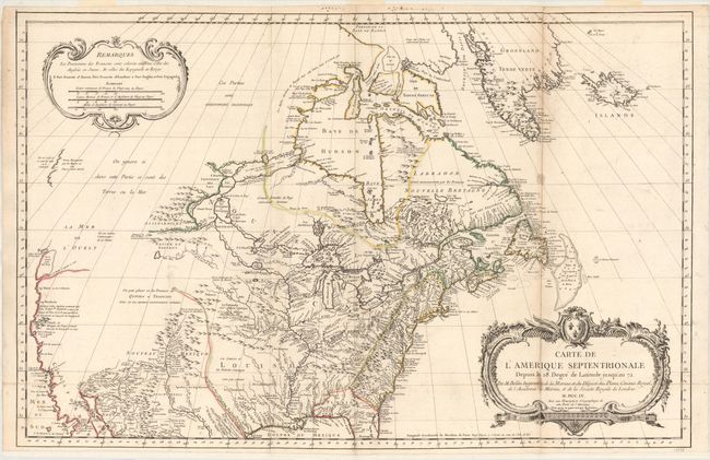
Auction 157, Lot 127
Subject: Colonial United States & Canada
Bellin, Jacques Nicolas
Carte de l'Amerique Septentrionale Depuis le 28 Degre de Latitude Jusqu'au 72, 1755
Size: 34 x 22 inches (86.4 x 55.9 cm)
Estimate: $1,500 - $1,800
NO RESERVE - Bellin's Important, Large Format Map of North America
Sold for: $950
Closed on 5/4/2016
Auction 157, Lot 128
Subject: United States & Canada
SDUK Society for the Diffusion of Useful Knowledge
[Lot of 15 - North America], 1832-34
Size: 12.3 x 15.1 inches (31.2 x 38.4 cm)
Estimate: $950 - $1,200
Matching Set of North America SDUK Maps
Sold for: $1,200
Closed on 5/4/2016
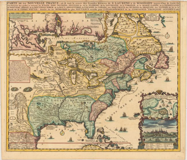
Auction 157, Lot 130
Subject: Colonial Eastern United States & Canada
Chatelain, Henry Abraham
Carte de la Nouvelle France, ou se voit le Cours des Grandes Rivieres de S. Laurens & de Mississipi Aujour d'hui S. Louis, aux Environs des Quelles se Trouvent les Etats, Pais, Nations, Peuples &c..., 1719
Size: 19.1 x 16.6 inches (48.5 x 42.2 cm)
Estimate: $2,200 - $2,500
One of the Most Informative 18th Century Maps of the French Possessions in North America
Sold for: $2,400
Closed on 5/4/2016
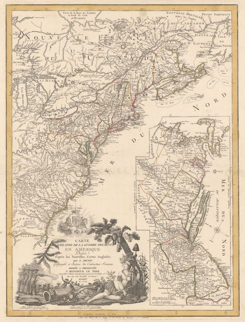
Auction 157, Lot 134
Subject: Colonial Eastern United States & Canada
Denis, Louis
Carte du Theatre de la Guerre Presente en Amerique Dressee d'Apres les Nouvelles Cartes Anglaises..., 1779
Size: 19.8 x 26.3 inches (50.3 x 66.8 cm)
Estimate: $4,750 - $6,000
Scarce American Revolutionary War Map
Sold for: $3,000
Closed on 5/4/2016
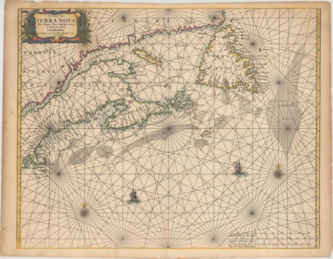
Auction 157, Lot 137
Subject: Canadian Maritimes & New England
Loon, Jan van
Pas-caerte van Terra Nova, Nova Francia, Nieuw Engeland en de Grote Rivier van Canada, 1666
Size: 21.2 x 16.8 inches (53.8 x 42.7 cm)
Estimate: $4,000 - $5,500
Very Influential Dutch Sea Chart of the Canadian Maritimes
Unsold
Closed on 5/4/2016
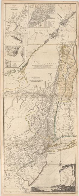
Auction 157, Lot 142
Subject: Colonial Northeastern United States & Quebec
Holland/Pownal
The Provinces of New York and New Jersey; with Part of Pensilvania, and the Province of Quebec, 1776
Size: 21.3 x 52.9 inches (54.1 x 134.4 cm)
Estimate: $5,500 - $7,000
Thomas Jefferys' Important Revolutionary War Period Map
Unsold
Closed on 5/4/2016
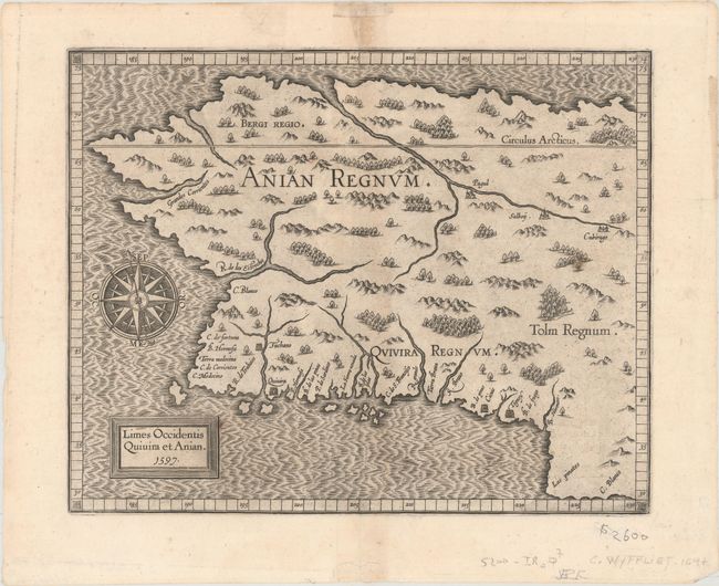
Auction 157, Lot 147
Subject: Alaska & Western Canada
Wytfliet, Cornelis
Limes Occidentis Quivira et Anian, 1597
Size: 11.4 x 9.2 inches (29 x 23.4 cm)
Estimate: $2,200 - $2,500
Early and Imaginary Map of Alaska and the Northwest Passage
Sold for: $1,500
Closed on 5/4/2016
7 lots