Showing No Reserve Lots(remove filter)
Filtered by Category:Books, Atlases, Travel Guides, Geography & Reference Books(Show All Categories)
Showing results for:Auction 189
Catalog Archive
15 lots
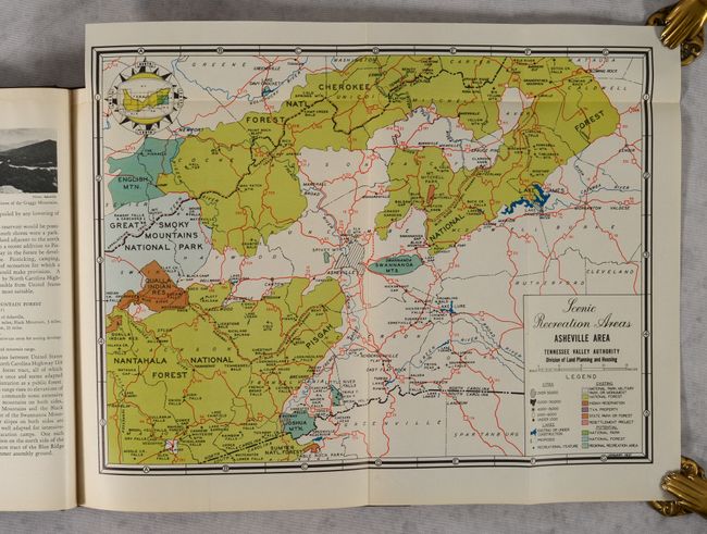
Auction 189, Lot 176
Subject: Southern United States, Tennessee Valley
U.S. Gov't Printing Office
The Scenic Resources of the Tennessee Valley - A Descriptive and Pictorial Inventory, 1938
Size: 8.6 x 11.1 inches (21.8 x 28.2 cm)
Estimate: $50 - $70
NO RESERVE
Sold for: $5
Closed on 9/14/2022
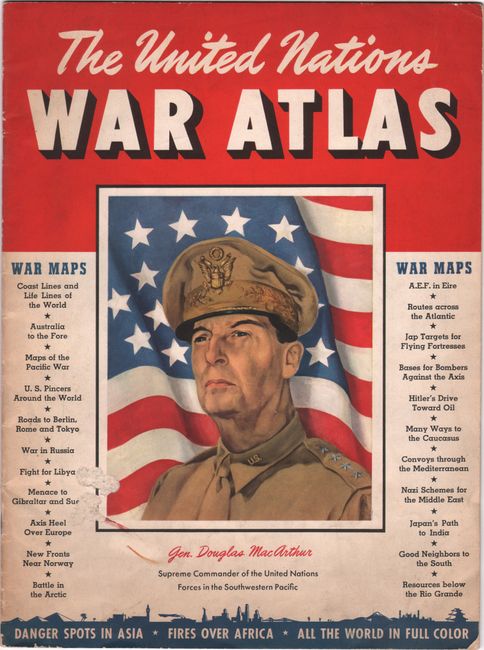
Auction 189, Lot 738
Subject: Atlases, World War II
The United Nations War Atlas, 1942
Size: 10 x 13.5 inches (25.4 x 34.3 cm)
Estimate: $120 - $150
NO RESERVE
Sold for: $100
Closed on 9/14/2022
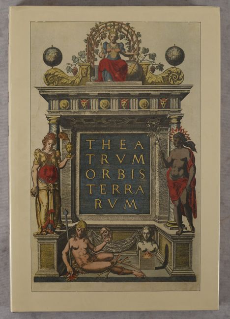
Auction 189, Lot 751
Subject: References, Facsimile Atlas
Ortelius, Abraham
[Facsimile] Die Schonsten Karten aus dem Theatrum Orbis Terrarum , 1970
Size: 11.3 x 16.3 inches (28.7 x 41.4 cm)
Estimate: $40 - $60
NO RESERVE
Sold for: $46
Closed on 9/14/2022
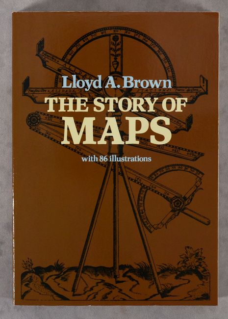
Auction 189, Lot 752
Subject: References
Brown, Lloyd Arnold
The Story of Maps, 1979
Size: 6.5 x 9.3 inches (16.5 x 23.6 cm)
Estimate: $20 - $35
NO RESERVE
Sold for: $1
Closed on 9/14/2022
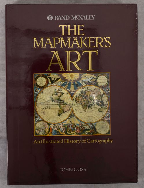
Auction 189, Lot 753
Subject: References
Goss, John
The Mapmaker's Art - An Illustrated History of Cartography, 1993
Size: 11 x 15 inches (27.9 x 38.1 cm)
Estimate: $90 - $120
NO RESERVE
Sold for: $160
Closed on 9/14/2022
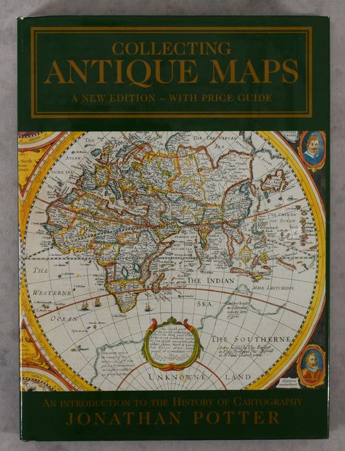
Auction 189, Lot 754
Subject: References
Potter, Jonathan
Collecting Antique Maps - An Introduction to the History of Cartography, 2001
Size: 8.9 x 12.1 inches (22.6 x 30.7 cm)
Estimate: $25 - $40
NO RESERVE
Sold for: $11
Closed on 9/14/2022
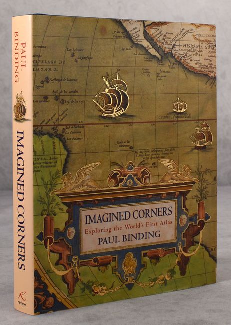
Auction 189, Lot 755
Subject: References, Mapmakers
Imagined Corners - Exploring the World's First Atlas, 2003
Size: 7.8 x 10 inches (19.8 x 25.4 cm)
Estimate: $15 - $30
NO RESERVE
Sold for: $130
Closed on 9/14/2022
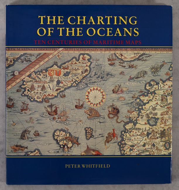
Auction 189, Lot 757
Subject: References, Sea Charts
Whitfield, Peter
The Charting of the Oceans - Ten Centuries of Maritime Maps, 1996
Size: 10.8 x 11.6 inches (27.4 x 29.5 cm)
Estimate: $25 - $40
NO RESERVE
Sold for: $26
Closed on 9/14/2022
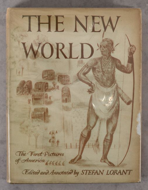
Auction 189, Lot 758
Subject: References, North America
Lorant, Stefan
The New World - The First Pictures of America Made by John White and Jacques Le Moyne and Engraved by Theodore De Bry..., 1946
Size: 9.2 x 12.3 inches (23.4 x 31.2 cm)
Estimate: $40 - $60
NO RESERVE
Sold for: $220
Closed on 9/14/2022
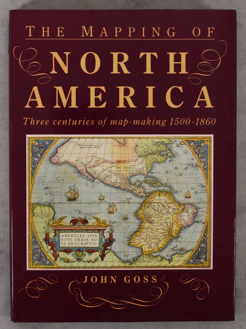
Auction 189, Lot 759
Subject: References, North America
Goss, John
The Mapping of North America - Three Centuries of Map-Making 1500-1860, 1990
Size: 10.4 x 14.4 inches (26.4 x 36.6 cm)
Estimate: $65 - $80
NO RESERVE
Sold for: $16
Closed on 9/14/2022
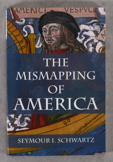
Auction 189, Lot 762
Subject: References, United States
The Mismapping of America, 2008
Size: 6 x 9 inches (15.2 x 22.9 cm)
Estimate: $15 - $30
NO RESERVE
Sold for: $120
Closed on 9/14/2022
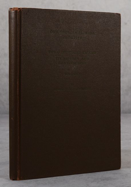
Auction 189, Lot 764
Subject: References, Georgia & Florida
Our Georgia-Florida Frontier - The Okefinokee Swamp - Its History and Cartography Volume I, 1945
Size: 7.3 x 10.3 inches (18.5 x 26.2 cm)
Estimate: $60 - $80
NO RESERVE
Sold for: $110
Closed on 9/14/2022
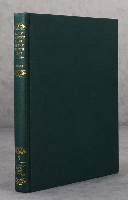
Auction 189, Lot 766
Subject: References, Britain
Shirley, Rodney W.
Early Printed Maps of the British Isles - A Bibliography 1477-1650, 1980
Size: 7.6 x 10 inches (19.3 x 25.4 cm)
Estimate: $110 - $140
NO RESERVE
Sold for: $45
Closed on 9/14/2022
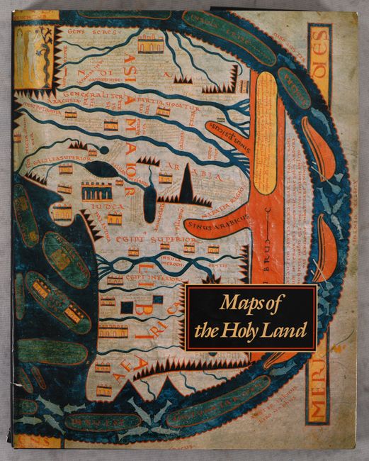
Auction 189, Lot 768
Subject: References, Holy Land
Nebenzahl, Kenneth
Maps of the Holy Land - Images of Terra Sancta Through Two Millennia, 1986
Size: 12.2 x 15.3 inches (31 x 38.9 cm)
Estimate: $90 - $110
NO RESERVE
Sold for: $26
Closed on 9/14/2022
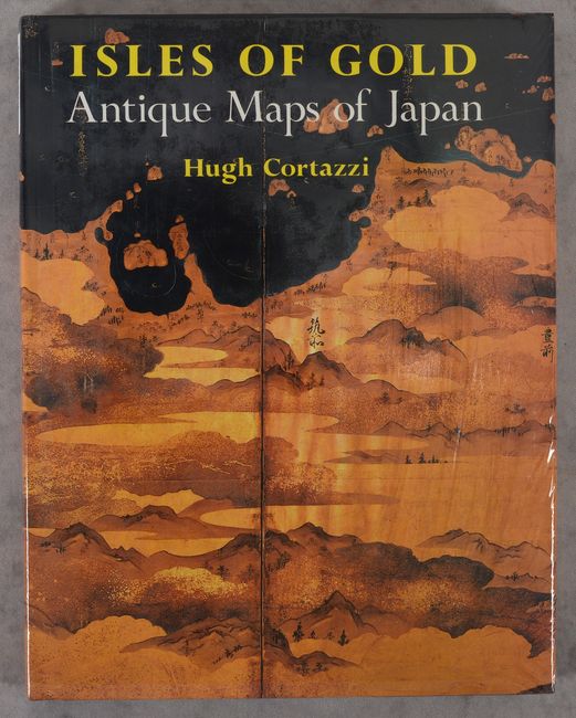
Auction 189, Lot 769
Subject: References, Japan
Cortazzi, Hugh
Isles of Gold - Antique Maps of Japan, 1992
Size: 9.4 x 11.9 inches (23.9 x 30.2 cm)
Estimate: $50 - $70
NO RESERVE
Sold for: $32
Closed on 9/14/2022
15 lots