Showing Featured Lots(remove filter)
Filtered by Category:Books, Atlases, Travel Guides, Geography & Reference Books(Show All Categories)
Showing results for:Auction 183
Catalog Archive
8 lots
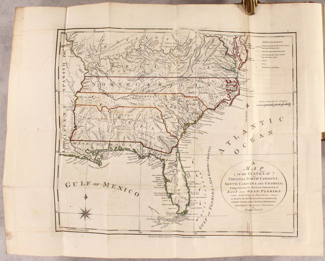
Auction 183, Lot 118
Subject: Eastern United States, Franklin
Morse, Jedidiah (Rev.)
[2 Maps in Book] A Map of the States of Virginia, North Carolina, South Carolina and Georgia; Comprehending the Spanish Provinces of East and West Florida... [and] A Map of the Northern and Middle States... [bound in] The American Geography..., 1792
Size: 14.4 x 12.4 inches (36.6 x 31.5 cm)
Estimate: $1,200 - $1,500
Includes Purcell's Map Locating the Proposed State of Franklin
Sold for: $1,600
Closed on 6/9/2021
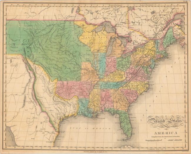
Auction 183, Lot 554
Subject: Atlases
Lavoisne/Aspin
A Complete Genealogical, Historical, Chronological, and Geographical Atlas; Being a General Guide to History, Both Ancient and Modern..., 1820
Size: 12.4 x 17.9 inches (31.5 x 45.5 cm)
Estimate: $1,600 - $1,900
Includes Melish's Popular Map of the United States
Sold for: $1,200
Closed on 6/9/2021

Auction 183, Lot 555
Subject: Atlases
Finley, Anthony
A New General Atlas, Comprising a Complete Set of Maps, Representing the Grand Divisions of the Globe..., 1824
Size: 10.9 x 13.9 inches (27.7 x 35.3 cm)
Estimate: $4,750 - $6,000
First Edition of Finley's General Atlas - Complete
Unsold
Closed on 6/9/2021
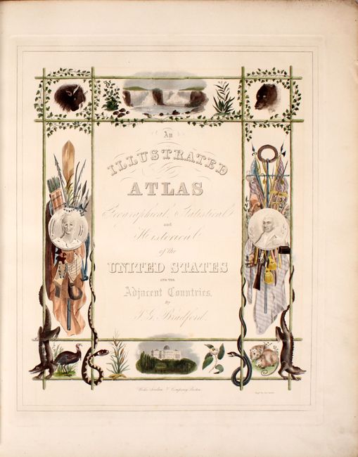
Auction 183, Lot 556
Subject: Atlases
Bradford, Thomas Gamaliel
An Illustrated Atlas Geographical Statistical and Historical of the United States and the Adjacent Countries, 1838
Size: 16.4 x 19.9 inches (41.7 x 50.5 cm)
Estimate: $6,000 - $7,500
Large Edition of Bradford's Elaborate Illustrated Atlas
Sold for: $4,500
Closed on 6/9/2021
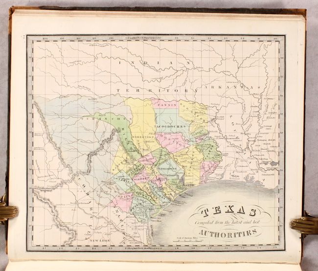
Auction 183, Lot 557
Subject: Atlases
Greenleaf, Jeremiah
A New Universal Atlas; Comprising Separate Maps of All the Principal Empires, Kingdoms & States Throughout the World: and Forming a Distinct Atlas of the United States..., 1842
Size: 12.5 x 14.8 inches (31.8 x 37.6 cm)
Estimate: $5,500 - $6,500
Greenleaf's Atlas with Important Maps of Texas, Iowa & Wisconsin
Sold for: $4,250
Closed on 6/9/2021
Auction 183, Lot 558
Subject: Atlases
Tanner, Henry Schenck
A New Universal Atlas Containing Maps of the Various Empires, Kingdoms, States and Republics of the World..., 1846
Size: 14 x 17.8 inches (35.6 x 45.2 cm)
Estimate: $3,750 - $4,500
Rare, Complete Tanner Atlas with Important Maps of Texas & Iowa
Unsold
Closed on 6/9/2021
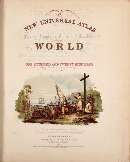
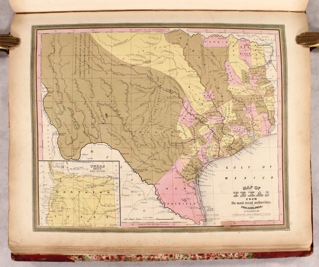
Auction 183, Lot 559
Subject: Atlases
Cowperthwait, Desilver & Butler
A New Universal Atlas Containing Maps of the Various Empires, Kingdoms, States and Republics of the World..., 1854
Size: 14.1 x 17.4 inches (35.8 x 44.2 cm)
Estimate: $3,000 - $4,000
Cowperthwait's Desirable Atlas Emphasizing the American Continent
Sold for: $2,200
Closed on 6/9/2021
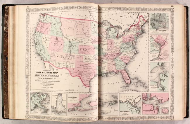
Auction 183, Lot 560
Subject: Atlases
Johnson and Ward
Johnson's New Illustrated (Steel Plate) Family Atlas, with Physical Geography, and with Descriptions Geographical, Statistical, and Historical..., 1863
Size: 14.9 x 18.5 inches (37.8 x 47 cm)
Estimate: $1,100 - $1,400
Complete with Several Civil War Edition Maps
Sold for: $1,100
Closed on 6/9/2021
8 lots