Subject: China
Period: 1662 (circa)
Publication: Novus Atlas
Color: Hand Color
Size:
23.6 x 18.2 inches
59.9 x 46.2 cm
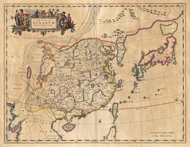
Superb map of the Chinese Empire based on the compilation of the Jesuit Father Martino Martini who traveled through the region between 1643 and 1650. This was a period of great internal unrest and his was a perilous journey. He was able to travel inland to the Great Wall and for the first time determined with any scientific accuracy the astronomical position of many cities and topographical features. After establishing a mission in Zhejiang province he returned to Rome via Amsterdam, where he met Joan Blaeu. Blaeu then prepared a group of eight maps covering China in great detail. This map presents Korea as a peninsula for the first time on a European map. The depiction of Japan follows the Blancus/Moreira type, but with Ezo as a separate island. At top is an ornamental title cartouche surrounded by peasants.
References: Goss (Blaeu) 210; Walter #36.
Condition: A
Mild toning and a few light creases, else fine with old color.