Catalog Archive
Auction 98, Lot 417

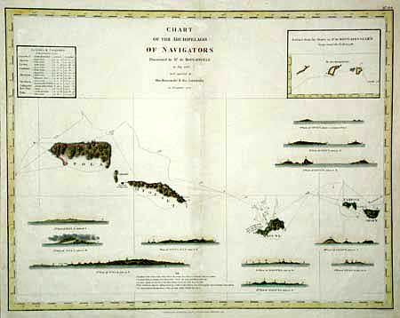
"Chart of the Archipelago of Navigators Discovered by Mr. De Bougainville in May 1768 and explored by the Boussole & the Astrolabe in December 1787", La Perouse, Comte Jean F. Galoup, de
Subject: Pacific Islands

Period: 1798 (published)

Publication: Atlas du Voyage de La Perouse

Color: Hand Color

Size:
19.2 x 15 inches
48.8 x 38.1 cm
Download High Resolution Image
(or just click on image to launch the Zoom viewer)

From the English edition of La Perouse's Voyages. Shows today's Samoan Islands with good detail of shoreline of Pola, Oyolava, Maouna, Fanfoue, and Opoun Islands with the tract of the ships indicated. Eleven profile views of the islands are keyed to positions on the chart. Inset of the explorers tract through the Navigareurs, and a table giving the latitude & longitude of the major islands. Published by G.G. & J. Robinson and called the best English version of the voyages by Howes.

References: Phillips (A) 693.

Condition: B

Good impression. A little weakening of paper on verso along centerfold.

Estimate: $250 - $300

Sold for: $130

Closed on 3/6/2002

Archived