Subject: Canada and Greenland
Period: 1597 (circa)
Publication:
Color: Black & White
Size:
11.5 x 9 inches
29.2 x 22.9 cm
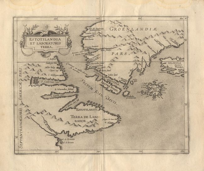
From the first printed atlas relating exclusively to America. This is an important and influential map depicting the first detailed record of the discoveries of Davis and Frobisher in their search for the Northwest Passage. The attractive map has a stipple engraved sea and a decorative title cartouche. It is centered on the Davis Strait and depicts much of Greenland, Labrador, Iceland as well as the mythical island of Frisland (complete with many cities and place names).
References: Burden #101; Kershaw #40
Condition: A
Crisp impression with faint shadow along centerfold and slight damp stains in top margin.