Subject: China and Korea
Period: 1636 (circa)
Publication:
Color: Hand Color
Size:
19.5 x 16 inches
49.5 x 40.6 cm
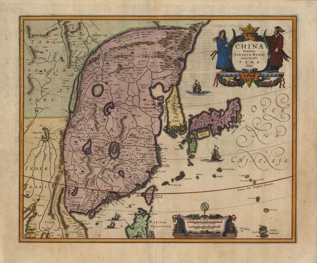
A lovely map of the region with the eastern part of China (bounded in the northwest by the Great Wall) dominated by several large lakes and major rivers. Korea as a strangely shaped island separated from the mainland by a narrow straight. The three main islands of Japan are shown on the Ortelius/Teixeira model. The map is richly embellished with sailing ships and junks, a decorative distance scale, and a title cartouche flanked by a Chinese man and woman.
References:
Condition: A
German text on verso with slight show through. A fine sharp impression with attractive later color. Despite a couple of tiny spots, the map is still in very good condition.