Catalog Archive
Auction 95, Lot 86

"Insulae Americanae Nempe: Cuba, Hispaniola, Jamaica, Pto Rico, Lucania, Antillae, vulgonCaribae Barlo-Et Sotto-Vento, etc.", Danckerts, Cornelius

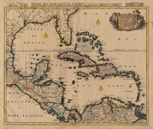
Subject: Colonial America

Period: 1696 (circa)

Publication:

Color: Hand Color

Size:
22.6 x 18.8 inches
57.4 x 47.8 cm
Download High Resolution Image
(or just click on image to launch the Zoom viewer)

Large handsome map of the entire Caribbean region covering the area between Virginia in the North and the mouth of the Orinoco River on the northern coast of South America. All the familiar island names are here: the Bahamas group, Cuba, Hispaniola and Jamaica, as well as the smaller islands in the Leeward Island group and the great Spanish trading ports of Cartagena and la Habana, all recalling the days of the Spanish Main and the English buccaneer fleets. Cartographically based on Blaeu's 1635 map with some minor additional place names. Three small compass roses and a decorative title cartouche engraved onto a drape held up by two putti. $1,400 RESERVE.

References:

Condition: B

Original color with some oxidation in cartouche, evenly toned with some marginal discoloration.

Estimate: $1,800 - $1,900

Sold for: $1,400

Closed on 6/13/2001

Archived