Catalog Archive
Auction 93, Lot 237

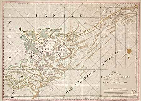
"Carte des Entrees de l'Escaut et de la Meuse avec les Bancs Passes Isles et Costes Comprise entre Gravelines et Rotterdam", Depot de la Marine

Subject: Netherlands

Period: 1760 (circa)

Publication:

Color: Hand Color

Size:
33.4 x 23.8 inches
84.8 x 60.5 cm
Download High Resolution Image
(or just click on image to launch the Zoom viewer)

Superb large sea chart of the southwest part of Holland, south of Rotterdam. The islands of the provinces of South-Holland and Zeeland are all shown and named, as well as the many waterways in this area. The coastline extends to the French city of Gravelines (near Calais). Throughout the map many cities are named, as well as the many banks, both off the coast and in the inland waterways. North is at the bottom, indicated by a decorative compass rose. The chart is filled with rhumb lines and a distance scale is below the title, at the lower right.

References:

Condition: A

A bit of very faint damp spots and a couple small tears in margin, overall very good.

Estimate: $1,100 - $1,200

Sold for: $750

Closed on 12/6/2000

Archived