Subject: Northern Pacific
Period: 1752-84 (published)
Publication:
Color: Hand Color
Size:
24.5 x 17.7 inches
62.2 x 45 cm
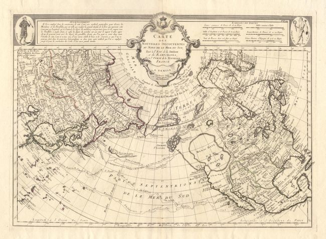
This is Santini's issue of Joseph Nicolas de l' Isle's rare 1750 map of the North Pacific with M. Remondini added to the Santini imprint. It is a cornerstone map of Alaska and the Pacific Northwest showing the discoveries of the Russians 1723, 1732 and 1741, the tracks of Bering's first and second voyages, De l'Isles voyage with Capt. Tchirikow in 1741, the track of De Frondat's voyage of 1709, and the route of the Galleons in 1743. The west coast of North America is entirely fictitious north of Cap Blanc with an enormous Sea of the West, Lac Valasco, Isle of Bernarda and a network of rivers and lakes making up most of a Northwest Passage. Title in rococo cartouche flanked a native of Kamchatka in upper left corner, native of Louisiana in upper right corner.
References: Tooley (America) #104, plt. #22.
Condition: A+
Minor, soft creases along centerfold, else very fine condition.