Catalog Archive
Auction 92, Lot 22

"Nouvelle Carte du Monde Suivant l'idee de Mercator ou est marquee la Toure que le Cap. Cowley tint pour en faire le tour", Moll, Herman
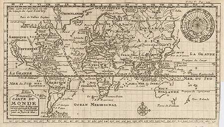
Subject: World

Period: 1699 (circa)

Publication: A Collection of Original Voyages… published by Capt. William Hacke…

Color: Black & White

Size:
11.2 x 6.5 inches
28.4 x 16.5 cm
Download High Resolution Image
(or just click on image to launch the Zoom viewer)

French version of this map on Mercator's projection. It is based on the large manuscript chart of the world drawn by William Hacke in 1687. Capt. Cowley's circumnavigation, the tracks of which are marked on the map, took place in 1683-86. CALIFORNIA IS SHOWN AS AN ISLAND and Australia, Tasmania and New Zealand are partially depicted. Inset at top right is a north polar projection.

References: Shirley #595.

Condition: B

Folding map, trimmed to neatline at binding side, as issued, with a short binding tear (repaired with archival tape) else fine.

Estimate: $350 - $400

Sold for: $350

Closed on 9/13/2000

Archived