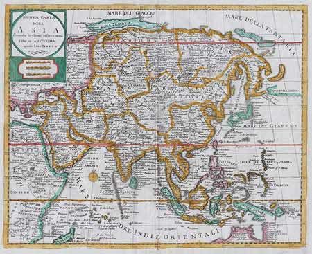
Subject: Asia
Period: 1740-50 (published)
Publication: Atlante novissimo
Color: Hand Color
Size:
13.5 x 11 inches
34.3 x 27.9 cm
An attractive map of the continent and the islands of South East Asia including the northern part of Australia. This is an Italian version of Isaac Tirion's map of 1733 that was based on Delisle and engraved by Jacob Keyser. There is a huge Kamchatka Peninsula and the icy cape K. Suetonines, which was believed to render it impossible to sail round the north-eastern tip of Asia. In Japan, Hokkaido is attached to the main island and the northern most island is identified at "Matsumai" after the ruling "daimyo" family who colonized Hokkaido in the 15th century. The northern coastline of Australia is shown, with "t Land der Negers" in the extreme west, and the eastern coast is named "Carpentarie" depicting the Dutch discoveries. Bold title cartouche and compass rose.
References:
Condition: A+