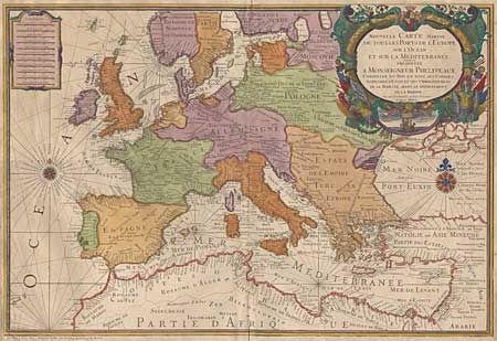
Subject: Europe
Period: 1670 (circa)
Publication:
Color: Hand Color
Size:
30 x 21.5 inches
76.2 x 54.6 cm
Very large sea chart of Europe. Detail only on the coastlines, except for some of the larger cities. The chart was drawn and engraved by Nicolas Berey and dedicated to Monseigneur Phelypeaaux, consellor to the King and director of the Depot de Marine. Alexis-Hubert Jaillot, Berey's son-in-law, inherited his plates when he passed away in 1665. The beautiful map is embellished with a large title cartouche surrounded by military flags and weapons, the royal arms, and a vignette of a sailing ship. It is further embellished with a strapwork scale of miles and two large compass roses with rhumb lines, with later coloring. Old repair on bottom fold and some roughness in margins.
References:
Condition: A