Catalog Archive
Auction 91, Lot 102

"Pascaerte van Terra Nova, Nova Francia Nieuw Engeland en de Groote Revier van Canada",

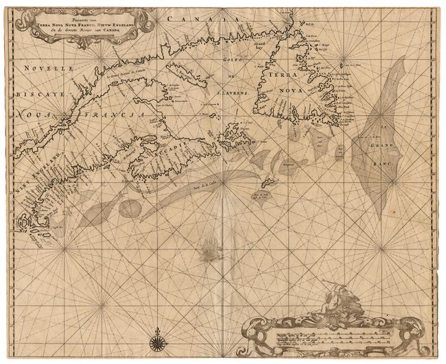
Subject: Canada and United States

Period: 1675 (published)

Publication: Het Earste Deel Van Het Brandende Veen

Color: Black & White

Size:
17.1 x 21 inches
43.4 x 53.3 cm
Download High Resolution Image
(or just click on image to launch the Zoom viewer)

An extremely rare sea chart of the Maritimes based on the 1661 chart of Joannes van Loon. The Dutch title to this work "Het Brandende Veen" refers to heaps of peat set ablaze on coasts to signal ships or warn them of shoals. The chart covers from Cape Cod through Newfoundland. It is derived from a number of sources including Bleau, Champlain, Sanson, and Gerritsz. Some English sources were ignored, such as the Avalon peninsula in Newfoundland and the omission of Prince Edward Island. The chart is embellished with rhumb lines, title and scale of miles cartouches, a compass rose and a sailing ship. Issued with very close margins. Ref: Koeman IV; Burden #365 and Kershaw #184. $8,500 RESERVE

References:

Condition: A+

Estimate: $11,000 - $12,000

Sold for: $6,000

Closed on 6/14/2000

Archived