Subject: Peru
Period: 1630 (published)
Publication: Nieuwe Wereldt ofte Beschrijvinghe van West-Indien…
Color: Hand Color
Size:
14 x 11 inches
35.6 x 27.9 cm
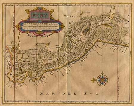
This great map is a foundation map for later Dutch maps of Peru. The map is the work of Hessel Gerritsz, one of the truly important Dutch cartographers of the 17th century. Most of his work was only done in manuscript and these maps, published by De Laet, are the only Gerritsz maps available to the collector today. The map vividly depicts the mountainous region and the large "Titicaca" lake which is dotted with islands. Large strapwork title cartouche and compass rose and beautiful original color. Lightly toned with a faint damp stain entering map from both sides. Overall very good condition. $650 RESERVE
References:
Condition: A