Subject: Colonial Mid-Atlantic United States
Period: 1631 (published)
Publication: Atlas Minor
Color: Hand Color
Size:
7.5 x 5.3 inches
19.1 x 13.5 cm
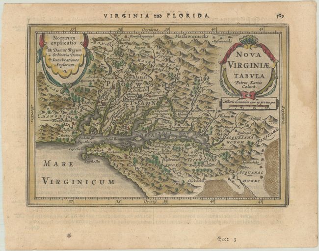
This delicately engraved map is a reduced version of John Smith's map of the Chesapeake Bay region. Although it is the second derivative of Smith's map, it is actually the first derivative published in an atlas. Despite its small size, it is filled with towns with both English and Indigenous names, including Iamestowne, and pictorial topography and a key to the types of buildings at top left. Engraved by Pieter van den Keere, with his Latinized name appearing below the title cartouche. German text on verso.
This map was a new addition for Jan Jansson's editions of the Atlas Minor, published in 5 editions between 1628-48. The copperplates for the original Atlas Minor editions published by Hondius were sold to parties in England between 1621-25. Jansson commissioned Pieter van den Keere and Abraham Goos to engrave new plates, which were close copies of the original editions.
References: Burden #223; Tooley (America) plt. 70; Van der Krogt (Vol. III) #9410:352A.1; Wooldridge #33.
Condition: B+
A crisp impression on a faintly toned sheet with light dampstains that just enter the map border at right and a small paper flaw in the bottom margin.