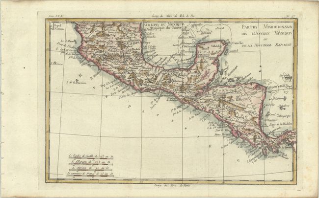
Subject: Southern Mexico & Central America
Period: 1780 (circa)
Publication: Atlas de Toutes les Parties Connues du Globe Terrestre
Color: Hand Color
Size:
12.6 x 8.4 inches
32 x 21.3 cm
This finely engraved map covers the region from Panama to well north of Guadalajara. It shows just the tip of the Baja and C. St. Lucas. There is good detail with many place names (Merida, Acapulco, Cozumel, etc.), rivers, and mountain ranges noted.
Rigobert Bonne was an important French cartographer of the late 18th century. In 1773 he succeeded Jacques Bellin as the royal cartographer in the office of the Hydrographer at the Depot de la Marine. Working in his official capacity, Bonne compiled some of the most detailed and accurate maps of the period.
References:
Condition: A
A dark impression, issued folding on a bright sheet with a "CB" watermark, binding holes along the left edge of the sheet, and a few spots of foxing along the edges of the sheet.