Subject: Southern United States & Mexico
Period: 1780 (circa)
Publication: Atlas de Toutes les Parties Connues du Globe Terrestre
Color: Hand Color
Size:
12.6 x 8.4 inches
32 x 21.3 cm
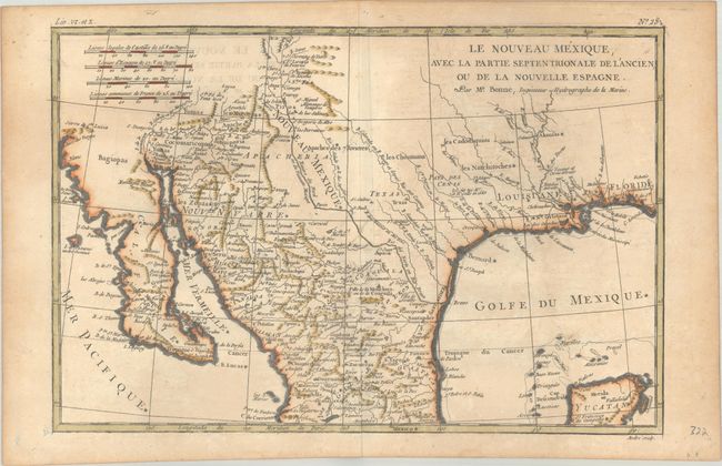
This attractive map details the region from West Florida to California and northern Mexico. In Texas, there is a city named Texas and a notation concerning the death of the explorer La Salle. There is excellent detail, particularly of the Jesuit missions in Mexico and the Southwest. In present-day Arizona, the Gila River is named R. de los Apostolos. The map is filled with place names and Indian villages, particularly in today's Arizona and New Mexico. The Baja peninsula is wildly misshapen.
Rigobert Bonne was an important French cartographer of the late 18th century. In 1773, he succeeded Jacques Bellin as the royal cartographer in the Office of the Hydrographer at the Depot de la Marine. Working in his official capacity, Bonne compiled some of the most detailed and accurate maps of the period.
References:
Condition: B+
A crisp impression on a sturdy sheet with some light toning and offsetting. There are two small holes in the lower left blank margin.