Subject: Martha's Vineyard, Massachusetts
Period: 1847 (dated)
Publication:
Color: Hand Color
Size:
14.2 x 10.4 inches
36.1 x 26.4 cm
The Office of Coast Survey is the oldest U.S. scientific organization, dating from 1807 when Congress directed that a "survey of the coast" be carried out. By 1836, it was called the U.S. Coast Survey and in 1878, the name was changed to the U.S. Coast and Geodetic Survey. Today the Office of Coast Survey is a division of the National Oceanic and Atmospheric Administration NOAA.
The survey teams, composed of civilians as well as Army and Naval officers, charted the nation's waterways and produced a wide array of reports, survey charts, hydrographic studies of tides and currents, astronomical studies and observations, and coastal pilots. These charts are an important record of the changing nature of the nation's coastlines. In additional to coastal charts, the U.S. Coast and Geodetic Survey produced land sketches, Civil War battle maps, and the early aeronautical charts.
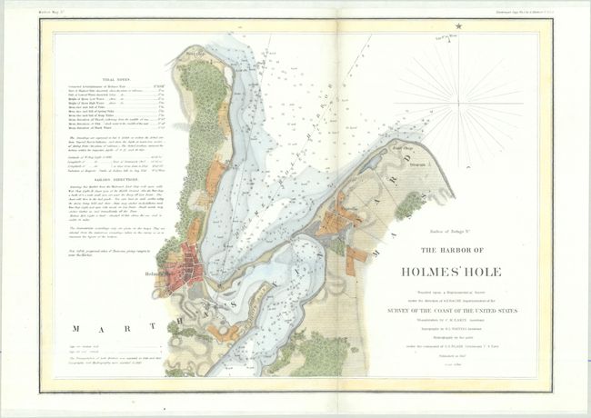
This small chart covers the northern part of Martha's Vineyard around today's Vineyard Haven. Inland detail includes various vegetation, roads, and individual buildings while the harbor is filled with both soundings and bottom types. A table at left features notes on tides and sailing directions. Produced under the direction of A.D. Bache.
References:
Condition: B+
A bright and colorful example that has been professionally backed with tissue to repair a complete separation along the vertical fold.