Subject: Western United States, Utah
Period: 1852 (published)
Publication:
Color: Hand Color
Size:
6.5 x 10.2 inches
16.5 x 25.9 cm
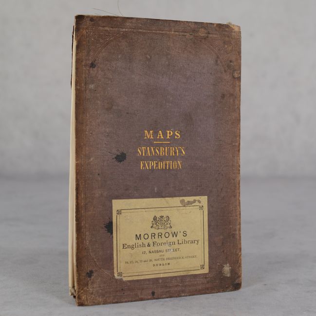
This great pair of maps is based upon Stansbury's famous explorations in Utah. They fold separately into stiff brown boards titled "Maps - Stansbury's Expedition." There is a label for "Morrow's English & Foreign Library" in Dublin attached to the front cover of this example.
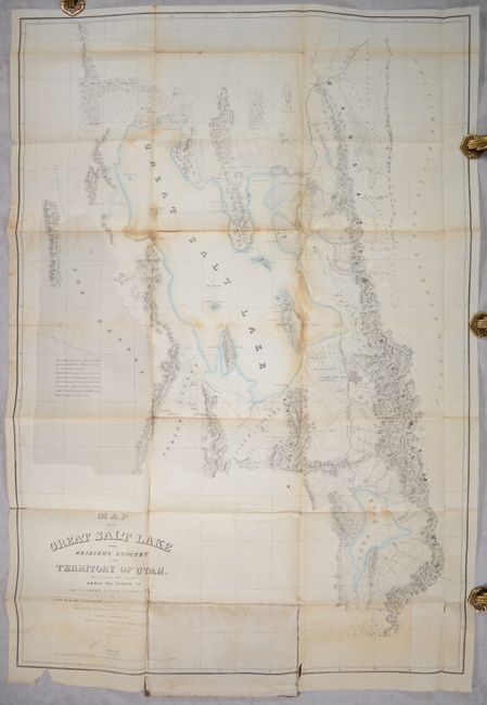
A. Map of the Great Salt Lake and Adjacent Country in the Territory of Utah..., (29.8 x 43.3"). This map details Stansbury's important exploration of the Great Salt Lake Basin that permanently established much topography and many of the place names of northwestern Utah. It extends from the 42nd parallel and includes the Wasatch Mountains, Cache Valley, and Ogden's Hole, and south to include Lake Utah and the Youab Valley. Indian, as well as Mormon, names are given for the creeks. A wonderful notation in the desert west of the lake provides important information for travelers: "This desert consists of clay and sand impregnated with salt. When wet, it has the consistency of mortar. Lightly loaded wagons can pass between Spring Valley and Pilot Peak in the driest part of the season. Forage and water must be carried for cattle, and the journey begun in the P. M. and continued through the night. Distance between springs 70 ms." Lithographed by Ackerman. Condition: Issued folding with contemporary color and moderate staining and foxing. There are some separations along the folds, with two vertical folds backed in archival tape to prevent further splits. A printer's crease runs through the title, and there is a chip in the blank margin at bottom left.
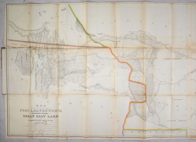
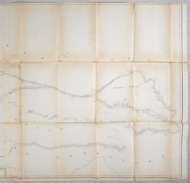
B. Map of a Reconnoissance Between Fort Leavenworth on the Missouri River and the Great Salt Lake in the Territory of Utah..., (67.8 x 28.5"). This map brings together some of the most important names in the cartography of the American West: it was made under the orders of Col. J.J. Albert, chief of the Topographical Bureau, by Capt. Howard Stansbury of the Corps of Topographical Engineers, aided by Lieut. J.W. Gunnison and Albert Carrington, and was drawn by Lieut. Gunnison and Charles Preuss. The immense map covers the Great Plains, Colorado, Wyoming, and Utah in considerable detail on a scale of 1" to about 16 miles. The detail is particularly evident in present-day Colorado, the Laramie Mountains (here labeled Black Hills), and in the vicinity of Salt Lake. Wheat devotes more than eight pages of text to this map, calling it "one of the most important [maps] of its decade, bringing permanently into Western cartography a number of outstanding details." Lithographed by Ackerman. On two sheets joined together, as issued. Condition: Issued folding with contemporary color with some staining and light toning. There are fold separations throughout, many of which are closed on verso with archival tape. A 0.5" section of border at left has been replaced in facsimile. Trimmed to just inside the border at top.
References: Howes #S-884; Wagner-Camp #219:1; Wheat (TMW) #765 & #764.
Condition: B
See description above for condition of maps. Spine has perished and boards are separated with one map attached to each board. Covers are stained with moderate wear. Old seller's stamp on verso is mostly peeled away.