Subject: Gulf of Mexico & Caribbean
Period: 1803 (published)
Publication: The Chronology and History of the World
Color: Black & White
Size:
22.6 x 16.4 inches
57.4 x 41.7 cm
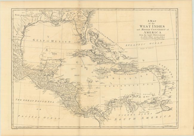
This boldly engraved chart of the Gulf of Mexico and the Caribbean is filled with interesting information, with many forts and towns named. The British colony of Georgia extends to Mobile Bay, and its boundary with Florida is noted as Limits Stipulated 1738, leaving the Spanish colony of Florida occupying only the peninsula. A line further south is noted as the Southern Bounds [Georgia] by Charter 1665. The southern portion of Florida is shown as a jumble of large islands, named Bay del Spiritu Santo. Texas is named as the New Kingdom of Leon. Engraved by Thomas Kitchin.
Blair's Chronology went through many editions well into the 19th century with maps added in the 1768 and later editions to help illustrate lands covered by the work, both ancient and modern. Through the years, most maps show little or no revision between the various editions.
References: cf. Shirley (BL Atlases) G.BLAI-1a #14.
Condition: B+
Issued folding on a sheet with "J Ruse" and Strasbourg Lily watermarks. There is some light offsetting and a short fold separation in the bottom margin that has been closed on verso with archival tape.