Subject: Black Sea
Period: 1700 (circa)
Publication:
Color: Hand Color
Size:
22.8 x 19.3 inches
57.9 x 49 cm
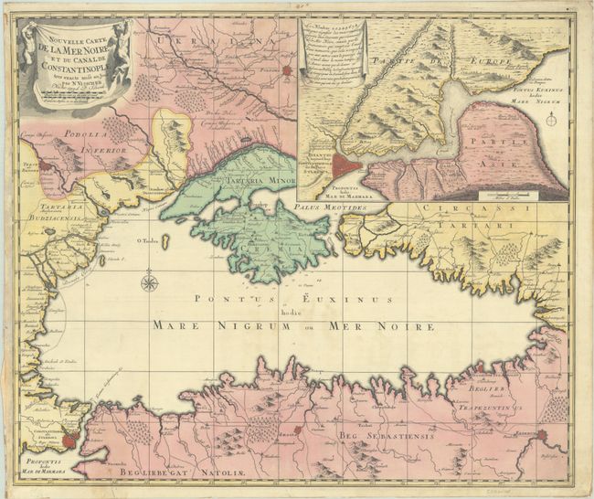
Superb map of the Black Sea with a large inset of the Bosporus with Constantinople and its fortifications. The cities of Constantinople, Pultava and Bender are depicted as miniature bird's-eye plans, and a number of additional cities are identified, many connected by old roads. Ukraina is noted north of Crimea. Because of its strategic location, Constantinopole was central to the region’s trade routes, which linked Europe, Persia, the Arabian peninsula, the Horn of Africa, the Caucasus, the Russian steppe, the Balkans, and the Mediterranean Basin.
References:
Condition: B+
A sharp impression with full contemporary color on a bright sheet. There was an area of paper weakness in the inset that has been reinforced on verso with kraft tape, and there is also kraft tape along the edges of the sheet on verso. A tear that enters 2" into image at bottom left has been archivally repaired on verso with old paper.