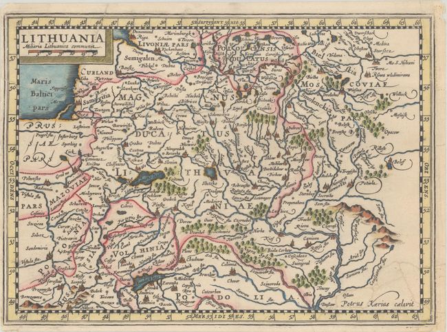
Subject: Lithuania & Belarus
Period: 1673 (published)
Publication: Atlas sive Cosmographicae Meditationes...
Color: Hand Color
Size:
9.8 x 7.1 inches
24.9 x 18 cm
This handsome early map covers all of Lithuania and Belarus. It extends from the Vistula River east to Russia and from Riga south to Ukraine. There is excellent detail, with several towns and cities named and rivers, lakes, and forests (including Nigra Sylva - a "Black Forest" located south of Kyiv). The title and distance scale appear in a block cartouche at top left. Masterfully engraved by Petrus Kaerius for Cloppenburgh's atlas, which was a medium-sized atlas - in between the folio and Atlas Minor sizes - based on Mercator's maps. Blank verso.
References: Van der Krogt (Vol. III) #1730:353.
Condition: B+
A sharp impression on a sheet backed in archival tissue to repair some small edge tears in the top left and bottom right corners. There are remnants of old tape in the corners on verso.