Subject: Shetland Islands, Scotland
Period: 1780 (circa)
Publication:
Color: Black & White
This attractive lot focused on the Shetland islands features a large folding chart, 3 smaller charts of specific islands/regions, and two coastal approach views:
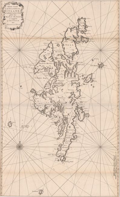
A. Nieuwe Caart van de Eylanden van Hitland, uit Verscheide Caarten te Samen Gestelt door Murdoch Mackenzie..., (20.6 x 33.8"). A nice chart showing the entirety of Shetland, extending from Swinburg Head north to Unst. There is good detail along the coasts with place names, small islands, depth soundings, and anchorages throughout. Adorned by rhumb lines in the waters, a compass rose, and strapwork title cartouche.
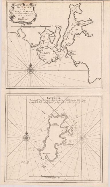
B. De Havens van Valey-Sound, en Grueting-Voe... [on sheet with] Fayerhil Vertoonende van Noord-Ronaldsha..., (10.6 x 19.6"). Two charts on one sheet. The upper chart depicts Valey Island and Gruting Voe (near Walls) in the western part of Shetland, while the lower chart details Fair Isle, the southernmost island.
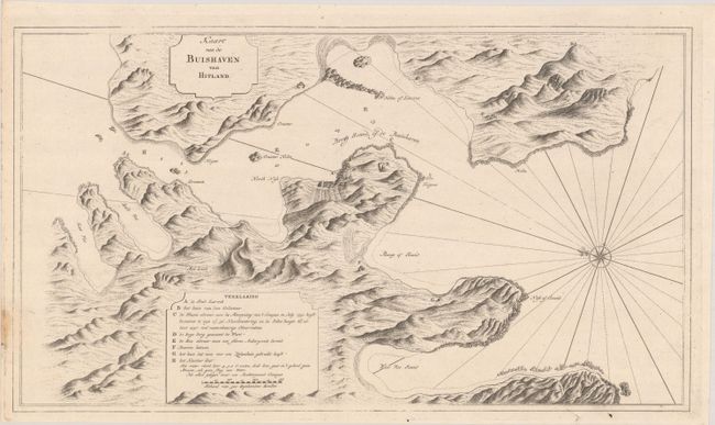
C. Kaart van de Buishaven van Hitland, (18.9 x 10.8"). This map shows the region around Lerwick, the largest city on Shetland, as well as part of Bressay Island. Topography is rendered with a nice three-dimensional quality and a key at bottom identifies 8 locations on the map.
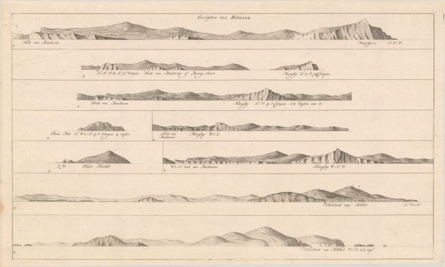
D. Gezigten van Hitland (18.9 x 11.1").
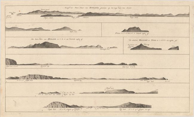
E. Gezigt der West-Kust van Hitland, Genomen op het Hoge Land van Fulo (18.9 x 11.0").
References:
Condition:
On very clean sheets of "C & I Honig" watermarked paper. The large folding chart of Shetland has some minor foxing along the upper fold and has been trimmed to the border all around by the binder (B+). The other four maps/views are near fine (A) with a couple minor stains along the sheet edges.