Subject: Western England
Period: 1610 (circa)
Publication: Camden's Britannia
Color: Hand Color
Size:
13.2 x 10.8 inches
33.5 x 27.4 cm
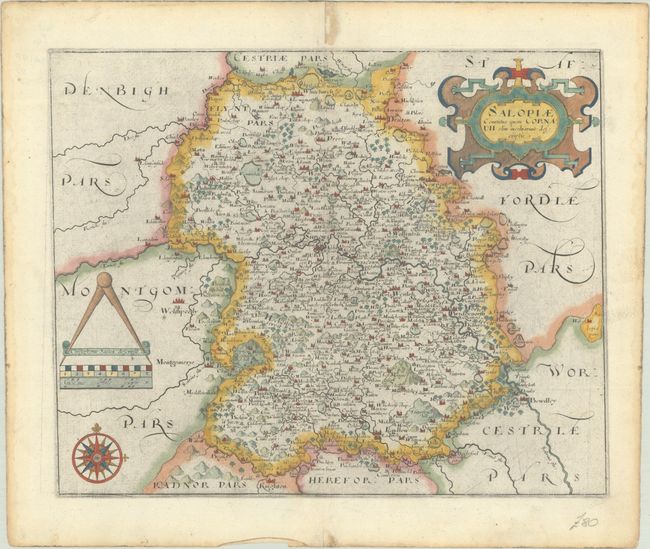
This beautifully engraved map of Shropshire was issued in Christopher Saxton's county atlas of England and Wales. It is widely considered to be the first national atlas in the world, and contains a total of 35 county maps. This example comes from the first edition published in 1579, with subsequent editions occurring up to 1772. Saxton's maps were countlessly copied over the next 200 years, and it wasn't until the Principal Triangulation of Great Britain beginning in 1784 did his maps become obsolete. Cartographically, the map centers on Shrewsbury and is filled with tiny towns, rivers, mountains, and forests. The map is embellished with a strapwork title cartouche, a compass rose, and measuring dividers above the distance scale. Saxton's imprint appears above the distance scale. Engraved by William Hole. Blank verso.
References: Shirley (BL Atlases) T.CAMD-1d.
Condition: A
A dark impression on a bright sheet with a coat of arms watermark, some printer's ink residue, and damp staining confined to the blank margins.