Subject: Napa County, California
Period: 1965 (circa)
Publication:
Color: Black & White
Size:
21 x 31.4 inches
53.3 x 79.8 cm
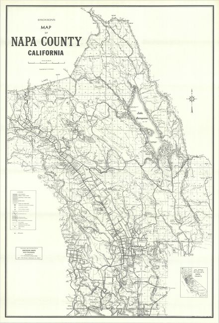
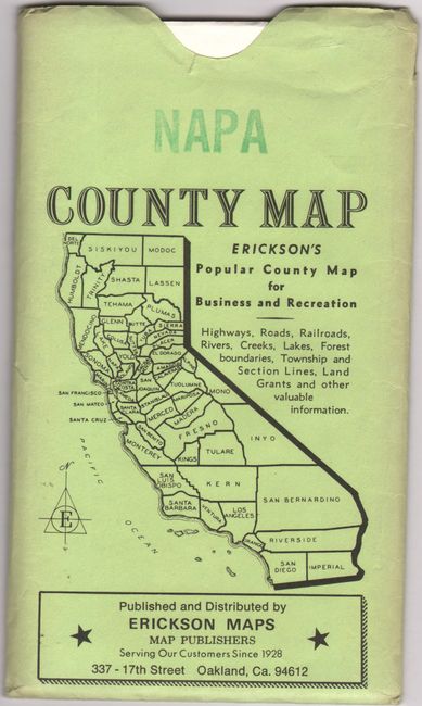
C.E. Erickson's map of the California county famous for its wine industry is filled with impressive detail. A legend identifies state highways, various types of road, railroads, incorporated cities, congested areas, park or reservation boundaries, streams, irrigation ditches and canals, campgrounds, trails, and, of course, wineries. At bottom right, an inset shows the county relative to the rest of the state. Published and distributed by Oakland-based Erickson Maps, sucessor to C.E. Erickson & Associates. Slides into a green pictorial envelope (4.8 x 8.3").
References:
Condition: A+
Clean and bright, issued folding. Envelope has a few short tears along the edges.