Subject: Southern United States, Georgia
Period: 1833 (circa)
Publication:
Color: Hand Color
Size:
12.6 x 15.9 inches
32 x 40.4 cm
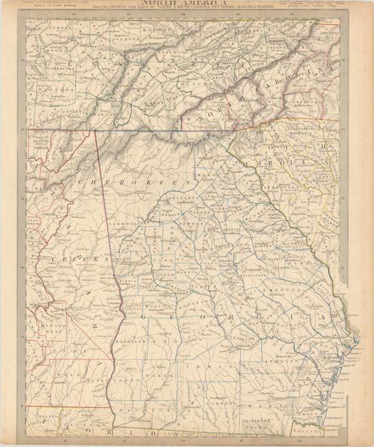
The beginning of the nineteenth century saw a period of rapid market growth and innovation in the map publishing world. Increased literacy and public interest in new frontiers and colonies overwhelmed the market because it was oriented toward the small, affluent market of the previous century. With the intent to fill this void, The Society for the Diffusion of Useful Knowledge (SDUK) was founded in 1828 in London, by Lord Brougham and a group of men dedicated to the education of the aspiring working class and the Utilitarian ideal of 'Knowledge is Power.' The society produced an array of education materials, but the series of maps was one of their most successful ventures. A number of engravers and printers were used to produce the maps, which eventually exceed 200 sheets, and continued to be published after the Society as a whole ceased to function.
This steel engraved map covers all of Georgia and extends west into Alabama to just beyond Montgomery. It also includes the western portions of North and South Carolina, and a large portion of Tennessee. County development, roads, watershed, and terrain are all detailed. Surrounded by a keyboard-style border.
References:
Condition: B+
Contemporary outline color with some minor toning along the edges. Trimmed to the border at bottom with loss of publisher's imprint and trimmed at top with partial loss of title, likely as issued.