Catalog Archive
Auction 204, Lot 260
NO RESERVE
"Carte du Mexique pour l'Histoire des Etablissemens Europeens", Bellin/Van Schley
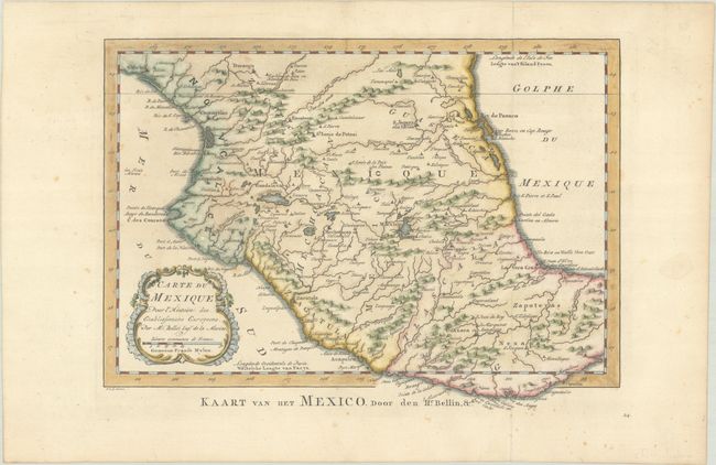
Subject: Central Mexico
Period: 1773 (published)
Publication: Raynal's Atlas Portatif
Color: Hand Color
Size:
11.5 x 8.3 inches
29.2 x 21.1 cm
Download High Resolution Image
(or just click on image to launch the Zoom viewer)
(or just click on image to launch the Zoom viewer)