Subject: North America
Period: 1830 (dated)
Publication: Atlas Universel
Color: Hand Color
Size:
15.5 x 21.2 inches
39.4 x 53.8 cm
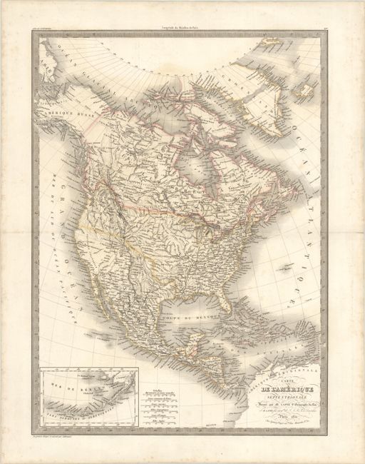
This is an interesting 19th-century French map of the continent showing the United States in an evolving configuration. The boundary between the United States and Canada reflects the United States claims in the disputed Columbia region (Oregon). Alaska is Amerique Russe with Nouveau Cornouailles (New Cornwall) occupying the panhandle. Mexico still encompasses Texas and the Southwest. The lakes Timpanagos and Teguayo are located in the Great Basin region with a conjectural R. Buenaventura ? extending to the Pacific. The map shows good detail of cities, rivers, and locations of Indian tribes but does not show state or territorial boundaries. At lower left is an inset of the Aleutian Islands and Bering Sea. Greenland appears to be bisected by a wide central passage. Engraved by Lallemand with Lapie's embossed stamp next to the distance scale.
References:
Condition: B+
Contemporary outline color on a sturdy sheet with light foxing, light dampstaining that is visible at the top of the map, and an archivally repaired centerfold separation at right that extends to the map border.