Subject: Atlases
Period: 1848 (published)
Publication:
Color: Hand Color
Size:
14.3 x 17.6 inches
36.3 x 44.7 cm
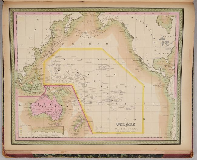
This is the third edition of Mitchell's important atlas. The title continues "with a special map of each of the United States, Plans of Cities &c. Comprehended in seventy sheets and forming a series of one hundred and seventeen Maps Plans and Sections." This famous and highly sought-after atlas is complete with all called for hand-colored maps of the world, North America and the other continents, Oceanica, the United States and its territories, and numerous city plans.
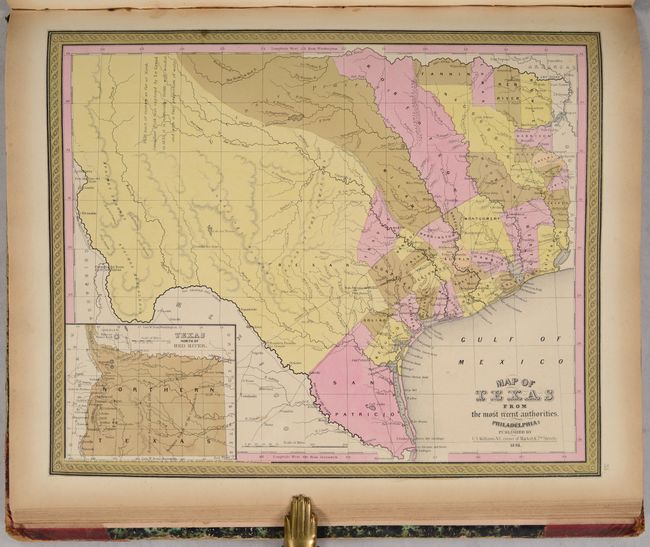
Of particular interest is The Map of Texas from the Most Recent Authorities, which was issued shortly after the state's annexation to the United States. The map portrays early county configurations such as Robertson and Milam, extending from central Texas northwestward to the Red River; San Patricio, extending from the Nueces to the Rio Grande; and Bexar, comprising all lands to the southwest and west along the Rio Grande and northwards into the present panhandle. The panhandle in an inset is titled, "Texas North of the Red River" at lower left. Several early roads are depicted including the Presido Road, and Fort Alamo, mines, and the presidios of Rio Grande, del Norte el de las Yuntas, del Paso del Norte are identified. The map includes many early settlements including Orozimbo, Bolivar, Qintana, Liverpool, De Kalb, Boston, Dangerfield, Smithland, Pulaski, Teran, Belgrade, Salem, Zavala, and Aurora, and more.
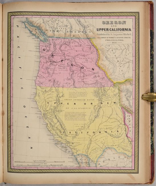
The map of Oregon and Upper California shows Oregon Territory extending to the Continental Divide with its northern boundary based upon the Treaty of 1846 with Britain and the southern boundary based upon the treaty of 1819 with Spain. Oregon City is shown as the capital. Lewis and Clarke's route, Fremont's Route, and the Oregon Trail are noted through wilderness dotted with a few missions, forts, and numerous Indian tribes. The area labeled Upper or New California includes present-day California, Nevada, Utah, Arizona, and parts of New Mexico, Colorado, and Wyoming. The capital is at Monterey, and the region where gold will eventually be found is named Nueva Helvetia. The unexplored interior is labeled and described as the Great Interior Basin of California, which is transversed by the Great Spanish Trail from P. Angelos to Santa Fe. The border with Mexico is substantially south of its true location leaving an expansive U.S. coastline on the Gulf of California.
Samuel Augustus Mitchell and his sons were the leading publishers of maps in the United States during most of the nineteenth century. Mitchell had come to Philadelphia around 1830 with the intention of improving the standard of geography textbooks. A New American Atlas, published in 1831, was his first work. Then, in 1845 he acquired the rights to Tanner's New Universal Atlas, and in 1846 he published his first edition of the present work. Mitchell published the atlas until 1850, when he sold the copyright to Cowperthwaite & Co. of Philadelphia, who continued to publish it until the mid-1850s, when it was purchased by Charles DeSilver.
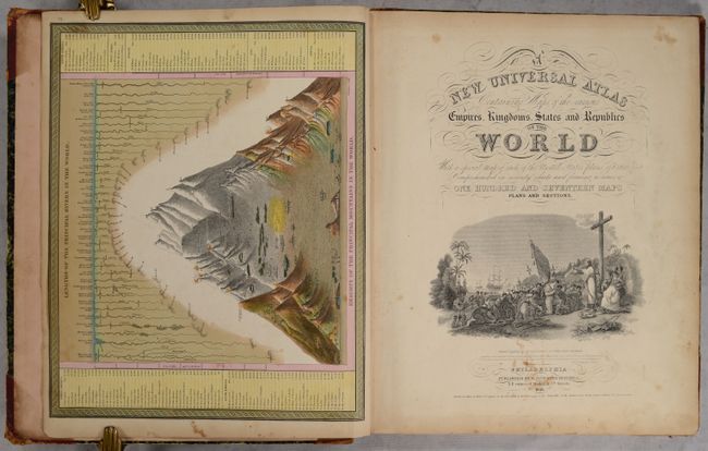
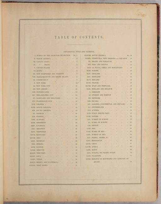
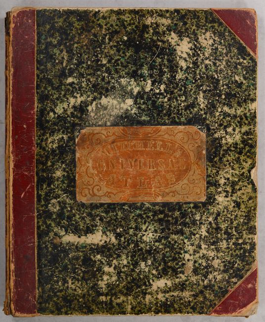
Includes a frontispiece showing a comparative view of mountains & rivers, pictorial title page depicting Columbus' arrival in the New World, table of contents, and 72 hand-colored maps. Hardbound in contemporary quarter red leather with tips over marbled paper- covered boards, with embossed title label on front cover. This edition was published by S. Augustus Mitchell, NE corner of Market & 7th Streets. An increasingly difficult to find atlas.
References:
Condition: B+
Condition grade is for the maps, which are in full contemporary color with light toning that is mostly confined to the edges of the sheet, occasional light foxing, and small stains on a few of the maps. The maps' contemporary color has oxidized in places with some areas of green color appearing light brown. The title page is soiled with some stains. The front and back covers are detached and heavily scuffed with some edge chips. The plates are still solidly bound together with the spine, which is heavily rubbed with some chipping.