Subject: Atlases
Period: 1601 (published)
Publication:
Color: Black & White
Size:
6.5 x 5 inches
16.5 x 12.7 cm
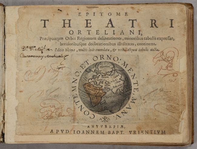
This rare and magnificent miniature atlas was produced by Jan Baptista Vrients for Filips Galle and includes 126 maps of the world, continents, and various regions around the world. This atlas is from the second series of pocket-atlases published by Galle with maps based on Ortelius' Theatrum Orbis Terrarum. The first pocket-sized atlas, Spieghel der Wereld, also by Galle, was published in 1577, with subsequent editions published in several languages through 1585. The maps were accompanied by text prepared by Peter Heyns, who used the text from the Theatrum. The numbers printed above the maps, adjacent to the letterpress title, corresponded with the number of the map within the Theatrum. This innovative, small atlas was designed to reach the lower middle class, and was a commercial success, prompting numerous reprints and imitations.
Apparently dissatisfied with the quality of the plates in the Spieghel der Wereld, Galle began a new edition in 1588, commonly known as the Epitome, replacing some of the old plates with newly engraved ones. The new plates had a cleaner style with simple double-lined borders. The Epitome was quite popular, and was published in editions until 1602. Over the years, Galle gradually introduced more new maps, both adding to and replacing the originals. By the final edition in 1602, only 10 of the original plates from the Spieghel remained. After 1598, the plates were passed to Jan B. Vrients, who retouched some of the plates and published the final editions of the Epitome in 1601 and 1602.
This example is a Latin edition of the Epitome, which only includes a handful of the original maps from the Spieghel der Wereld and mostly newly-engraved maps with the simpler borders. Of particular interest are the maps of the world and continents:
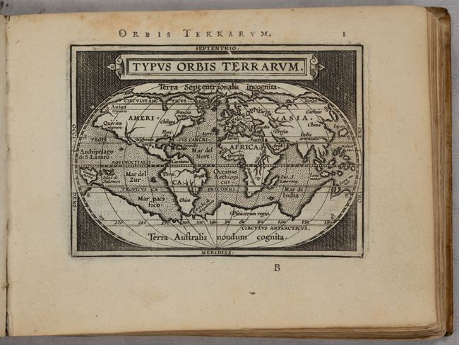
A. Typus Orbis Terrarum. This map was reduced from Ortelius' folio map of 1587. While North America is still a bit too broad, South America has a more correct form. The Northwest Passage, taken from Mercator, is still prominent and there are large landmasses at both poles. References: Shirley #161; Van der Krogt (Vol. III) #0001:332A.
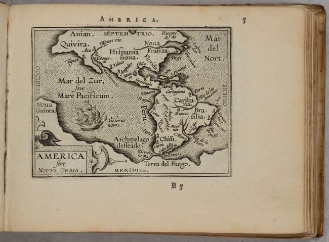
B. America sive Novus Orbis. This charming miniature map was updated from its predecessor, Philippe Galle's first miniature map derived from Ortelius and published in 1577. This edition has a more accurate outline for South America, but actually includes less detail than its predecessor. Only a few rivers and place names are noted. The vast southern continent is prominently featured, encompassing both Tierra del Fuego and Nova Guinea. The map is embellished with a strapwork title cartouche, a large galleon, and stippled seas. References: Burden #123; Van der Krogt (Vol. III) #9000:332.
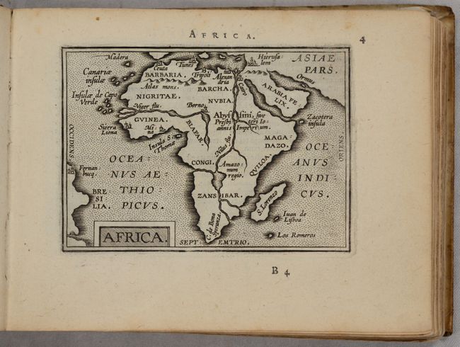
C. Africa. This handsome miniature map of Africa is lacking a great deal of detail but is interesting for its strange depiction of the Nile, which originates in a large lake south of the Equator. From this lake four large rivers flow to the seas: the Nile to the Mediterranean, the Congo to the Atlantic, what could be the Zambeze to the Indian Ocean, and a fourth spurious river flowing south. There are only two town identified south of the Sahara Desert: Sierra Leone and Mina in Guinea. References: Betz #28; Van der Krogt (Vol. III) #8600:332.
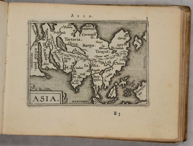
D. Asia. This charming little map is a simplified version of Ortelius' folio map of the continent. A large mountain range extends the length of the continent, and Africa appears to be due west. Korea does not appear, and Japan has a rudimentary shape, although updated from Ortelius' kite-shape. Only major rivers and a few cities are noted. References: Van der Krogt (Vol. III) #8000:332.
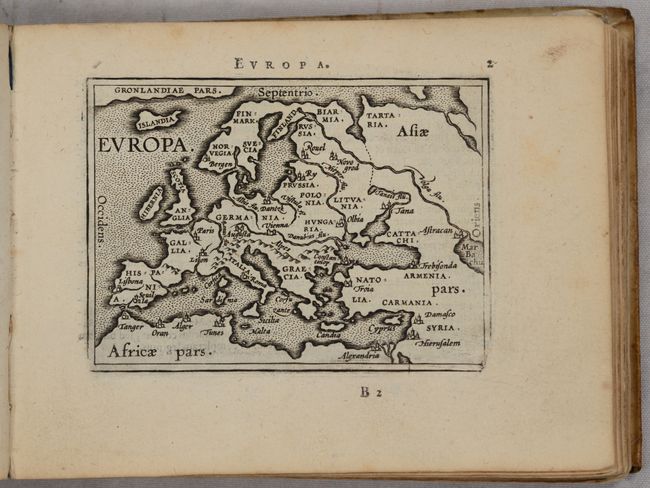
E. Europa. This simple map of Europe focuses on the major rivers, mountain ranges, and cities in Europe. Greenland stretches across the top of the map. References: Van der Krogt (Vol. III) #1000:332.
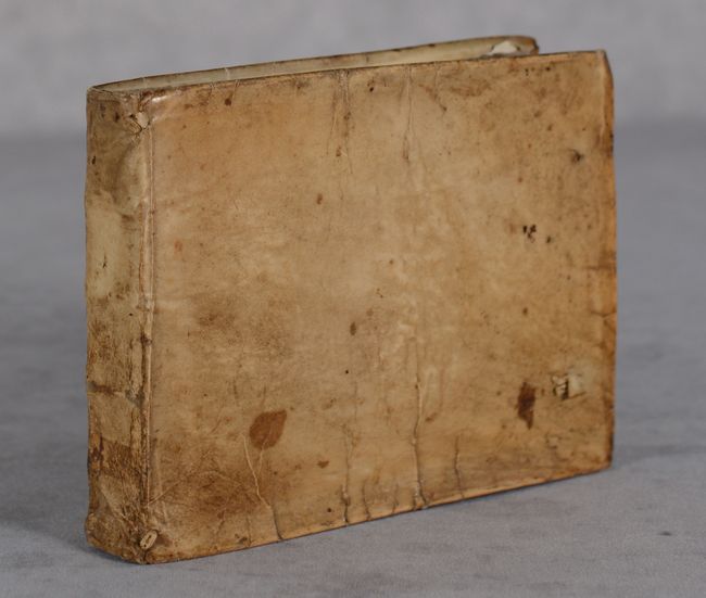
Bound in original vellum-covered boards with holes along the fore-edge of the front and back covers, indicating that there were likely previously leather or cloth ties. Appears to be missing the front free-endpaper and the back pastedown.
References: Van der Krogt (Vol. III) #332:13.
Condition: A
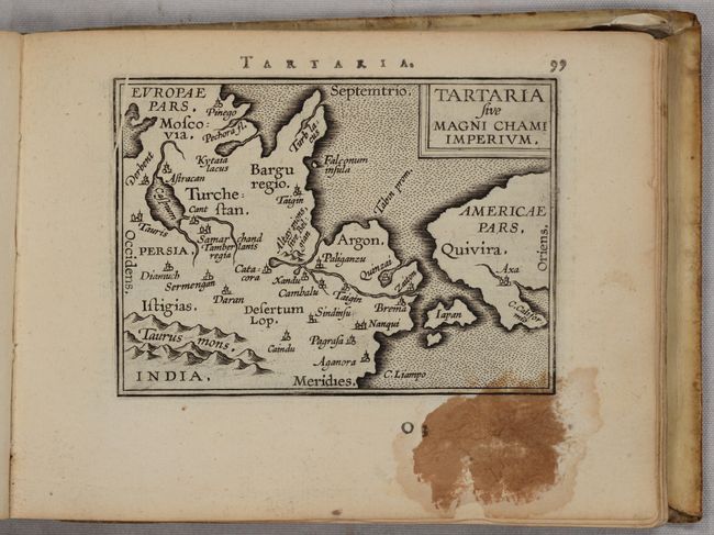
Condition grade is for the maps, which have nice impressions and occasional minor foxing and soiling, most of which is confined to the blank margins. There are faint dampstains along the far edges of some of the leaves. The map of Tartaria has a large ink stain at bottom right that enters the image just a bit. The title page has old manuscript ink notations, moderate soiling, and has been remargined at left and bottom, with loss of the publication date (which is however reiterated in the introductory text by Vrients). The covers are quite soiled and a bit warped with some cracks to the vellum.