Subject: China, Korea & Japan
Period: 1636 (circa)
Publication:
Color: Hand Color
Size:
19.6 x 16.1 inches
49.8 x 40.9 cm
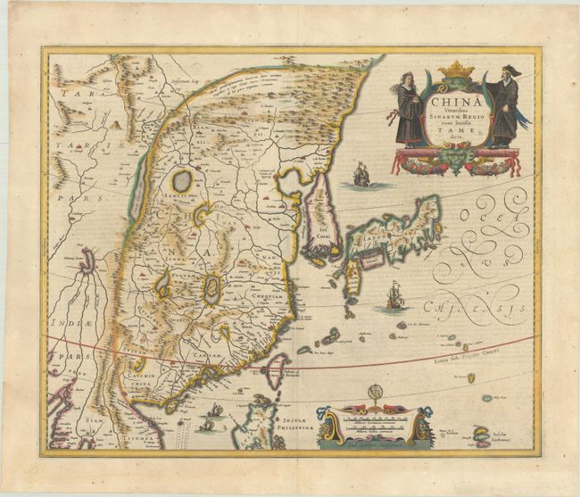
Several large lakes dominate the topography of this elegantly engraved map of China. The Great Wall forms the northern boundary of China. The fictitious Chiamay Lacus is shown with numerous rivers flowing south into India and Siam. Korea is depicted as a strangely shaped island separated from the mainland by a narrow strait. Taiwan is located in a roughly correct position, named as both Pakan al I. Formosa, with the additional place names of Gillira, Wankan, and Tayoan. The three main islands of Japan are shown on the Ortelius/Teixeira model. The map is richly embellished with European sailing ships and Chinese sampans, a decorative distance scale, and a title cartouche flanked by a Chinese man and woman. Jansson's map is very similar to Blaeu's map of the same name, with a few differences: the calligraphic Oceanus Chinensis appears in three lines; the ships to the north and south of Japan are sailing towards the east rather than the west; and there are no lines of longitude. German text on verso, published between 1636-42.
References: Caboara #24; Van der Krogt (Vol. I) #8410:1B.
Condition: A
A nice impression on a sheet with clean, wide margins with light show-through of text on verso. There is a small, professionally repaired hole in bottom left blank margin and a tiny hole in top blank margin.