Subject: Northern Europe & Scandinavia
Period: 1574 (published)
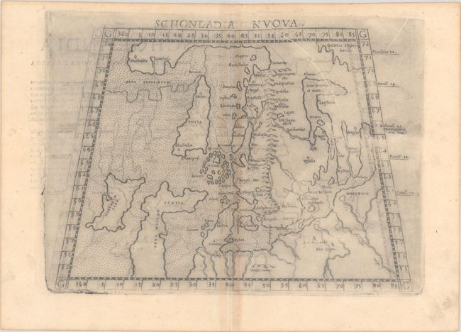
Publication: La Geografia di Claudio Tolomeo Alessandrino…
Color: Black & White
Size:
10 x 7.3 inches
25.4 x 18.5 cm
This fine copperplate map is one of the earliest obtainable maps of Scandinavia. It is Ruscelli's "modern" map of Greenland, Scandinavia, and northern Europe, although there are still several Ptolemaic features of the map. Norway is separated from Greenland by a narrow strait, and Iceland is depicted as a long, thin island called Thyle, which is depicted larger than Ireland. Part of Britain is presented in its unique early form in which Scotland appears to be jutting sharply to the east. The Faroes and Shetlands are one island group. The map is presented on a trapezoidal projection. This is the second state, with slightly different hatching in the Scandinavian mountains and Italian text on verso.
References: Ginsberg #18; Mickwitz & Miekkavaara #220-43.
Condition: B
There is moderate offsetting, printer's ink residue, and a few printer's creases at top.