Subject: Western England
Period: 1648 (circa)
Publication: Toonneel des Aerdrycks oft Nieuwe Atlas
Color: Hand Color
Size:
19.6 x 16.1 inches
49.8 x 40.9 cm
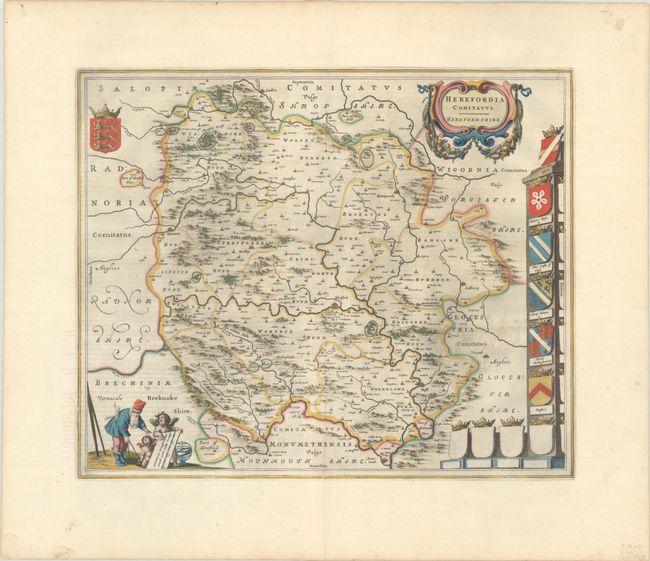
This beautiful map of Herefordshire is engraved with delicately rendered trees, mountains and towns. Malvern Hill is on the eastern edge of the map with Monmouth to the south. Ludlow is located in the far northern part of the map and Brestayne and Hay border the west. The crests of prominent families are shown at right, with several empty crests. The map is further embellished with a title cartouche featuring garlands and the scale of miles attended by a surveyor and a pair of putti. Dutch text on verso, published between 1648-62.
References: Van der Krogt (Vol. II) #5510:2.
Condition: A
A dark impression with full contemporary color on a bright sheet with a large watermark of the god Atlas and some printer's ink residue. There is a small hole in the right blank margin.