Subject: Britain
Period: 1729 (published)
Publication: Introductionis in Universam Geographiam
Color: Hand Color
Size:
10.3 x 8.4 inches
26.2 x 21.3 cm
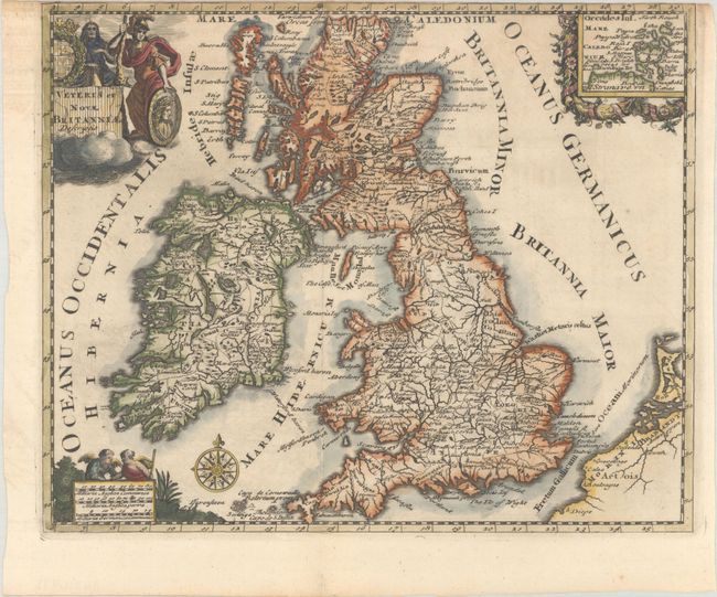
Very decorative small map of Britain showing counties and major cities. A decorative inset at upper right depicts the Orkney Islands. Embellished with a compass rose, distance scale with two angels, and a title cartouche featuring the royal coat of arms and a soldier.
Cluver's Introductio in Universam Geographicam was a popular atlas, appearing in over 45 editions during a 100-year period. The first edition was published without maps in the 1620s, and the first edition to include maps was published circa 1641. The various editions were published in different cities throughout Europe, including Amsterdam, Nuremberg, and London. This map is from an Amsterdam edition, edited by Bruzen de la Martiniere with maps by Jan Wolters and four newly engraved maps after Delisle.
References: Shirley (BL Atlases) T.CLUV-8b.
Condition: B+
A dark impression on a bright sheet, trimmed to the neatline at top, as issued. There is light toning in the top border.