Subject: North Atlantic
Period: 1872 (dated)
Publication:
Color: Black & White
Size:
36.6 x 23.8 inches
93 x 60.5 cm
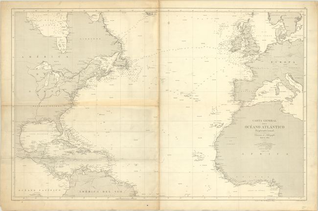
This large Spanish chart details the Atlantic coastlines from Labrador to Brazil in the Americas and the European and African coastlines from Norway to the Gulf of Guinea. Soundings, rocks, shoals, and fishing banks are noted in the waters while cities are named and located along the coasts. The interiors are mostly void save for a few rivers and political boundaries. The prime meridian runs through Cadiz. Engraved by C. Leclercq with lettering by F. Bregante. First published in 1864 and updated to 1872.
References:
Condition: B+
Issued on watermarked paper with archival repairs to some separations and two tears along the centerfold. Folded horizontally by a previous owner with some light soiling on the left half. There are archival repairs to a number of short edge tears and tiny pinholes in the image only visible when held to light.