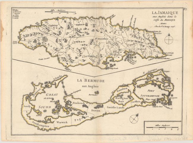
Subject: Jamaica & Bermuda
Period: 1746 (dated)
Publication: Atlas Nouveau Portatif
Color: Hand Color
Size:
10.7 x 7.9 inches
27.2 x 20.1 cm
These two maps on one sheet show the British Possessions in the Caribbean and the Atlantic Ocean, Jamaica above Bermuda. Jamaica is engraved to show the plantations, denoting those growing sugar, cotton, cacao, and indigo. The map of Bermuda includes an interesting cartographic error which resulted from copying John Speed's map of 1627. In that map, Bermuda was superimposed over a map of the coastline of New England and Virginia to show the relative position of Bermuda in addition to the main map of the island. Le Rouge dropped the coastlines of North America, but left the small depiction of Bermuda, which appears on this map as a small offshore island named Bermudos.
References: Palmer (MCC-19) #35.
Condition: A
Nice impression and contemporary outline color on a sheet with a bunch of grapes watermark, faint toning along centerfold, and a couple of stains at paper edge, well away from map.