Current Auction
Lot 331
Current Auction

Price reduced by $50

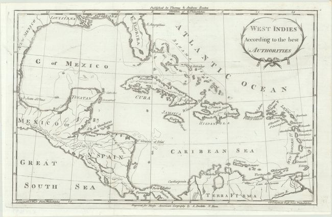
"West Indies According to the Best Authorities", Morse, Jedidiah (Rev.)

Subject: Gulf of Mexico & Caribbean

Period: 1793 (circa)

Publication: American Geography

Color: Black & White

Size:
12.2 x 7.9 inches
31 x 20.1 cm
Download High Resolution Image
(or just click on image to launch the Zoom viewer)

This map covers the entire Caribbean Basin along with portions of the southern United States, Central America, and northern South America. Florida is divided into East and West, and the Texas coastline is named New Mexico. River systems and topography are shown in the interior and there is some basic detail along the coastlines. Engraved by Amos Doolittle for Morse's American Geography and published by Thomas & Andrews in Boston.

See also lot 789 for Wheat & Brun's Maps and Charts Published in America Before 1800… that lists this map.

References: Wheat & Brun #686.

Condition: A

A crisp impression on a bright sheet. Issued folding.

Estimate: $140 - $170

Sold for: $50

Closed on 4/24/2024

Closed