Subject: Western Mexico
Period: 1622 (circa)
Publication:
Color: Black & White
Size:
11.6 x 8.5 inches
29.5 x 21.6 cm
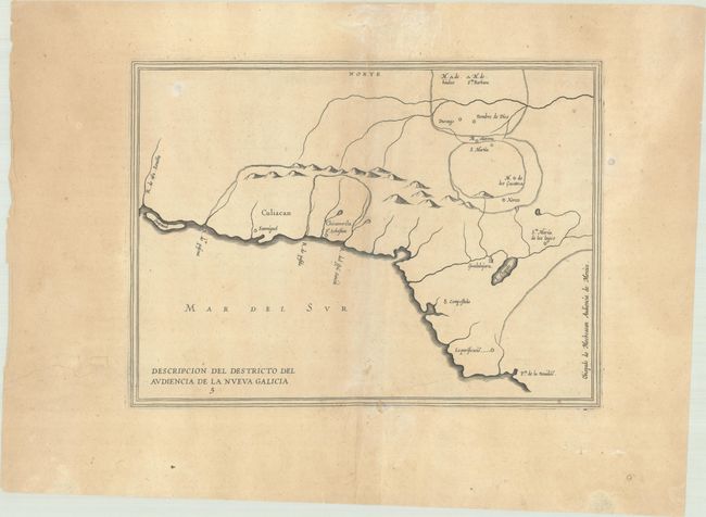
This simple outline map of Nueva Galicia is based on Juan López de Velasco’s manuscript and covers the western part of present-day Mexico. Some of the early Spanish settlements are named including Guadalajara, San Miguel, Xeres, Compostela, Durango, and San Martin. The map locates a large Lake Chapala and Pto. de la Navidad, which is just south of Puerto Vallarta, near today's Barre de Navidad. The map extends north along the coast to name the R. de Na. Senora and shows the island Guayaual, most likely a reference to the land bar creating the Laguna del Caimanero south of Mazatlan.
Antonio de Herrera Y Tordesillas was the official historian of Spain and the Indies. He compiled a history of the Spanish conquests and early explorations in the Americas, complete with several engraved maps of the region. His work (Historia General de los Hechos de los Castellanos) was originally published in 1601 with several editions and translations thereafter.
References: Shirley (BL Atlases) G.HERR-2a #4.
Condition: B+
A crisp impression on a lightly toned sheet with a simple cross watermark and an archivally repaired tear and two wormholes in the ample blank margins. There are a few unobtrusive light spots in map image and a few short wormtracks that have been infilled with archival materials, with a minute amount of the lower border replaced in facsimile.