Subject: Southwestern United States & Mexico
Period: 1848 (circa)
Publication: Atlas of the World
Color: Hand Color
Size:
10.9 x 8.9 inches
27.7 x 22.6 cm
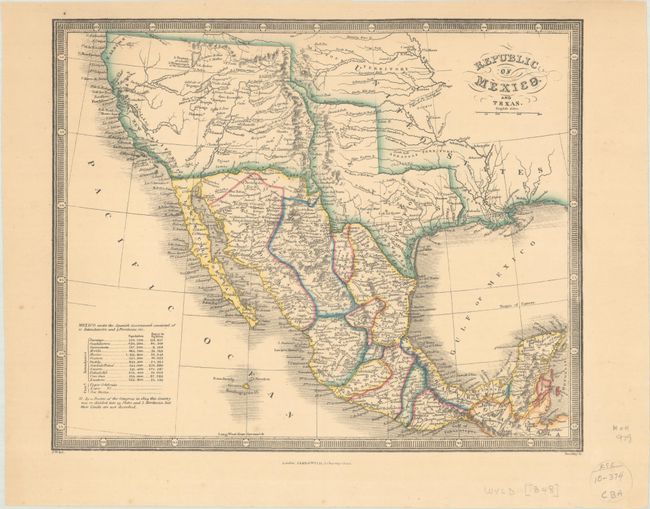
This map covers the region from northern California south to Guatemala and shows the political divisions of Mexico in vibrant outline color. There is good detail of topography and the river system with a note in the Great Basin stating "L. Youtaw probably L. Timpanogos of the Spaniards." The Boundary of 1848 is noted along the Gila River between Mexico and the US, a result of the Treaty of Guadalupe Hidalgo. Texas, which had become a state in 1845, is still in a transitional period prior to the boundary being finalized, appearing in the stovepipe configuration. A table at bottom left shows the population and square miles of the provinces of Mexico. The map is surrounded by a keyboard-style border. Engraved by Stockley.
References:
Condition: A
A few minor spots and a hint of toning.